Estimated Value: $26,671 - $72,000
Studio
--
Bath
1,000
Sq Ft
$51/Sq Ft
Est. Value
About This Home
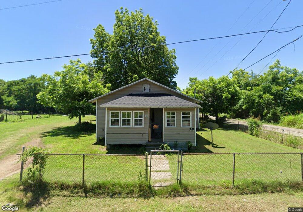
This home is located at 143 Oak St, Hayti, MO 63851 and is currently estimated at $50,890, approximately $50 per square foot. 143 Oak St is a home with nearby schools including Mathis Elementary School, Wallace Elementary School, and Hayti High School.
Ownership History
Date
Name
Owned For
Owner Type
Purchase Details
Closed on
Sep 28, 2023
Sold by
Ruff Antjuan and Ruff Erika S
Bought by
Af Ruff Investments
Current Estimated Value
Purchase Details
Closed on
Mar 10, 2022
Sold by
Walton Betty J
Bought by
Martin Grain Company
Purchase Details
Closed on
Aug 14, 2018
Sold by
Irving Leola
Bought by
Shavers Rickey D
Purchase Details
Closed on
Apr 22, 2013
Sold by
Irving Leola
Bought by
Jones Richard
Create a Home Valuation Report for This Property
The Home Valuation Report is an in-depth analysis detailing your home's value as well as a comparison with similar homes in the area
Purchase History
| Date | Buyer | Sale Price | Title Company |
|---|---|---|---|
| Af Ruff Investments | -- | None Listed On Document | |
| Af Ruff Investments | -- | None Listed On Document | |
| Martin Grain Company | -- | Mcgee Jacqueline T | |
| Martin Grain Company | -- | Mcgee Jacqueline T | |
| Shavers Rickey D | -- | None Available | |
| Jones Richard | -- | None Available |
Source: Public Records
Tax History
| Year | Tax Paid | Tax Assessment Tax Assessment Total Assessment is a certain percentage of the fair market value that is determined by local assessors to be the total taxable value of land and additions on the property. | Land | Improvement |
|---|---|---|---|---|
| 2025 | $145 | $2,500 | $0 | $0 |
| 2024 | $145 | $2,400 | $0 | $0 |
| 2023 | $142 | $2,400 | $0 | $0 |
| 2022 | $140 | $2,370 | $0 | $0 |
| 2020 | $139 | $2,370 | $0 | $0 |
| 2019 | $137 | $2,370 | $0 | $0 |
| 2018 | $132 | $2,370 | $0 | $0 |
| 2017 | $132 | $2,370 | $0 | $0 |
| 2016 | -- | $2,370 | $0 | $0 |
| 2015 | -- | $2,370 | $0 | $0 |
| 2013 | -- | $2,370 | $0 | $0 |
Source: Public Records
Map
Nearby Homes
- 0 W Washington St
- 110 E Main St
- 835 Missouri 84
- 0 Highway 412
- 1014 S Klinkhardt St
- 200 E Grant St
- 000000 First Martin Luther King Dr
- 301 E Jackson St
- 604 N 3rd St
- 600 E Reed St
- 0 County Road 406
- 0 County Road 263 Unit MIS25048822
- 0 County Road 258
- 1110 Collins Ave
- 939 Grand Ave
- 802 Beckwith Ave
- 1202 Grand Ave
- 933 Beckwith Ave
- 406 W 4th St
- 700 Carleton Ave
- 00000 First Street Martin Luther King Dr
- 120 Willow St
- 487 Rd
- 509 Rd Rd
- 519 Braggadocio Rd
- 299 S Martin Luther King Dr
- 461 S Martin Luther King Dr
- 491 S Martin Luther King Dr
- 335 S Martin Luther King Dr
- 251 1st St
- 555 S Martin Luther King Dr
- 380 Rapoport St
- 458 Rapoport St
- 618 S Martin Luther King Dr
- 215 N Pemiscot St
- 219 S Martin Luther King Dr
- 558 Rapoport St
- 417 Rapoport St
- 180 S Martin Luther King Dr
- 650 Kennedy St
Your Personal Tour Guide
Ask me questions while you tour the home.