Estimated Value: $307,817 - $691,000
Studio
--
Bath
--
Sq Ft
11,108
Sq Ft Lot
About This Home
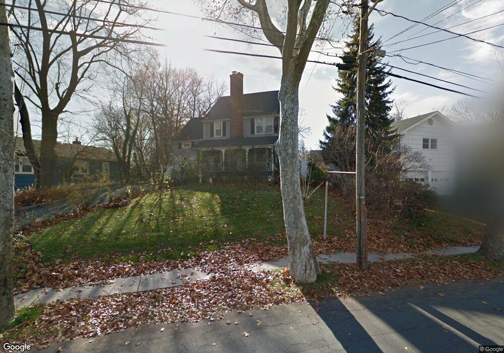
This home is located at 1432 Brookside Dr, Union, NJ 07083 and is currently estimated at $528,704. 1432 Brookside Dr is a home located in Union County with nearby schools including Livingston Elementary School, Union High School, and St Michael Parish School.
Ownership History
Date
Name
Owned For
Owner Type
Purchase Details
Closed on
Feb 13, 2003
Sold by
Skarzynski Peter
Bought by
Melo Emilia
Current Estimated Value
Home Financials for this Owner
Home Financials are based on the most recent Mortgage that was taken out on this home.
Original Mortgage
$260,000
Outstanding Balance
$111,595
Interest Rate
5.98%
Estimated Equity
$417,109
Purchase Details
Closed on
Feb 24, 1994
Sold by
Sileo Jos D
Bought by
Skarzynski Peter R and Skarzynski Suzanne
Home Financials for this Owner
Home Financials are based on the most recent Mortgage that was taken out on this home.
Original Mortgage
$170,000
Interest Rate
7.27%
Create a Home Valuation Report for This Property
The Home Valuation Report is an in-depth analysis detailing your home's value as well as a comparison with similar homes in the area
Home Values in the Area
Average Home Value in this Area
Purchase History
| Date | Buyer | Sale Price | Title Company |
|---|---|---|---|
| Melo Emilia | $325,000 | -- | |
| Skarzynski Peter R | $189,000 | -- |
Source: Public Records
Mortgage History
| Date | Status | Borrower | Loan Amount |
|---|---|---|---|
| Open | Melo Emilia | $260,000 | |
| Previous Owner | Skarzynski Peter R | $170,000 |
Source: Public Records
Tax History
| Year | Tax Paid | Tax Assessment Tax Assessment Total Assessment is a certain percentage of the fair market value that is determined by local assessors to be the total taxable value of land and additions on the property. | Land | Improvement |
|---|---|---|---|---|
| 2025 | $10,036 | $44,900 | $21,400 | $23,500 |
| 2024 | $9,729 | $44,900 | $21,400 | $23,500 |
Source: Public Records
Map
Nearby Homes
- 1453 Morris Ave
- 970 Lorraine Ave
- 1393 Cornell Place
- 1090 Salem Rd
- 980 Salem Rd
- 950 Carteret Ave
- 936 Arnet Ave
- 951 Liberty Ave
- 875 Salem Rd
- 321 Sherwood Rd
- 130 Valley View Rd
- 537 Us Highway 22
- 566 Chapman St
- 564 Chapman St
- 525 Us Highway 22
- 359 Harvard Ave
- 260 Millard Ave
- 575 Purce St
- 35 Eastern Pkwy
- 5 Station Square
- 1440 Brookside Dr
- 1426 Brookside Dr
- 15 Skyview Rd
- 1420 Brookside Dr
- 1433 Brookside Dr
- 1429 Brookside Dr
- 19 Skyview Rd
- 1439 Brookside Dr
- 1427 Brookside Dr
- 8 Skyview Rd
- 4 Skyview Rd
- 1443 Brookside Dr
- 1054 Lorraine Ave
- 1052 Lorraine Ave
- 1060 Lorraine Ave
- 1048 Lorraine Ave
- 30 Skyview Rd
- 1447 Brookside Dr
- 1064 Lorraine Ave
- 21 Skyview Rd
Your Personal Tour Guide
Ask me questions while you tour the home.