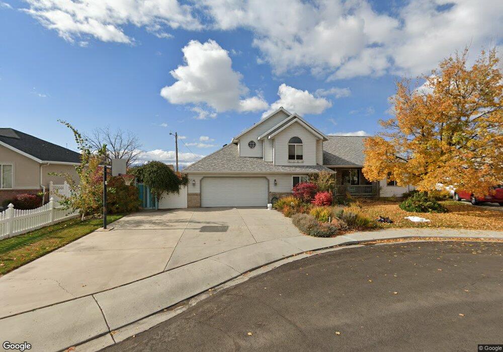
1433 N 600 W Orem, UT 84057
Bonneville NeighborhoodEstimated Value: $568,000 - $657,000
6
Beds
2
Baths
3,011
Sq Ft
$198/Sq Ft
Est. Value
About This Home
This home is located at 1433 N 600 W, Orem, UT 84057 and is currently estimated at $597,356, approximately $198 per square foot. 1433 N 600 W is a home located in Utah County with nearby schools including Bonneville Elementary School, Orem Junior High School, and Timpanogos High School.
Ownership History
Date
Name
Owned For
Owner Type
Purchase Details
Closed on
Aug 3, 2021
Sold by
Bingham Brent T and Bingham Nina K
Bought by
Rental Prop 5 Llc
Current Estimated Value
Home Financials for this Owner
Home Financials are based on the most recent Mortgage that was taken out on this home.
Original Mortgage
$350,475
Outstanding Balance
$318,293
Interest Rate
2.96%
Mortgage Type
New Conventional
Estimated Equity
$279,063
Purchase Details
Closed on
Jul 21, 2021
Sold by
Nichols Jason T
Bought by
Bingham Brent T and Bingham Nina K
Home Financials for this Owner
Home Financials are based on the most recent Mortgage that was taken out on this home.
Original Mortgage
$350,475
Outstanding Balance
$318,293
Interest Rate
2.96%
Mortgage Type
New Conventional
Estimated Equity
$279,063
Purchase Details
Closed on
Oct 16, 2015
Sold by
Edwards Melissa
Bought by
Nichols Jason T
Home Financials for this Owner
Home Financials are based on the most recent Mortgage that was taken out on this home.
Original Mortgage
$234,572
Interest Rate
3.87%
Mortgage Type
FHA
Purchase Details
Closed on
Oct 26, 2009
Sold by
Bke Inc
Bought by
Edwards Melissa
Home Financials for this Owner
Home Financials are based on the most recent Mortgage that was taken out on this home.
Original Mortgage
$204,975
Interest Rate
5%
Mortgage Type
FHA
Purchase Details
Closed on
Sep 17, 2007
Sold by
Makin Brent
Bought by
Bke Inc
Home Financials for this Owner
Home Financials are based on the most recent Mortgage that was taken out on this home.
Original Mortgage
$197,747
Interest Rate
6.67%
Mortgage Type
Seller Take Back
Purchase Details
Closed on
Nov 15, 2006
Sold by
Teal Todd
Bought by
Makin Brent
Purchase Details
Closed on
Nov 26, 1997
Sold by
Thornton Linda Allred Hall and Thornton Russell Brent
Bought by
Makin Brent
Home Financials for this Owner
Home Financials are based on the most recent Mortgage that was taken out on this home.
Original Mortgage
$107,000
Interest Rate
7.33%
Mortgage Type
Seller Take Back
Create a Home Valuation Report for This Property
The Home Valuation Report is an in-depth analysis detailing your home's value as well as a comparison with similar homes in the area
Home Values in the Area
Average Home Value in this Area
Purchase History
| Date | Buyer | Sale Price | Title Company |
|---|---|---|---|
| Rental Prop 5 Llc | -- | Charger Title | |
| Bingham Brent T | -- | Metro National Title | |
| Nichols Jason T | -- | Us Title Insurance Agency | |
| Edwards Melissa | -- | Access Title Company | |
| Bke Inc | -- | Access Title Company | |
| Makin Brent | -- | Charity Title Insurance Age | |
| Makin Brent | -- | Old Republic Title Co Of Uta |
Source: Public Records
Mortgage History
| Date | Status | Borrower | Loan Amount |
|---|---|---|---|
| Open | Bingham Brent T | $350,475 | |
| Previous Owner | Nichols Jason T | $234,572 | |
| Previous Owner | Edwards Melissa | $204,975 | |
| Previous Owner | Bke Inc | $197,747 | |
| Previous Owner | Makin Brent | $107,000 |
Source: Public Records
Tax History
| Year | Tax Paid | Tax Assessment Tax Assessment Total Assessment is a certain percentage of the fair market value that is determined by local assessors to be the total taxable value of land and additions on the property. | Land | Improvement |
|---|---|---|---|---|
| 2025 | $2,181 | $300,410 | -- | -- |
| 2024 | $2,181 | $266,695 | $0 | $0 |
| 2023 | $1,994 | $262,075 | $0 | $0 |
| 2022 | $1,961 | $249,645 | $0 | $0 |
| 2021 | $1,824 | $351,700 | $183,600 | $168,100 |
| 2020 | $1,645 | $311,700 | $146,900 | $164,800 |
| 2019 | $1,559 | $307,200 | $146,900 | $160,300 |
| 2018 | $1,530 | $288,100 | $134,300 | $153,800 |
| 2017 | $1,525 | $153,835 | $0 | $0 |
| 2016 | $1,467 | $136,510 | $0 | $0 |
| 2015 | $1,353 | $119,020 | $0 | $0 |
| 2014 | $1,317 | $115,335 | $0 | $0 |
Source: Public Records
Map
Nearby Homes
- 582 W 1300 N
- 527 W 1450 N
- 1405 N 770 W
- 512 W 1450 N
- 1545 N State St Unit 1
- 1244 N 580 W
- 1230 N 685 W
- 1552 N 740 W
- 1461 N Amiron Way Unit B
- 538 W 1120 N
- 332 W Amiron Way Unit D
- 1123 N 800 W
- 287 W 1380 N
- 1548 N 275 West St Unit 2
- 1547 N 275 West St Unit 5
- 1566 N 275 West St Unit 1
- 967 W 1630 N
- 1663 N 980 W
- 999 W 1100 N
- 645 W 920 N
Your Personal Tour Guide
Ask me questions while you tour the home.