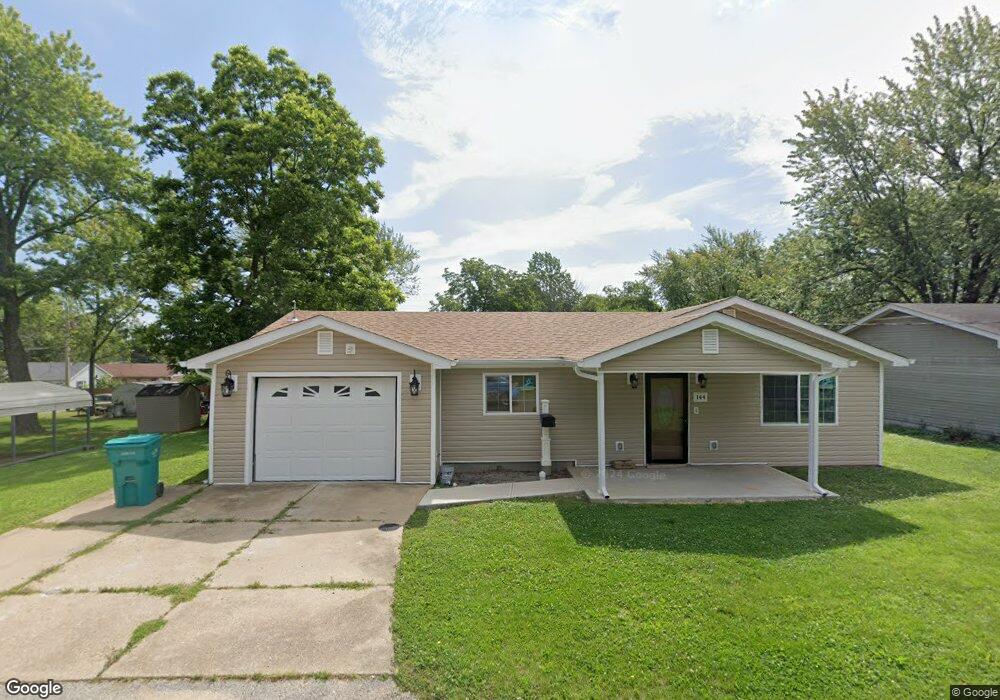
144 Division St Sullivan, MO 63080
Estimated Value: $146,000 - $173,000
1
Bed
1
Bath
1,024
Sq Ft
$153/Sq Ft
Est. Value
About This Home
This home is located at 144 Division St, Sullivan, MO 63080 and is currently estimated at $156,645, approximately $152 per square foot. 144 Division St is a home located in Franklin County with nearby schools including Sullivan Primary School, Sullivan Elementary School, and Sullivan Middle School.
Ownership History
Date
Name
Owned For
Owner Type
Purchase Details
Closed on
May 23, 2025
Sold by
Cuneio Ryan and Cuneio Mackynze
Bought by
Cuneio Ryan and Cuneio Mackynze R
Current Estimated Value
Home Financials for this Owner
Home Financials are based on the most recent Mortgage that was taken out on this home.
Original Mortgage
$129,625
Outstanding Balance
$129,069
Interest Rate
6.83%
Mortgage Type
Credit Line Revolving
Estimated Equity
$27,576
Purchase Details
Closed on
Jul 28, 2021
Sold by
Carter Mary F
Bought by
Cuneio Ryan
Home Financials for this Owner
Home Financials are based on the most recent Mortgage that was taken out on this home.
Original Mortgage
$26,019
Interest Rate
2.8%
Mortgage Type
FHA
Purchase Details
Closed on
Jul 15, 2014
Sold by
Carter James E and Carter Mary F
Bought by
Carter James E and Carater Mary F
Create a Home Valuation Report for This Property
The Home Valuation Report is an in-depth analysis detailing your home's value as well as a comparison with similar homes in the area
Home Values in the Area
Average Home Value in this Area
Purchase History
| Date | Buyer | Sale Price | Title Company |
|---|---|---|---|
| Cuneio Ryan | -- | None Listed On Document | |
| Cuneio Ryan | -- | None Listed On Document | |
| Cuneio Ryan | -- | None Available | |
| Carter James E | -- | -- |
Source: Public Records
Mortgage History
| Date | Status | Borrower | Loan Amount |
|---|---|---|---|
| Open | Cuneio Ryan | $129,625 | |
| Closed | Cuneio Ryan | $129,625 | |
| Previous Owner | Cuneio Ryan | $26,019 |
Source: Public Records
Tax History
| Year | Tax Paid | Tax Assessment Tax Assessment Total Assessment is a certain percentage of the fair market value that is determined by local assessors to be the total taxable value of land and additions on the property. | Land | Improvement |
|---|---|---|---|---|
| 2025 | $1,313 | $21,203 | $0 | $0 |
| 2024 | $1,313 | $6,700 | $0 | $0 |
| 2023 | $389 | $5,075 | $0 | $0 |
| 2022 | $704 | $12,151 | $0 | $0 |
| 2021 | $763 | $13,091 | $0 | $0 |
| 2020 | $712 | $11,980 | $0 | $0 |
| 2019 | $713 | $11,980 | $0 | $0 |
| 2018 | $677 | $11,235 | $0 | $0 |
| 2017 | $651 | $11,235 | $0 | $0 |
Source: Public Records
Map
Nearby Homes
- 167 Christland Dr
- 502 Elmont Rd
- 812 Raymond St
- 710 Madison St
- 332 Fair St
- 0 Progress Dr Unit Lot 4 MAR20038653
- 615 Madison St
- 773 Crawford Cir
- 112 Orchard St
- 612 Crestview Dr
- 2 Sequoia at Deer Meadows
- 621 S Mansion St
- 705 S Mansion St
- 2 Meadows
- 1025 Buck Ct
- 2 Aspen at Deer Meadows
- 25 Crockett St
- 1026 Franklin St
- 1039 Clover Hill Dr
- 1043 Clover Hill Dr
- 120 Division St
- 141 Division St
- 152 Division St
- 108 Division St
- 129 Jackson St
- 104 Hilda Crow Dr
- 201 Division St
- 139 Jackson St
- 108 Hilda Crow Dr
- 119 Jackson St
- 209 Division St
- 212 Division St
- 109 Jackson St
- 113 Hilda Crow Dr
- 215 Division St
- 122 Jackson St
- 205 Jackson St
- 219 Division St
- 120 Hilda Crow Dr
- 219 Jackson St
Your Personal Tour Guide
Ask me questions while you tour the home.