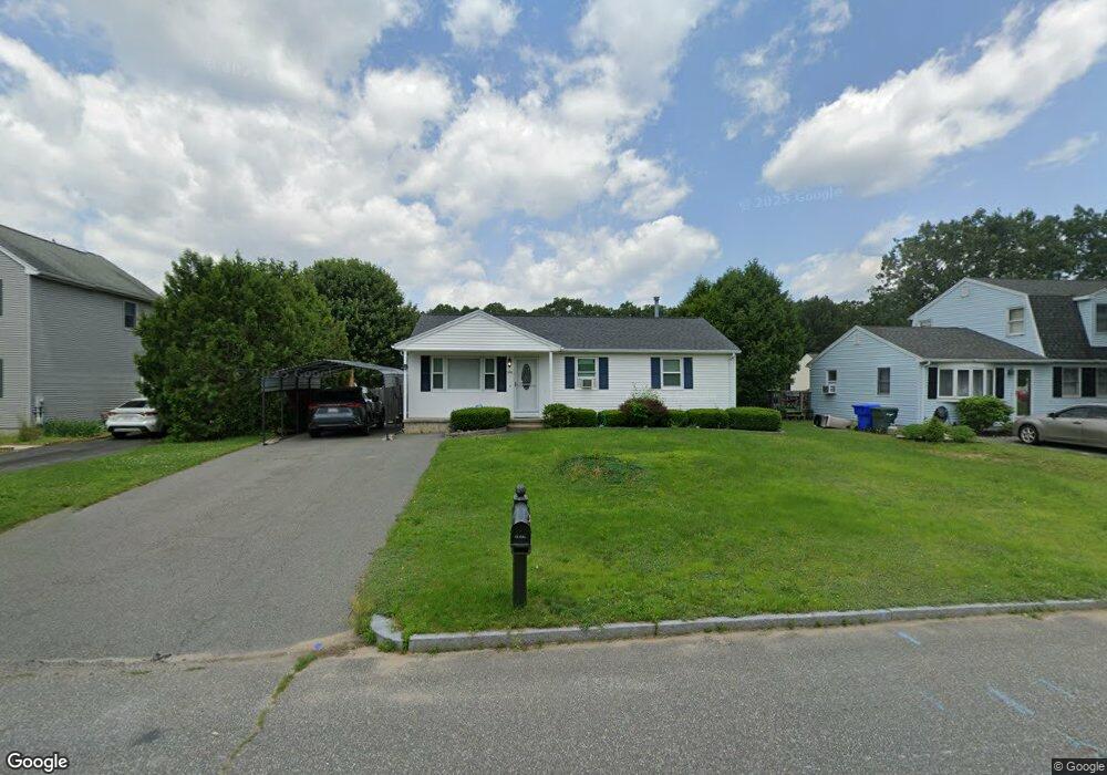
144 Starling Rd Springfield, MA 01119
Sixteen Acres NeighborhoodEstimated Value: $293,667 - $323,000
3
Beds
1
Bath
1,056
Sq Ft
$297/Sq Ft
Est. Value
About This Home
This home is located at 144 Starling Rd, Springfield, MA 01119 and is currently estimated at $313,667, approximately $297 per square foot. 144 Starling Rd is a home located in Hampden County with nearby schools including Mary M. Lynch Elementary School, John J Duggan Middle, and Springfield Central High School.
Ownership History
Date
Name
Owned For
Owner Type
Purchase Details
Closed on
Jan 31, 2002
Sold by
Porth Kent E and Porth Donna E
Bought by
Acevedo Antonio R and Acevedo Adairis
Current Estimated Value
Home Financials for this Owner
Home Financials are based on the most recent Mortgage that was taken out on this home.
Original Mortgage
$121,043
Interest Rate
7.15%
Mortgage Type
Purchase Money Mortgage
Purchase Details
Closed on
Jul 30, 1992
Sold by
Calabrese Charles R
Bought by
Hill Donna E and Porth Kent E K
Home Financials for this Owner
Home Financials are based on the most recent Mortgage that was taken out on this home.
Original Mortgage
$80,000
Interest Rate
8.46%
Mortgage Type
Purchase Money Mortgage
Create a Home Valuation Report for This Property
The Home Valuation Report is an in-depth analysis detailing your home's value as well as a comparison with similar homes in the area
Home Values in the Area
Average Home Value in this Area
Purchase History
We collect this data history from publicly available records. To have your information removed, we recommend requesting removal directly through your county’s website.
| Date | Buyer | Sale Price | Title Company |
|---|---|---|---|
| Acevedo Antonio R | $122,000 | -- | |
| Hill Donna E | $85,000 | -- |
Source: Public Records
Mortgage History
We collect this data history from publicly available records. To have your information removed, we recommend requesting removal directly through your county’s website.
| Date | Status | Borrower | Loan Amount |
|---|---|---|---|
| Open | Hill Donna E | $159,137 | |
| Closed | Hill Donna E | $121,043 | |
| Previous Owner | Hill Donna E | $81,000 | |
| Previous Owner | Hill Donna E | $80,000 |
Source: Public Records
Tax History
| Year | Tax Paid | Tax Assessment Tax Assessment Total Assessment is a certain percentage of the fair market value that is determined by local assessors to be the total taxable value of land and additions on the property. | Land | Improvement |
|---|---|---|---|---|
| 2025 | $3,956 | $252,300 | $51,800 | $200,500 |
| 2024 | $3,520 | $219,200 | $51,800 | $167,400 |
| 2023 | $3,625 | $212,600 | $49,300 | $163,300 |
| 2022 | $3,192 | $169,600 | $49,300 | $120,300 |
| 2021 | $3,177 | $168,100 | $44,800 | $123,300 |
| 2020 | $3,094 | $158,400 | $44,800 | $113,600 |
| 2019 | $2,982 | $151,500 | $44,800 | $106,700 |
| 2018 | $2,909 | $147,800 | $44,800 | $103,000 |
| 2017 | $2,688 | $136,700 | $44,600 | $92,100 |
| 2016 | $2,540 | $129,200 | $44,600 | $84,600 |
| 2015 | $2,626 | $133,500 | $44,600 | $88,900 |
Source: Public Records
Map
Nearby Homes
- 22 Pheasant Dr
- 192 Gardens Dr
- 45 Juniper Dr
- 224 Nassau Dr
- 44 Maebeth St
- 11 Lamplighter Ln
- 854 Grayson Dr
- 373 Nassau Dr
- 40 Better Way
- 70 Shumway St Unit 29
- 19 Annies Way
- 63 Hope St
- 16 Pioneer Way
- 16 Mobile Home Way
- 0 Marine St Unit 73517890
- - Glenwood St
- 115 Senator St
- 147 Parkerview St
- 7 Brandon Ave
- 289 Morton St
- 152 Starling Rd
- 134 Starling Rd
- 51 Pheasant Dr
- 59 Pheasant Dr
- 43 Pheasant Dr
- 160 Starling Rd
- 126 Starling Rd
- 143 Starling Rd
- 135 Starling Rd
- 151 Starling Rd
- 67 Pheasant Dr
- 35 Pheasant Dr
- 125 Starling Rd
- 170 Starling Rd
- 118 Starling Rd
- 161 Starling Rd
- 75 Pheasant Dr
- 29 Pheasant Dr
- 136 Kathleen St
- 115 Starling Rd
Your Personal Tour Guide
Ask me questions while you tour the home.