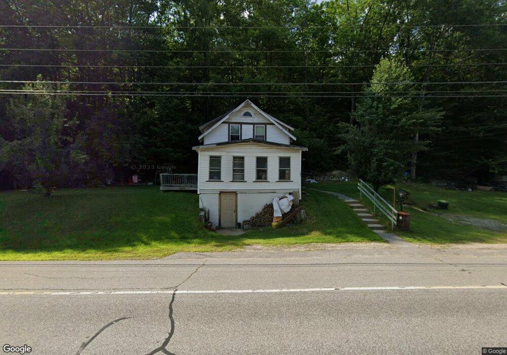
1442 Route 2 Rumford, ME 04276
Estimated Value: $115,462 - $278,000
Studio
--
Bath
1,050
Sq Ft
$179/Sq Ft
Est. Value
About This Home
This home is located at 1442 Route 2, Rumford, ME 04276 and is currently estimated at $187,866, approximately $178 per square foot. 1442 Route 2 is a home with nearby schools including Rumford Elementary School, Meroby Elementary School, and Mountain Valley Middle School.
Create a Home Valuation Report for This Property
The Home Valuation Report is an in-depth analysis detailing your home's value as well as a comparison with similar homes in the area
Home Values in the Area
Average Home Value in this Area
Tax History
| Year | Tax Paid | Tax Assessment Tax Assessment Total Assessment is a certain percentage of the fair market value that is determined by local assessors to be the total taxable value of land and additions on the property. | Land | Improvement |
|---|---|---|---|---|
| 2025 | $1,663 | $88,800 | $19,800 | $69,000 |
| 2024 | $1,476 | $88,800 | $19,800 | $69,000 |
| 2023 | $1,408 | $63,500 | $14,100 | $49,400 |
| 2022 | $1,408 | $63,500 | $14,100 | $49,400 |
| 2021 | $1,426 | $63,500 | $14,100 | $49,400 |
| 2020 | $1,435 | $63,500 | $14,100 | $49,400 |
| 2019 | $1,054 | $34,568 | $7,500 | $27,068 |
| 2018 | $1,028 | $34,568 | $7,500 | $27,068 |
| 2017 | $997 | $34,568 | $7,500 | $27,068 |
| 2016 | $968 | $34,568 | $7,500 | $27,068 |
| 2015 | $949 | $34,568 | $7,500 | $27,068 |
| 2014 | $932 | $34,568 | $7,500 | $27,068 |
Source: Public Records
Map
Nearby Homes
- Map 240 Lot 1 Map 239 Lot 4
- 1257 Route 2 Unit 23
- 018 Bear Ln
- 019 upper Bear Ln
- 19 Bear Ln
- 18 Bear Ln
- 117 Martin Rd
- Map 402 Lot 8 Rd
- 19 Hawk Ln
- 2408 U S 2
- 2379 Intervale Rd
- 2165 Main St
- 88 Hall Hill Rd
- 33 Buck Rd
- 247 Ellis River Rd
- 2139 Intervale Rd
- Lot 18-1 Isthmus Rd
- TBD Tara's Way
- 688 Prospect Ave
- 627 Prospect Ave
Your Personal Tour Guide
Ask me questions while you tour the home.