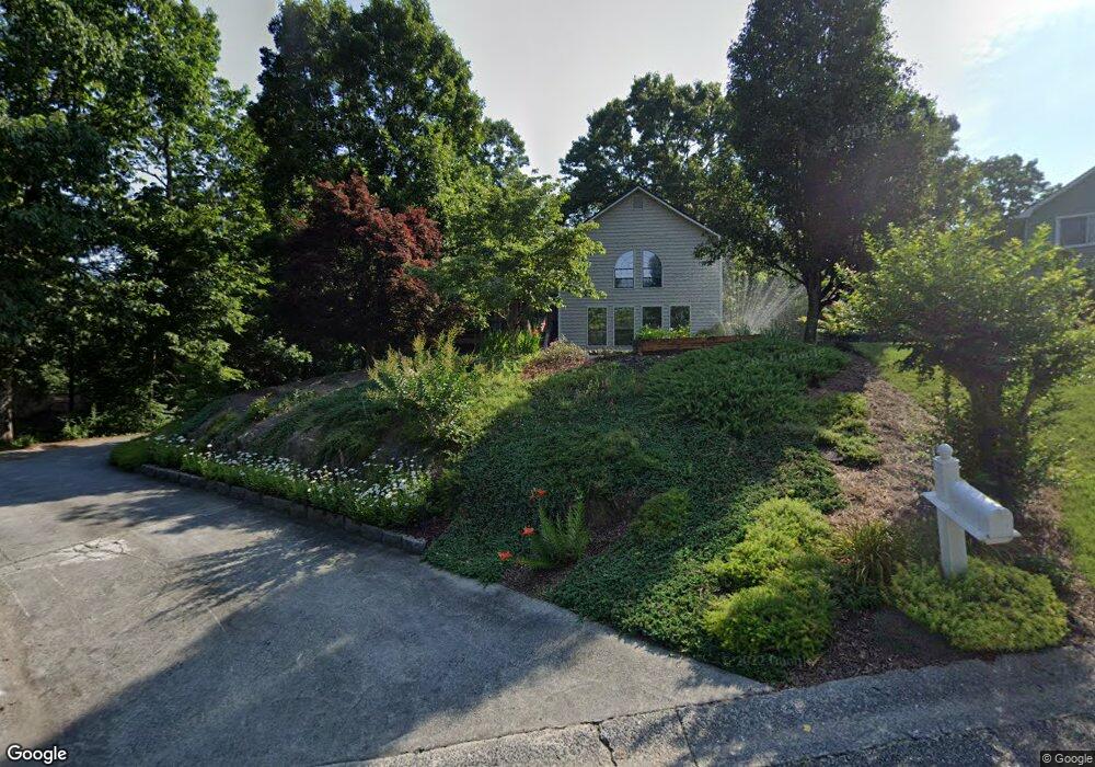
1443 White Path Trail Canton, GA 30114
Estimated Value: $415,474 - $445,000
3
Beds
2
Baths
2,416
Sq Ft
$178/Sq Ft
Est. Value
About This Home
This home is located at 1443 White Path Trail, Canton, GA 30114 and is currently estimated at $430,237, approximately $178 per square foot. 1443 White Path Trail is a home located in Cherokee County with nearby schools including Liberty Elementary School, Freedom Middle School, and Cherokee High School.
Ownership History
Date
Name
Owned For
Owner Type
Purchase Details
Closed on
Mar 28, 1997
Sold by
Butler David
Bought by
Porter Charles and Taylor Dawn
Current Estimated Value
Purchase Details
Closed on
Aug 4, 1993
Sold by
Rolfes Gordon L
Bought by
Butler J Daivd
Home Financials for this Owner
Home Financials are based on the most recent Mortgage that was taken out on this home.
Original Mortgage
$91,618
Interest Rate
7.34%
Create a Home Valuation Report for This Property
The Home Valuation Report is an in-depth analysis detailing your home's value as well as a comparison with similar homes in the area
Home Values in the Area
Average Home Value in this Area
Purchase History
| Date | Buyer | Sale Price | Title Company |
|---|---|---|---|
| Porter Charles | $114,500 | -- | |
| Butler J Daivd | $90,650 | -- |
Source: Public Records
Mortgage History
| Date | Status | Borrower | Loan Amount |
|---|---|---|---|
| Previous Owner | Butler J Daivd | $91,618 | |
| Closed | Porter Charles | $0 |
Source: Public Records
Tax History
| Year | Tax Paid | Tax Assessment Tax Assessment Total Assessment is a certain percentage of the fair market value that is determined by local assessors to be the total taxable value of land and additions on the property. | Land | Improvement |
|---|---|---|---|---|
| 2025 | $3,333 | $142,708 | $31,600 | $111,108 |
| 2024 | $3,560 | $154,668 | $34,000 | $120,668 |
| 2023 | $2,860 | $142,068 | $26,400 | $115,668 |
| 2022 | $2,732 | $113,788 | $24,000 | $89,788 |
| 2021 | $2,313 | $85,952 | $18,640 | $67,312 |
| 2020 | $2,137 | $78,276 | $16,800 | $61,476 |
| 2019 | $2,056 | $74,800 | $15,200 | $59,600 |
| 2018 | $1,974 | $71,320 | $15,200 | $56,120 |
| 2017 | $1,965 | $176,200 | $13,600 | $56,880 |
| 2016 | $1,931 | $171,600 | $13,600 | $55,040 |
| 2015 | $1,626 | $144,000 | $11,200 | $46,400 |
| 2014 | $1,404 | $124,900 | $8,200 | $41,760 |
Source: Public Records
Map
Nearby Homes
- 275 Villa Creek Pkwy
- 245 Villa Creek Pkwy
- 231 Villa Creek Pkwy Unit 9
- 401 Water Oak Ct
- 2550 Ridge Rd
- 1098 Boxwood Ln
- 2215 Mills Wood Run
- 413 Arrowhead Trail Unit 4D
- 234 Winterbury Dr
- 123 Diamond Ridge Ave
- 407 Redwood Trail
- 206 Providence Walk Ct
- 836 Topaz Valley
- 205 Creekside Pass
- 215 Lori Ln
- 227 Elmbrook Ln Unit 3L
- 235 Elmbrook Ln
- 312 Woodland Pass
- 311 Nobleman Way
- 191 Brookwood Dr
- 1433 White Path Trail
- 1453 White Path Trail
- 1432 White Path Trail
- 1452 White Path Trail
- 1423 White Path Trail
- 1463 White Path Trail
- 1894 White Rd
- 1462 White Path Trail
- 1534 Adobe Trail
- 1413 White Path Trail
- 1270 Little Deer Run
- 1270 Little Deer Run Unit ..
- 1544 Adobe Trail
- 1280 Little Deer Run
- 1472 White Path Trail
- 1250 Little Deer Run
- 1524 Adobe Trail
- 1300 Little Deer Run
- 1403 White Path Trail
- 1240 Little Deer Run
Your Personal Tour Guide
Ask me questions while you tour the home.