Estimated Value: $397,998 - $429,000
3
Beds
2
Baths
1,464
Sq Ft
$281/Sq Ft
Est. Value
About This Home
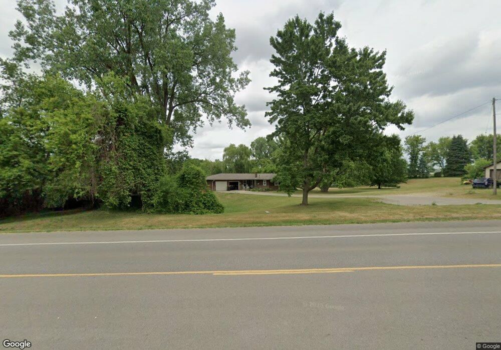
This home is located at 1445 142nd Ave, Dorr, MI 49323 and is currently estimated at $412,000, approximately $281 per square foot. 1445 142nd Ave is a home located in Allegan County with nearby schools including Wayland High School and Moline Christian School.
Ownership History
Date
Name
Owned For
Owner Type
Purchase Details
Closed on
Dec 9, 2013
Sold by
Norton Joseph D and Norton Peggy A
Bought by
Nylaan Jeffery J and Nylaan Jamie L
Current Estimated Value
Home Financials for this Owner
Home Financials are based on the most recent Mortgage that was taken out on this home.
Original Mortgage
$154,584
Outstanding Balance
$115,358
Interest Rate
4.17%
Mortgage Type
New Conventional
Estimated Equity
$296,642
Create a Home Valuation Report for This Property
The Home Valuation Report is an in-depth analysis detailing your home's value as well as a comparison with similar homes in the area
Home Values in the Area
Average Home Value in this Area
Purchase History
| Date | Buyer | Sale Price | Title Company |
|---|---|---|---|
| Nylaan Jeffery J | $160,000 | Trans Grandville |
Source: Public Records
Mortgage History
| Date | Status | Borrower | Loan Amount |
|---|---|---|---|
| Open | Nylaan Jeffery J | $154,584 |
Source: Public Records
Tax History
| Year | Tax Paid | Tax Assessment Tax Assessment Total Assessment is a certain percentage of the fair market value that is determined by local assessors to be the total taxable value of land and additions on the property. | Land | Improvement |
|---|---|---|---|---|
| 2025 | $3,365 | $218,000 | $92,300 | $125,700 |
| 2024 | $3,054 | $189,400 | $68,400 | $121,000 |
| 2023 | $3,130 | $175,100 | $66,400 | $108,700 |
| 2022 | $3,054 | $148,500 | $56,400 | $92,100 |
| 2021 | $2,861 | $143,800 | $55,100 | $88,700 |
| 2020 | $2,732 | $144,600 | $57,800 | $86,800 |
| 2019 | $2,732 | $133,100 | $47,800 | $85,300 |
| 2018 | $2,697 | $121,300 | $47,800 | $73,500 |
| 2017 | $0 | $104,100 | $26,800 | $77,300 |
| 2016 | $0 | $87,500 | $24,700 | $62,800 |
| 2015 | -- | $87,500 | $24,700 | $62,800 |
| 2014 | -- | $83,100 | $26,100 | $57,000 |
| 2013 | -- | $80,800 | $27,100 | $53,700 |
Source: Public Records
Map
Nearby Homes
- Lot 11 Walnut Dale Dr
- 4162 Radstock Dr
- 4365 Chappel St
- 1232 Rosewood Ave
- 1341 142nd Ave
- 4273 Highpoint Dr Unit 112
- 4269 Highpoint Dr Unit 114
- 4271 Highpoint Dr Unit 113
- 4294 Highpoint Dr Unit 103
- Lots A&B 142nd Ave
- 1069 Sunnyside Dr
- 4255 Cloverfield Ct
- Unit 108 Highpoint Dr
- 4279 Highpoint Dr
- 4251 Butternut Dr
- Lot 120 Old Farm Dr
- 4257 Old Farm Dr
- Lot 131 Butternut Dr
- 4286 Butternut Dr
- 4221 Century Dr
- 1435 142nd Ave
- 1456 142nd Ave
- 1456 142nd Ave
- 1417 142nd Ave
- 4214 14th St
- 1476 142nd Ave
- 4116 14th St
- 4230 14th St
- 4192 14th St
- 0 14th St Unit LOT B 3526015
- 0 14th St Unit LOT A
- 1494 14th St Unit A
- 1486 142nd Ave
- 4215 14th St
- 4247 14th St
- 1496 142nd Ave
- 4148 14th St
- 1503 142nd Ave
- 1508 142nd Ave
- 4151 14th St
Your Personal Tour Guide
Ask me questions while you tour the home.