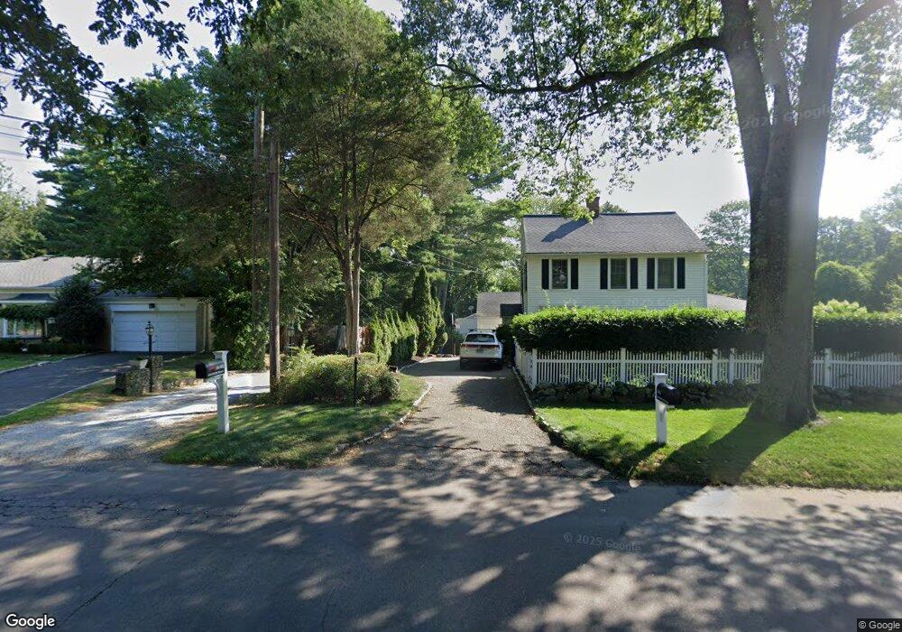
1446 Bronson Rd Fairfield, CT 06824
University NeighborhoodEstimated Value: $1,027,320 - $1,406,000
3
Beds
5
Baths
1,988
Sq Ft
$602/Sq Ft
Est. Value
About This Home
This home is located at 1446 Bronson Rd, Fairfield, CT 06824 and is currently estimated at $1,196,580, approximately $601 per square foot. 1446 Bronson Rd is a home located in Fairfield County with nearby schools including Mill Hill School, Roger Ludlowe Middle School, and Fairfield Ludlowe High School.
Ownership History
Date
Name
Owned For
Owner Type
Purchase Details
Closed on
Oct 5, 2006
Sold by
Williams Beth C
Bought by
Janis Andrew J and Janis Charlotte A
Current Estimated Value
Purchase Details
Closed on
Jul 30, 2002
Sold by
Breau Ann R
Bought by
Williams Beth C
Purchase Details
Closed on
May 28, 1993
Sold by
Southport Chase Lp
Bought by
Hanis Andrew J and Hanis Janis Charlotte
Create a Home Valuation Report for This Property
The Home Valuation Report is an in-depth analysis detailing your home's value as well as a comparison with similar homes in the area
Home Values in the Area
Average Home Value in this Area
Purchase History
| Date | Buyer | Sale Price | Title Company |
|---|---|---|---|
| Janis Andrew J | $880,000 | -- | |
| Janis Andrew J | $880,000 | -- | |
| Williams Beth C | $444,000 | -- | |
| Williams Beth C | $444,000 | -- | |
| Hanis Andrew J | $589,500 | -- | |
| Hanis Andrew J | $589,500 | -- |
Source: Public Records
Mortgage History
| Date | Status | Borrower | Loan Amount |
|---|---|---|---|
| Open | Hanis Andrew J | $688,000 | |
| Closed | Hanis Andrew J | $711,537 |
Source: Public Records
Tax History
| Year | Tax Paid | Tax Assessment Tax Assessment Total Assessment is a certain percentage of the fair market value that is determined by local assessors to be the total taxable value of land and additions on the property. | Land | Improvement |
|---|---|---|---|---|
| 2025 | $11,596 | $408,450 | $310,100 | $98,350 |
| 2024 | $11,396 | $408,450 | $310,100 | $98,350 |
| 2023 | $11,236 | $408,450 | $310,100 | $98,350 |
| 2022 | $11,126 | $408,450 | $310,100 | $98,350 |
| 2021 | $11,020 | $408,450 | $310,100 | $98,350 |
| 2020 | $10,957 | $409,010 | $306,880 | $102,130 |
| 2019 | $10,957 | $409,010 | $306,880 | $102,130 |
| 2018 | $10,782 | $409,010 | $306,880 | $102,130 |
| 2017 | $10,561 | $409,010 | $306,880 | $102,130 |
| 2016 | $10,409 | $409,010 | $306,880 | $102,130 |
| 2015 | $10,117 | $408,100 | $323,260 | $84,840 |
| 2014 | $9,958 | $408,100 | $323,260 | $84,840 |
Source: Public Records
Map
Nearby Homes
- 127 Field Rock Rd
- 320 Warner Hill Rd
- 1353 Mill Plain Rd
- 360 Duck Farm Rd
- 647 Bronson Rd
- 88 Middlebrook Dr
- 148 Millspaugh Dr
- 2683 Bronson Rd
- 329 Bronson Rd
- 610 Unquowa Rd
- 570 Unquowa Rd
- 188 Henderson Rd
- 688 Hulls Farm Rd
- 22 Knollwood Dr
- 20 Ermine St
- 260 Range Rd
- 631 Reid St
- 245 Unquowa Rd Unit 82
- 1120 Mill Hill Terrace
- 52 Robin Ln
- 1444 Bronson Rd
- 11 Twin Brooks Ln
- 1450 Bronson Rd
- 25 Twin Brooks Ln
- 1482 Bronson Rd
- 47 Twin Brooks Ln
- 1498 Bronson Rd
- 40 Twin Brooks Ln
- 14 Twin Brooks Ln
- 65 Twin Brooks Ln
- 81 Twin Brooks Ln
- 10 Twin Brooks Ln
- 30 Warner Hill Rd
- 15 Warner Hill Rd
- 1400 Bronson Rd
- 58 Twin Brooks Ln
- 101 Twin Brooks Ln
- 74 Twin Brooks Ln
- 100 Twin Brooks Ln
- 1371 Bronson Rd
Your Personal Tour Guide
Ask me questions while you tour the home.