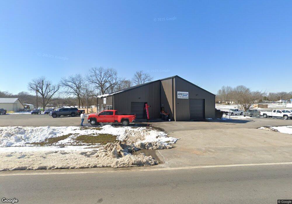
145 N Highway 62 Rogers, AR 72756
Estimated Value: $341,158
Studio
--
Bath
4,000
Sq Ft
$85/Sq Ft
Est. Value
About This Home
This home is located at 145 N Highway 62, Rogers, AR 72756 and is currently estimated at $341,158, approximately $85 per square foot. 145 N Highway 62 is a home located in Benton County with nearby schools including Grace Hill Elementary School, Oakdale Middle School, and Rogers Heritage High School.
Ownership History
Date
Name
Owned For
Owner Type
Purchase Details
Closed on
Dec 21, 2023
Sold by
Mcbride Gary A and Mcbride Sheri Burgin
Bought by
Edwards Terry Matthew and Edwards Ashley
Current Estimated Value
Purchase Details
Closed on
Apr 21, 1999
Bought by
Mcbride and Thibodeau
Purchase Details
Closed on
Jan 8, 1999
Bought by
Mcbride and Thibodeau
Purchase Details
Closed on
Aug 30, 1993
Bought by
Woods Trust
Purchase Details
Closed on
Aug 6, 1993
Bought by
Woods Rev Living Trust
Purchase Details
Closed on
Mar 30, 1988
Bought by
Kinndman
Purchase Details
Closed on
Mar 22, 1988
Bought by
Woods
Purchase Details
Closed on
Apr 19, 1985
Bought by
Schell Maurice L
Create a Home Valuation Report for This Property
The Home Valuation Report is an in-depth analysis detailing your home's value as well as a comparison with similar homes in the area
Home Values in the Area
Average Home Value in this Area
Purchase History
We collect this data history from publicly available records. To have your information removed, we recommend requesting removal directly through your county’s website.
| Date | Buyer | Sale Price | Title Company |
|---|---|---|---|
| Edwards Terry Matthew | $300,000 | Waco Title | |
| Mcbride | -- | -- | |
| Mcbride | $150,000 | -- | |
| Woods Trust | -- | -- | |
| Woods Rev Living Trust | -- | -- | |
| Kinndman | $54,000 | -- | |
| Woods | $70,000 | -- | |
| Schell Maurice L | -- | -- |
Source: Public Records
Tax History
| Year | Tax Paid | Tax Assessment Tax Assessment Total Assessment is a certain percentage of the fair market value that is determined by local assessors to be the total taxable value of land and additions on the property. | Land | Improvement |
|---|---|---|---|---|
| 2025 | $4,887 | $88,032 | $11,193 | $76,839 |
| 2024 | $594 | $11,193 | $11,193 | -- |
| 2023 | $830 | $15,630 | $3,180 | $12,450 |
| 2022 | $936 | $15,630 | $3,180 | $12,450 |
| 2021 | $934 | $15,630 | $3,180 | $12,450 |
| 2020 | $875 | $14,570 | $3,180 | $11,390 |
| 2019 | $875 | $14,570 | $3,180 | $11,390 |
| 2018 | $875 | $14,570 | $3,180 | $11,390 |
| 2017 | $824 | $14,570 | $3,180 | $11,390 |
| 2016 | $824 | $14,570 | $3,180 | $11,390 |
| 2015 | $714 | $13,440 | $3,180 | $10,260 |
| 2014 | $764 | $13,440 | $3,180 | $10,260 |
Source: Public Records
Map
Nearby Homes
- 150 N Highway 62
- 131 Hobbs Rd
- 329 Rader Rd
- 0 Rader Rd Unit 1290308
- 949 Red Cedar Place
- Lot #15 Red Cedar Place
- 13585 Andy Jack Rd
- 11925 Arkie Rd
- 10635 Prairie Creek Rd N
- 13482 Sugar Creek Rd
- 12878 Kellie Cir
- 11010 Meadowlark Rd
- 11010 Meadow Lark Rd
- 12620 Lindy Ln
- 11680 Amy Ave
- 12116 Robinwood Dr
- 12437 Wildwood Dr
- 13262 Walnut Valley Rd
- 5219 Joe Ln
- 13610 Degraff Rd
- 145 S Hwy 62
- 14903 S Highway 62
- 320 Rader Rd
- 62 S Us Hwy
- 62 N Highway 62
- 506 Hidden Forest Trail
- 506 Hidden Forest
- 13 N Hwy 62
- 3.87 Ac N Hwy 62
- 105 Russell Rd
- 275 W Rose St
- 1.2Ac N Hwy 62
- 0 S Highway 62 Rader Rd Unit Parcel K - Lot 13
- 0 S Highway 62 Rader Rd Unit Parcel J - Lot 12
- 0 S Highway 62 Rader Rd Unit Parcel I - Lot 11
- 0 S Highway 62 Rader Rd Unit Parcel H - Lot 10
- 0 S Highway 62 Rader Rd Unit Parcel G - Lot 9
- 0 S Highway 62 Rader Rd Unit Parcel F - Lot 8
- 0 S Highway 62 Rader Rd Unit Parcel E - Lot 7
- 0 S Highway 62 Rader Rd Unit Parcel D - Lot 4
Your Personal Tour Guide
Ask me questions while you tour the home.