Estimated Value: $919,000 - $1,089,000
3
Beds
2
Baths
1,990
Sq Ft
$493/Sq Ft
Est. Value
About This Home
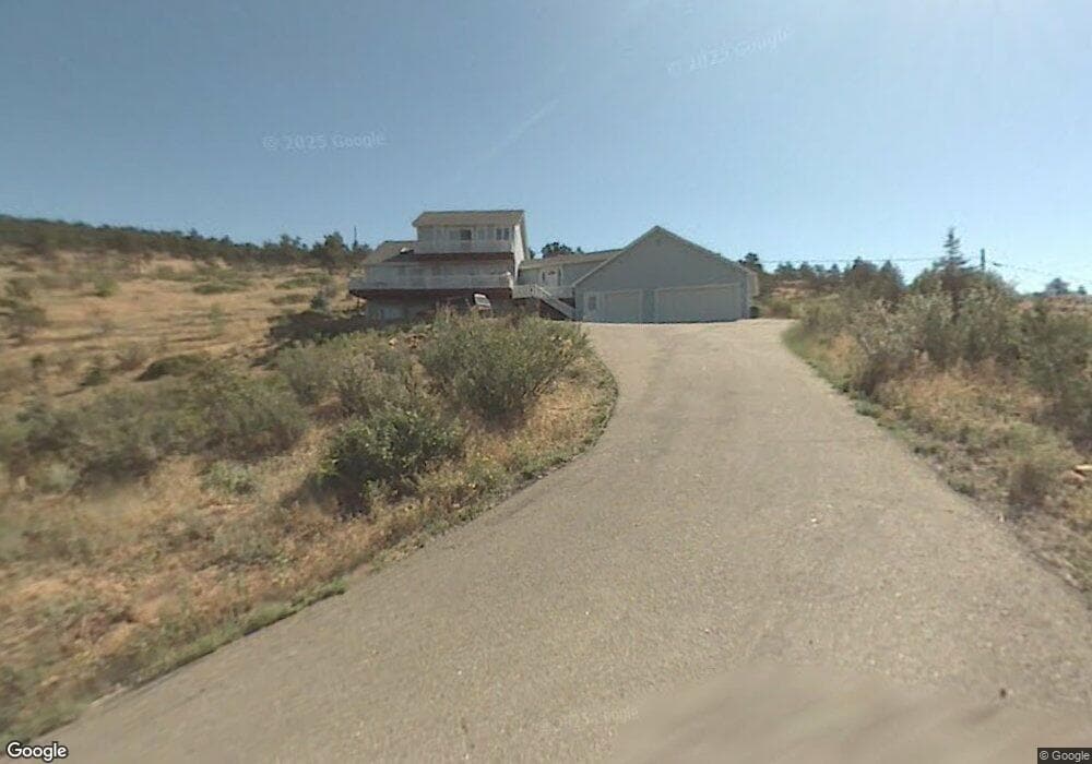
This home is located at 146 Kelling Dr, Lyons, CO 80540 and is currently estimated at $980,988, approximately $492 per square foot. 146 Kelling Dr is a home with nearby schools including Lyons Elementary School and Lyons Middle/Senior High School.
Ownership History
Date
Name
Owned For
Owner Type
Purchase Details
Closed on
Nov 22, 1994
Sold by
Cook Marshall and Cook Barbara N
Bought by
Cook Marshall A
Current Estimated Value
Home Financials for this Owner
Home Financials are based on the most recent Mortgage that was taken out on this home.
Original Mortgage
$159,250
Interest Rate
8.88%
Purchase Details
Closed on
Sep 13, 1993
Sold by
Kelling Steven G and Kelling Sharen K
Bought by
Cook Marshall
Purchase Details
Closed on
Nov 20, 1992
Bought by
Cook Marshall A and Cook Barbara N
Create a Home Valuation Report for This Property
The Home Valuation Report is an in-depth analysis detailing your home's value as well as a comparison with similar homes in the area
Purchase History
We collect this data history from publicly available records. To have your information removed, we recommend requesting removal directly through your county’s website.
| Date | Buyer | Sale Price | Title Company |
|---|---|---|---|
| Cook Marshall A | -- | Commonwealth Land Title Ins | |
| Cook Marshall | $26,000 | -- | |
| Cook Marshall A | -- | -- |
Source: Public Records
Mortgage History
We collect this data history from publicly available records. To have your information removed, we recommend requesting removal directly through your county’s website.
| Date | Status | Borrower | Loan Amount |
|---|---|---|---|
| Closed | Cook Marshall A | $159,250 |
Source: Public Records
Tax History
| Year | Tax Paid | Tax Assessment Tax Assessment Total Assessment is a certain percentage of the fair market value that is determined by local assessors to be the total taxable value of land and additions on the property. | Land | Improvement |
|---|---|---|---|---|
| 2025 | $6,687 | $60,269 | $9,568 | $50,701 |
| 2024 | $6,021 | $55,394 | $8,794 | $46,600 |
| 2023 | $5,940 | $57,332 | $8,167 | $52,850 |
| 2022 | $5,643 | $45,766 | $7,471 | $38,295 |
| 2021 | $5,330 | $45,016 | $7,686 | $37,330 |
| 2020 | $4,771 | $39,926 | $21,164 | $18,762 |
| 2019 | $4,676 | $39,926 | $21,164 | $18,762 |
| 2018 | $4,050 | $35,273 | $21,312 | $13,961 |
| 2017 | $3,983 | $38,996 | $23,562 | $15,434 |
| 2016 | $3,887 | $33,511 | $21,014 | $12,497 |
| 2015 | $3,695 | $27,549 | $4,139 | $23,410 |
| 2014 | $2,856 | $27,549 | $4,139 | $23,410 |
Source: Public Records
Map
Nearby Homes
- 240 Main St
- 217 Park St
- 202 Welch Dr
- 342 4th Ave
- 123 Falcon Ln
- 121 Osprey Ln
- 213 Welch Dr
- 17667 Route 7
- 421 Stickney Ave
- 122 Longs Peak Dr
- 926 4th Ave
- 350 Mcconnell Dr
- 352 Mcconnell Dr
- 125 Longs Peak Dr
- 215 Ewald Ave
- 223 Stone Canyon Rd
- 400 Carter Dr
- 1040 5th Ave 2 and 4
- 1040 5th Ave 5
- 430 Carter Dr
- 145 Kelling Dr
- 147 Kelling Dr
- 144 Kelling Dr
- 143 Kelling Dr
- 142 Kelling Dr
- 617 1st Ave
- 616 Overlook Dr
- 141 Kelling Dr
- 619 1st Ave
- 618 Overlook Dr
- 416 2nd Ave
- 416 2nd Ave Unit 1,2,3
- 48 E Main St
- 139 Kelling Dr
- 621 1st Ave
- 620 Overlook Dr
- 0 Overlook Dr Unit 636960
- 138 E Main St Unit 7
- 160 Main St
- 42 E Main St
Your Personal Tour Guide
Ask me questions while you tour the home.