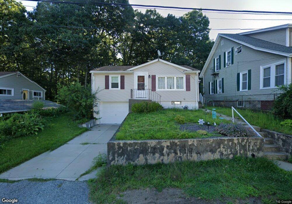
146 Saint Agnes Ave Woonsocket, RI 02895
East Woonsocket NeighborhoodEstimated Value: $325,968 - $411,000
2
Beds
1
Bath
840
Sq Ft
$430/Sq Ft
Est. Value
About This Home
This home is located at 146 Saint Agnes Ave, Woonsocket, RI 02895 and is currently estimated at $360,992, approximately $429 per square foot. 146 Saint Agnes Ave is a home located in Providence County with nearby schools including Woonsocket High School, Rise Prep Mayoral Academy Middle School, and Rise Prep Mayoral Academy.
Ownership History
Date
Name
Owned For
Owner Type
Purchase Details
Closed on
Aug 25, 2017
Sold by
Haynes Edwin P
Bought by
Deer Brian A and Deer Ashley M
Current Estimated Value
Home Financials for this Owner
Home Financials are based on the most recent Mortgage that was taken out on this home.
Original Mortgage
$64,000
Outstanding Balance
$52,993
Interest Rate
4.03%
Mortgage Type
New Conventional
Estimated Equity
$307,999
Create a Home Valuation Report for This Property
The Home Valuation Report is an in-depth analysis detailing your home's value as well as a comparison with similar homes in the area
Home Values in the Area
Average Home Value in this Area
Purchase History
We collect this data history from publicly available records. To have your information removed, we recommend requesting removal directly through your county’s website.
| Date | Buyer | Sale Price | Title Company |
|---|---|---|---|
| Deer Brian A | $80,000 | -- | |
| Deer Brian A | $80,000 | -- |
Source: Public Records
Mortgage History
We collect this data history from publicly available records. To have your information removed, we recommend requesting removal directly through your county’s website.
| Date | Status | Borrower | Loan Amount |
|---|---|---|---|
| Open | Deer Brian A | $64,000 | |
| Closed | Deer Brian A | $64,000 | |
| Previous Owner | Deer Brian A | $10,687 |
Source: Public Records
Tax History
| Year | Tax Paid | Tax Assessment Tax Assessment Total Assessment is a certain percentage of the fair market value that is determined by local assessors to be the total taxable value of land and additions on the property. | Land | Improvement |
|---|---|---|---|---|
| 2025 | $3,369 | $300,000 | $95,400 | $204,600 |
| 2024 | $3,096 | $212,900 | $90,600 | $122,300 |
| 2023 | $2,976 | $212,900 | $90,600 | $122,300 |
| 2022 | $2,976 | $212,900 | $90,600 | $122,300 |
| 2021 | $3,126 | $131,600 | $58,100 | $73,500 |
| 2020 | $3,158 | $131,600 | $58,100 | $73,500 |
| 2018 | $3,169 | $131,600 | $58,100 | $73,500 |
| 2017 | $3,549 | $117,900 | $53,300 | $64,600 |
| 2016 | $3,754 | $117,900 | $53,300 | $64,600 |
| 2015 | $4,313 | $117,900 | $53,300 | $64,600 |
| 2014 | $4,262 | $118,600 | $58,700 | $59,900 |
Source: Public Records
Map
Nearby Homes
- 213 St Louis Ave
- 86 Fall St
- 212 Saint Louis Ave
- 200 Saint Louis Ave
- 124 Saint Leon Ave
- 79 Saint Agnes Ave
- 188 Saint Louis Ave
- 1088 Diamond Hill Rd
- 77 Theresa Marie Ave
- 33 Achille St
- 7 Theresa Marie Ave
- 1175 Diamond Hill Rd Unit 305
- 120 Grange Ave
- 74 Henry St
- 194 Paine St
- 81 Florida Ave
- 538 Wood Ave
- Lot 2 Pulaski Blvd
- 76 Sweet Ave
- 96 Mill St Unit 303
- 134 Saint Agnes Ave
- 154 Saint Agnes Ave
- 145 Saint Agnes Ave
- 110 Saint Agnes Ave
- 145 St Agnes St
- 127 Saint Agnes Ave
- 165 Saint Agnes Ave
- 14 Fall St
- 178 Saint Agnes Ave
- 103 Saint Agnes Ave
- 199 Linden Ave
- 96 Saint Agnes Ave
- 276 Saint Louis Ave
- 292 St Louis Ave
- 163 Linden Ave
- 7 Fall St
- 185 Saint Agnes Ave
- 256 Saint Louis Ave
- 82 Saint Agnes Ave
- 211 Linden Ave
Your Personal Tour Guide
Ask me questions while you tour the home.