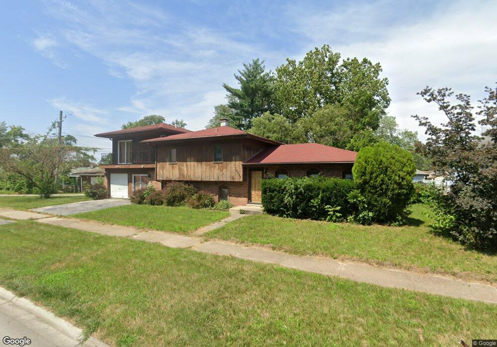
14627 Shepard Dr Dolton, IL 60419
Estimated Value: $165,000 - $241,000
About This Home
This home is located at 14627 Shepard Dr, Dolton, IL 60419 and is currently estimated at $189,926, approximately $119 per square foot. 14627 Shepard Dr is a home located in Cook County with nearby schools including Berger-Vandenberg Elementary School, Creative Communications Academy, and School Of Fine Arts Academy.
Ownership History
We collect this data history from publicly available records. To have your information removed, we recommend requesting removal directly through your county’s website.
Purchase Details
Purchase Details
Purchase Details
Purchase Details
Home Values in the Area
Average Home Value in this Area
Purchase History
We collect this data history from publicly available records. To have your information removed, we recommend requesting removal directly through your county’s website.
| Date | Buyer | Sale Price | Title Company |
|---|---|---|---|
| -- | Chicago Title | ||
| -- | Accommodation | ||
| $35,000 | Fidelity National Title | ||
| -- | None Available |
Tax History
We collect this data history from publicly available records. To have your information removed, we recommend requesting removal directly through your county’s website.
| Year | Tax Paid | Tax Assessment Tax Assessment Total Assessment is a certain percentage of the fair market value that is determined by local assessors to be the total taxable value of land and additions on the property. | Land | Improvement |
|---|---|---|---|---|
| 2025 | $8,462 | $15,000 | $3,066 | $11,934 |
| 2024 | $8,462 | $15,000 | $3,066 | $11,934 |
| 2023 | $9,537 | $15,000 | $3,066 | $11,934 |
| 2022 | $9,537 | $13,176 | $2,706 | $10,470 |
| 2021 | $9,073 | $13,174 | $2,705 | $10,469 |
| 2020 | $8,475 | $13,174 | $2,705 | $10,469 |
| 2019 | $9,085 | $12,458 | $2,525 | $9,933 |
| 2018 | $6,552 | $12,458 | $2,525 | $9,933 |
| 2017 | $6,240 | $12,458 | $2,525 | $9,933 |
| 2016 | $6,192 | $12,210 | $2,344 | $9,866 |
| 2015 | $5,903 | $12,210 | $2,344 | $9,866 |
| 2014 | $5,863 | $12,210 | $2,344 | $9,866 |
| 2013 | $6,234 | $13,560 | $2,344 | $11,216 |
Map
- 1031 E 146th St
- 14619 Minerva Ave
- 14658 Lincoln Ave
- 14631 Lincoln Ave
- 14703 Ellis Ave
- 14525 Dobson Ave
- 14708 Shepard Dr
- 14549 Lincoln Ave
- 14544 Woodlawn Ave
- 14720 Shepard Dr
- 14500 Dobson Ave
- 14761 Lincoln Ave
- 14446 Minerva Ave
- 14641 Avalon Ave
- 14505 Woodlawn Ave
- 14408 Dobson Ave
- 14444 Shepard Dr
- 14634 Kenwood Ave
- 14737 Kimbark Ave
- 14418 Drexel Ave
- 14632 Shepard Dr
- 14636 Shepard Dr
- 14628 Shepard Dr
- 14638 Shepard Dr
- 14640 Shepard Dr
- 14622 Shepard Dr
- 14659 Lincoln Ave
- 14659 Lincoln Ave
- 14655 Lincoln Ave
- 14655 Lincoln Ave
- 14644 Shepard Dr
- 14620 Shepard Dr
- 14663 Lincoln Ave
- 14651 Lincoln Ave
- 14651 Lincoln Ave
- 14669 Lincoln Ave
- 14669 Lincoln Ave
- 14635 Shepard Dr
- 14671 Lincoln Ave
- 14671 Lincoln Ave
Ask me questions while you tour the home.