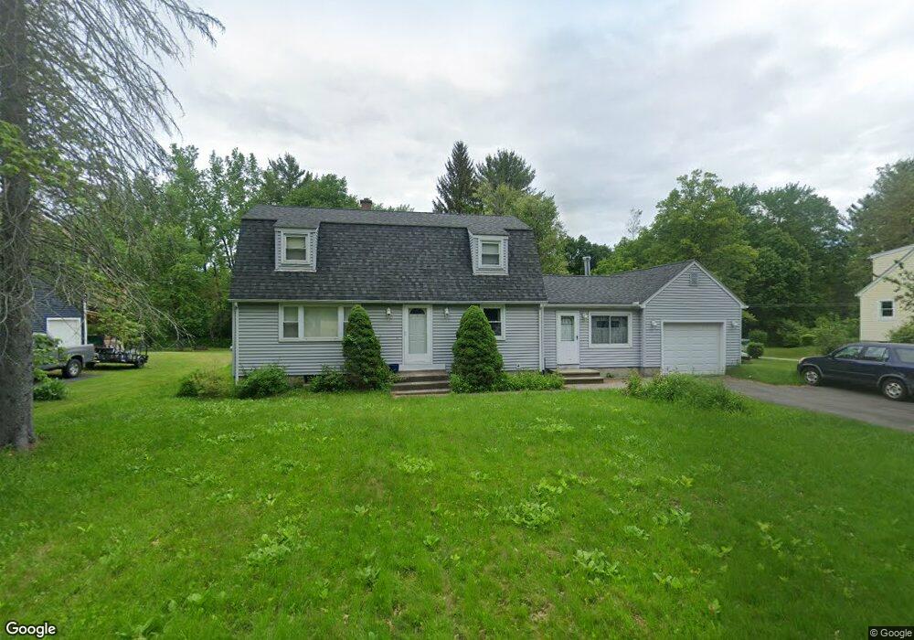
147 Sackett Rd Westfield, MA 01085
Estimated Value: $403,000 - $446,000
3
Beds
2
Baths
1,940
Sq Ft
$217/Sq Ft
Est. Value
About This Home
This home is located at 147 Sackett Rd, Westfield, MA 01085 and is currently estimated at $420,999, approximately $217 per square foot. 147 Sackett Rd is a home located in Hampden County with nearby schools including Westfield High School.
Ownership History
Date
Name
Owned For
Owner Type
Purchase Details
Closed on
Dec 1, 1997
Sold by
Bowler Kevin M
Bought by
Centeno Jose A and Centeno Maria T
Current Estimated Value
Home Financials for this Owner
Home Financials are based on the most recent Mortgage that was taken out on this home.
Original Mortgage
$104,397
Outstanding Balance
$17,709
Interest Rate
7.26%
Mortgage Type
Purchase Money Mortgage
Estimated Equity
$403,290
Purchase Details
Closed on
Jun 23, 1997
Sold by
Devereaux Robert W and Bonavita Albert J
Bought by
Bowler Kevin M
Home Financials for this Owner
Home Financials are based on the most recent Mortgage that was taken out on this home.
Original Mortgage
$80,000
Interest Rate
7.87%
Mortgage Type
Purchase Money Mortgage
Create a Home Valuation Report for This Property
The Home Valuation Report is an in-depth analysis detailing your home's value as well as a comparison with similar homes in the area
Home Values in the Area
Average Home Value in this Area
Purchase History
| Date | Buyer | Sale Price | Title Company |
|---|---|---|---|
| Centeno Jose A | $115,000 | -- | |
| Bowler Kevin M | $75,000 | -- |
Source: Public Records
Mortgage History
| Date | Status | Borrower | Loan Amount |
|---|---|---|---|
| Open | Bowler Kevin M | $13,000 | |
| Open | Bowler Kevin M | $104,397 | |
| Previous Owner | Bowler Kevin M | $80,000 | |
| Previous Owner | Bowler Kevin M | $80,000 |
Source: Public Records
Tax History
| Year | Tax Paid | Tax Assessment Tax Assessment Total Assessment is a certain percentage of the fair market value that is determined by local assessors to be the total taxable value of land and additions on the property. | Land | Improvement |
|---|---|---|---|---|
| 2025 | $5,038 | $331,900 | $118,500 | $213,400 |
| 2024 | $5,029 | $314,900 | $107,400 | $207,500 |
| 2023 | $4,667 | $284,600 | $102,300 | $182,300 |
| 2022 | $4,667 | $252,400 | $91,500 | $160,900 |
| 2021 | $4,522 | $239,500 | $86,400 | $153,100 |
| 2020 | $4,385 | $227,800 | $86,400 | $141,400 |
| 2019 | $4,282 | $217,700 | $82,100 | $135,600 |
| 2018 | $4,215 | $217,700 | $82,100 | $135,600 |
| 2017 | $4,142 | $213,300 | $83,500 | $129,800 |
| 2016 | $4,147 | $213,300 | $83,500 | $129,800 |
| 2015 | $3,843 | $207,300 | $83,500 | $123,800 |
| 2014 | $2,874 | $207,300 | $83,500 | $123,800 |
Source: Public Records
Map
Nearby Homes
- 0 Fox Hill Dr
- 145 Honey Pot Rd
- 240 Hillside Rd
- 377 N Loomis St
- 2 Sugar Maple Ln
- 112 Sunnyside Rd
- 324 Russell Rd Unit 204
- 324 Russell Rd Unit 109
- 26 Hayre St
- 42 Putnam Dr
- 74 S Maple St
- 25 Tannery Rd Unit 6A
- 44 Llewellyn Dr
- 70 S Maple St
- 44 Tannery Rd
- 30 Wynnfield Cir
- 16 Squawfield Rd
- 32 Allen Ave
- 29 Tall Pines Trail
- 42R Jefferson St
- 143 Sackett Rd
- 151 Sackett Rd
- 150 Sackett Rd
- 146 Sackett Rd
- 155 Sackett Rd
- 139 Sackett Rd
- 142 Sackett Rd
- 156 Sackett Rd
- 159 Sackett Rd
- 133 Sackett Rd
- 160 Sackett Rd
- Lot 2 Sackett Rd
- Parcel A Sackett Rd
- 161 Sackett Rd
- 127 Sackett Rd
- 166 Sackett Rd
- 70 Janis Rd
- 123 Sackett Rd
- 11 Crescent Ridge Rd
- 19 Crescent Ridge Rd
Your Personal Tour Guide
Ask me questions while you tour the home.