Estimated Value: $362,000 - $547,000
4
Beds
3
Baths
2,448
Sq Ft
$177/Sq Ft
Est. Value
About This Home
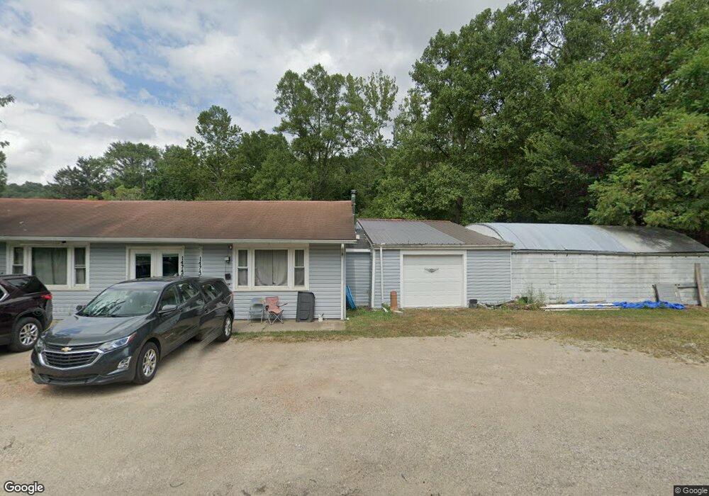
This home is located at 14709 State Route 93 S, Logan, OH 43138 and is currently estimated at $433,128, approximately $176 per square foot. 14709 State Route 93 S is a home located in Hocking County with nearby schools including Union Furnace Elementary School, Logan Christian School, and St. John the Evangelist School.
Ownership History
Date
Name
Owned For
Owner Type
Purchase Details
Closed on
Jul 11, 2016
Sold by
Stephenson Ronald F and Stephenson Debra
Bought by
Jones Scott A and Jones Richauna P
Current Estimated Value
Home Financials for this Owner
Home Financials are based on the most recent Mortgage that was taken out on this home.
Original Mortgage
$157,102
Interest Rate
3.75%
Mortgage Type
FHA
Create a Home Valuation Report for This Property
The Home Valuation Report is an in-depth analysis detailing your home's value as well as a comparison with similar homes in the area
Purchase History
| Date | Buyer | Sale Price | Title Company |
|---|---|---|---|
| Jones Scott A | $160,000 | None Available |
Source: Public Records
Mortgage History
| Date | Status | Borrower | Loan Amount |
|---|---|---|---|
| Closed | Jones Scott A | $157,102 |
Source: Public Records
Tax History
| Year | Tax Paid | Tax Assessment Tax Assessment Total Assessment is a certain percentage of the fair market value that is determined by local assessors to be the total taxable value of land and additions on the property. | Land | Improvement |
|---|---|---|---|---|
| 2025 | $3,595 | $107,360 | $29,400 | $77,960 |
| 2024 | $3,595 | $61,610 | $20,540 | $41,070 |
| 2023 | $2,322 | $61,610 | $20,540 | $41,070 |
| 2022 | $2,326 | $61,610 | $20,540 | $41,070 |
| 2021 | $2,279 | $56,720 | $14,670 | $42,050 |
| 2020 | $2,269 | $56,720 | $14,670 | $42,050 |
| 2019 | $2,270 | $56,720 | $14,670 | $42,050 |
| 2018 | $2,090 | $53,440 | $11,390 | $42,050 |
| 2017 | $2,050 | $53,440 | $11,390 | $42,050 |
| 2016 | $2,035 | $53,440 | $11,390 | $42,050 |
| 2015 | $1,986 | $50,300 | $13,530 | $36,770 |
| 2014 | $1,989 | $50,300 | $13,530 | $36,770 |
| 2013 | $1,997 | $50,300 | $13,530 | $36,770 |
Source: Public Records
Map
Nearby Homes
- 0 Lilac Ln Unit Lot 73
- 32263 Cedar Ln
- 32366 Lilac Ln
- 15050 Old McArthur Rd
- 0 Calico Ridge Rd Unit 226005949
- 13706 Old McArthur Rd
- 15155 Sauerkraut Rd
- 15532 Ohio 93
- 31440 Deerfield Dr
- 13464 State Route 664 S
- 14462 Ohio 664
- 743 Summit Dr
- 849 Mohican Ave
- 293 Mae St
- 915 Charles St
- 14509 State Route 664 S
- 14121 State Route 664 S
- 31044 Mays Rd
- 135 Ruth Ave
- 184 Florence Ave
- 31680 Harsh Rd
- 14775 State Route 93 S
- 14745 State Route 93 S
- 14701 State Route 93 S
- 31612 Harsh Rd
- 31608 Harsh Rd
- 31616 Harsh Rd
- 14635 State Route 93 S
- 14270 Old McArthur Rd
- 14571 State Route 93 S
- 14475 Ohio 93
- 14808 State Route 93 S
- 31526 Harsh Rd
- 14551 Ohio 93
- 13915 Wildwood Dr
- 31601 Harsh Rd
- 14266 Old McArthur Rd
- 31478 Harsh Rd
- 14279 State Route 93 S
- 14541 State Route 93 S
Your Personal Tour Guide
Ask me questions while you tour the home.