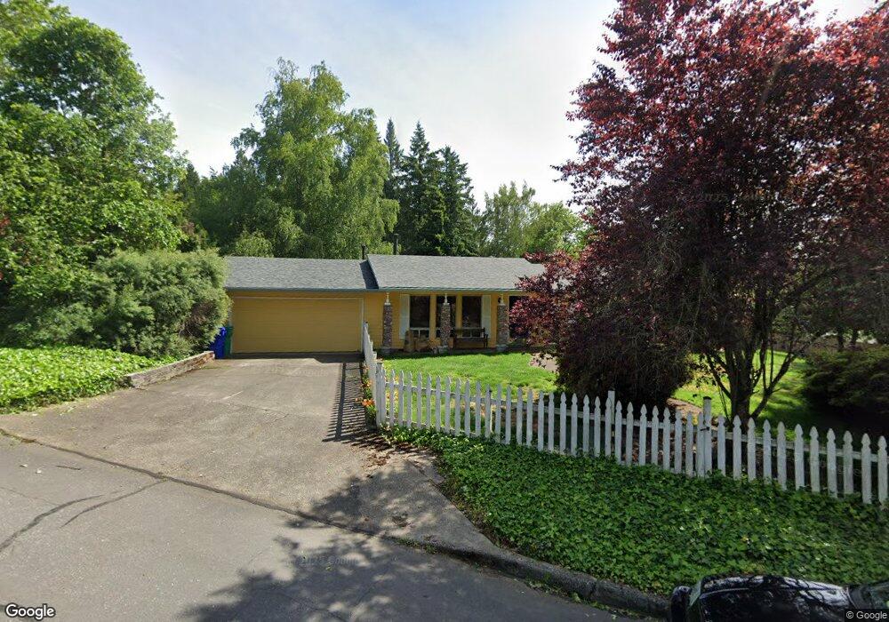
1490 SW 31st St Gresham, OR 97080
Gresham Butte NeighborhoodEstimated Value: $417,000 - $464,000
3
Beds
3
Baths
1,456
Sq Ft
$308/Sq Ft
Est. Value
About This Home
This home is located at 1490 SW 31st St, Gresham, OR 97080 and is currently estimated at $448,836, approximately $308 per square foot. 1490 SW 31st St is a home located in Multnomah County with nearby schools including Dexter McCarty Middle School, Gresham High School, and Portland Adventist Elementary School.
Ownership History
Date
Name
Owned For
Owner Type
Purchase Details
Closed on
Apr 27, 2016
Sold by
Dempsey Gary E
Bought by
Bracco Michael G
Current Estimated Value
Purchase Details
Closed on
Nov 17, 2003
Sold by
Dempsey Wilfred E
Bought by
Dempsey Gary E
Home Financials for this Owner
Home Financials are based on the most recent Mortgage that was taken out on this home.
Original Mortgage
$135,000
Interest Rate
5.89%
Mortgage Type
Purchase Money Mortgage
Create a Home Valuation Report for This Property
The Home Valuation Report is an in-depth analysis detailing your home's value as well as a comparison with similar homes in the area
Home Values in the Area
Average Home Value in this Area
Purchase History
We collect this data history from publicly available records. To have your information removed, we recommend requesting removal directly through your county’s website.
| Date | Buyer | Sale Price | Title Company |
|---|---|---|---|
| Bracco Michael G | $273,000 | First American | |
| Dempsey Gary E | $150,000 | Fidelity Natl Title Co Of Or |
Source: Public Records
Mortgage History
We collect this data history from publicly available records. To have your information removed, we recommend requesting removal directly through your county’s website.
| Date | Status | Borrower | Loan Amount |
|---|---|---|---|
| Previous Owner | Dempsey Gary E | $135,000 |
Source: Public Records
Tax History
| Year | Tax Paid | Tax Assessment Tax Assessment Total Assessment is a certain percentage of the fair market value that is determined by local assessors to be the total taxable value of land and additions on the property. | Land | Improvement |
|---|---|---|---|---|
| 2025 | $5,098 | $250,500 | -- | -- |
| 2024 | $4,880 | $243,210 | -- | -- |
| 2023 | $4,446 | $236,130 | $0 | $0 |
| 2022 | $4,322 | $229,260 | $0 | $0 |
| 2021 | $4,213 | $222,590 | $0 | $0 |
| 2020 | $3,964 | $216,110 | $0 | $0 |
| 2019 | $3,860 | $209,820 | $0 | $0 |
| 2018 | $3,681 | $203,710 | $0 | $0 |
| 2017 | $3,531 | $197,780 | $0 | $0 |
| 2016 | $3,113 | $192,020 | $0 | $0 |
| 2015 | $3,046 | $186,430 | $0 | $0 |
| 2014 | $2,972 | $181,000 | $0 | $0 |
Source: Public Records
Map
Nearby Homes
- 1320 SW 31st St
- 1278 SW 27th Ct
- 1721 SW Butler Rd
- 2068 SW 34th St
- 1261 SW Binford Lake Pkwy
- 1363 SW Binford Lake Pkwy
- 2331 SW 27th Dr
- 3986 SW Rodlun Rd
- 4002 SW Rodlun Rd
- 4126 SW Rodlun Rd
- 3533 SW Eleven Mile Ave
- 3511 SW Eleven Mile Ave
- 3555 SW Eleven Mile Ave
- 1944 SW 20th Ct
- 3577 SW Eleven Mile Ave
- 2188 SW Binford Lake Pkwy
- 3619 SW Eleven Mile Ave
- 3512 SW Battaglia Ave
- 3691 SW Eleven Mile Ave
- 3582 SW Battaglia Ave
- 3190 SW Towle Ave
- 1450 SW 31st St
- 3059 SW Chastain Ave
- 1495 SW 31st St
- 1646 SW Willow Pkwy
- 3220 SW Towle Ave
- 3120 SW Orchard Place
- 1410 SW 31st St
- 3025 SW Chastain Ave
- 1647 SW Willow Pkwy
- 3100 SW Orchard Place
- 1390 SW 31st St
- 3150 SW Orchard Place
- 1395 SW 31st St
- 3270 SW Towle Ave
- 3019 SW Chastain Ave
- 3052 SW Towle Ave
- 3020 SW Chastain Ave
- 1697 SW Willow Pkwy
- 3151 SW Orchard Place
Your Personal Tour Guide
Ask me questions while you tour the home.