Estimated Value: $332,000 - $406,000
5
Beds
3
Baths
2,024
Sq Ft
$180/Sq Ft
Est. Value
About This Home
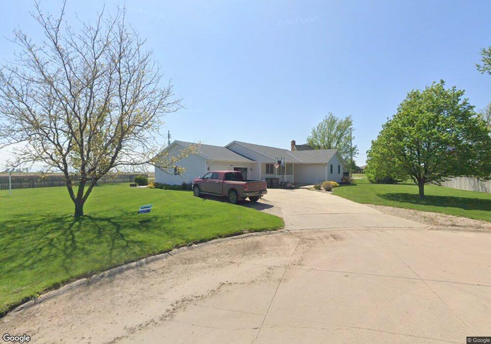
This home is located at 1495 E St, Utica, NE 68456 and is currently estimated at $365,262, approximately $180 per square foot. 1495 E St is a home located in Seward County with nearby schools including Centennial Elementary School, Centennial High School, and St. Paul Lutheran School.
Ownership History
Date
Name
Owned For
Owner Type
Purchase Details
Closed on
Aug 5, 2022
Sold by
Peterson Tony D and Peterson Cathy J
Bought by
Peterson Tony D and Peterson Cathy J
Current Estimated Value
Purchase Details
Closed on
Jan 31, 2018
Sold by
Stoll Erin R
Bought by
Stoll Craig R
Purchase Details
Closed on
May 29, 2015
Sold by
Hammer Chad D and Hammer Megan D
Bought by
Stoll Craig R and Stoll Erin R
Home Financials for this Owner
Home Financials are based on the most recent Mortgage that was taken out on this home.
Original Mortgage
$186,200
Interest Rate
3.71%
Mortgage Type
New Conventional
Create a Home Valuation Report for This Property
The Home Valuation Report is an in-depth analysis detailing your home's value as well as a comparison with similar homes in the area
Purchase History
| Date | Buyer | Sale Price | Title Company |
|---|---|---|---|
| Peterson Tony D | -- | None Listed On Document | |
| Stoll Craig R | -- | None Available | |
| Stoll Craig R | -- | York County Title Co |
Source: Public Records
Mortgage History
| Date | Status | Borrower | Loan Amount |
|---|---|---|---|
| Previous Owner | Stoll Craig R | $186,200 |
Source: Public Records
Tax History
| Year | Tax Paid | Tax Assessment Tax Assessment Total Assessment is a certain percentage of the fair market value that is determined by local assessors to be the total taxable value of land and additions on the property. | Land | Improvement |
|---|---|---|---|---|
| 2025 | $2,938 | $313,293 | $20,599 | $292,694 |
| 2024 | $2,939 | $286,418 | $18,902 | $267,516 |
| 2023 | $3,448 | $268,529 | $18,902 | $249,627 |
| 2022 | $3,259 | $241,783 | $18,902 | $222,881 |
| 2021 | $2,821 | $215,036 | $18,902 | $196,134 |
| 2020 | $2,765 | $213,602 | $18,902 | $194,700 |
| 2019 | $2,475 | $195,510 | $18,764 | $176,746 |
| 2018 | $2,403 | $191,855 | $18,413 | $173,442 |
| 2017 | $2,297 | $206,797 | $22,858 | $183,939 |
| 2016 | $2,183 | $178,995 | $17,536 | $161,459 |
| 2015 | $2,094 | $178,995 | $17,536 | $161,459 |
| 2013 | -- | $179,670 | $17,536 | $162,134 |
Source: Public Records
Map
Nearby Homes
- 141 Bronco Cir
- 300 2nd St
- 601 A St
- 303 Stafford St
- 402 Gordon St
- 1113 Bessie St
- 1026 Frances St
- 603 Omaha St
- 400 Main St
- 0003 Rock Creek Rd
- 0001 Rock Creek Rd
- 597 406th
- 0002 Rock Creek Rd
- 1107 Road P
- 2307 Nebraska 69
- 1419 Road N
- 2304 E 16th St
- 0 Tbd 294 Rd Unit 11552208
- 0 Tbd 294 Rd Unit 24423505
- 1719 N Brookside Ln
Your Personal Tour Guide
Ask me questions while you tour the home.