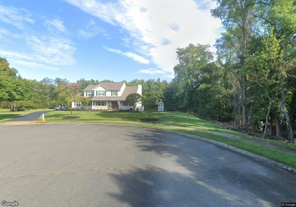
1496 Deborah Ct Wall Township, NJ 07719
Estimated Value: $1,060,877 - $1,252,000
About This Home
This home is located at 1496 Deborah Ct, Wall Township, NJ 07719 and is currently estimated at $1,117,469, approximately $483 per square foot. 1496 Deborah Ct is a home located in Monmouth County with nearby schools including Wall High School, The Brookside School, and St. Catharine School.
Ownership History
We collect this data history from publicly available records. To have your information removed, we recommend requesting removal directly through your county’s website.
Purchase Details
Home Values in the Area
Average Home Value in this Area
Purchase History
We collect this data history from publicly available records. To have your information removed, we recommend requesting removal directly through your county’s website.
| Date | Buyer | Sale Price | Title Company |
|---|---|---|---|
| $249,900 | -- |
Tax History
We collect this data history from publicly available records. To have your information removed, we recommend requesting removal directly through your county’s website.
| Year | Tax Paid | Tax Assessment Tax Assessment Total Assessment is a certain percentage of the fair market value that is determined by local assessors to be the total taxable value of land and additions on the property. | Land | Improvement |
|---|---|---|---|---|
| 2026 | $13,252 | $597,200 | $262,200 | $335,000 |
| 2025 | $13,252 | $597,200 | $262,200 | $335,000 |
| 2024 | $12,225 | $597,200 | $262,200 | $335,000 |
| 2023 | $12,225 | $597,200 | $262,200 | $335,000 |
| 2022 | $11,926 | $597,200 | $262,200 | $335,000 |
| 2021 | $11,926 | $597,200 | $262,200 | $335,000 |
| 2020 | $11,783 | $597,200 | $262,200 | $335,000 |
| 2019 | $11,639 | $597,200 | $262,200 | $335,000 |
| 2018 | $11,538 | $597,200 | $262,200 | $335,000 |
| 2017 | $11,311 | $597,200 | $262,200 | $335,000 |
| 2016 | $11,072 | $597,200 | $262,200 | $335,000 |
| 2015 | $11,254 | $381,500 | $131,600 | $249,900 |
| 2014 | $11,406 | $395,500 | $145,600 | $249,900 |
Map
- 1908 Shadowbrook Dr
- 1903 Shadowbrook Dr
- 71 S Manor Ct
- 11 S Manor Ct
- 1301 Wedgewood Rd
- 1317 W Magnolia Ave
- 1936 Troy Dr
- 1207 Ocean Rd
- 2130 Shadow Ln
- 2005 Nassau Dr
- 2008 Fairway Dr
- 1205 Wildwood Ave
- 1210 Candlewood Ln
- 909 Prospect Ave
- 1120 New York Ave
- 1919 Atlantic Ave Unit 25
- 1919 Atlantic Ave Unit 7
- 1919 Atlantic Ave Unit 12
- 813 Ocean Rd
- 2389 Church St
- 1495 Ocean Rd
- 1497 Deborah Ct
- 1494 Deborah Ct
- 2098 Ohadi Dr
- 1493 Ocean Rd
- 1498 Ocean Rd
- 1495 Deborah Ct
- 2099 Ohadi Dr
- 1496 Ocean Rd
- 1499 Ocean Rd
- 1492 Deborah Ct
- 1493 Deborah Ct
- 1504 Ocean Rd
- 2096 Ohadi Dr
- 1491 Samuel Dr
- 1492 Ocean Rd
- 1493 Samuel Dr
- 2097 Ohadi Dr
- 2104 Baileys Corner Rd
- 1491 Deborah Ct
Ask me questions while you tour the home.