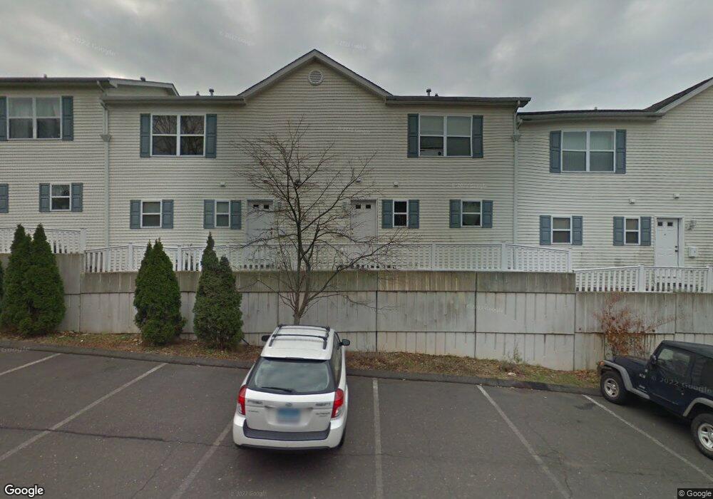
15 Ferris Ave Unit D Norwalk, CT 06854
Spring Hill NeighborhoodEstimated Value: $411,283 - $436,000
2
Beds
2
Baths
1,175
Sq Ft
$358/Sq Ft
Est. Value
About This Home
This home is located at 15 Ferris Ave Unit D, Norwalk, CT 06854 and is currently estimated at $420,571, approximately $357 per square foot. 15 Ferris Ave Unit D is a home located in Fairfield County with nearby schools including Kendall Elementary School, Ponus Ridge Middle School, and Brien Mcmahon High School.
Ownership History
Date
Name
Owned For
Owner Type
Purchase Details
Closed on
Oct 21, 2009
Sold by
Koniecko Przemyslaw and Kulas Beata
Bought by
Grant Michael
Current Estimated Value
Home Financials for this Owner
Home Financials are based on the most recent Mortgage that was taken out on this home.
Original Mortgage
$324,022
Outstanding Balance
$211,689
Interest Rate
5.09%
Estimated Equity
$208,882
Create a Home Valuation Report for This Property
The Home Valuation Report is an in-depth analysis detailing your home's value as well as a comparison with similar homes in the area
Home Values in the Area
Average Home Value in this Area
Purchase History
| Date | Buyer | Sale Price | Title Company |
|---|---|---|---|
| Grant Michael | $330,000 | -- | |
| Grant Michael | $330,000 | -- |
Source: Public Records
Mortgage History
| Date | Status | Borrower | Loan Amount |
|---|---|---|---|
| Open | Grant Michael | $324,022 | |
| Closed | Grant Michael | $324,022 |
Source: Public Records
Tax History
| Year | Tax Paid | Tax Assessment Tax Assessment Total Assessment is a certain percentage of the fair market value that is determined by local assessors to be the total taxable value of land and additions on the property. | Land | Improvement |
|---|---|---|---|---|
| 2025 | $5,183 | $216,450 | $0 | $216,450 |
| 2024 | $5,106 | $216,450 | $0 | $216,450 |
| 2023 | $3,974 | $157,930 | $0 | $157,930 |
| 2022 | $3,900 | $157,930 | $0 | $157,930 |
| 2021 | $3,798 | $157,930 | $0 | $157,930 |
| 2020 | $3,796 | $157,930 | $0 | $157,930 |
| 2019 | $3,690 | $157,930 | $0 | $157,930 |
| 2018 | $3,474 | $130,290 | $0 | $130,290 |
| 2017 | $3,354 | $130,290 | $0 | $130,290 |
| 2016 | $3,322 | $130,290 | $0 | $130,290 |
| 2015 | $3,313 | $130,290 | $0 | $130,290 |
| 2014 | $3,270 | $130,290 | $0 | $130,290 |
Source: Public Records
Map
Nearby Homes
- 34 Ferris Ave Unit A2
- 9 Frost St
- 29 Hyatt Ave
- 39 Stuart Ave Unit 8
- 47 Cedar St Unit 2
- 75 N Taylor Ave
- 1 Phillips St Unit 4
- 82 Ledgebrook Dr
- 37 Brooklawn Ave
- 1 Horizon Dr Unit 28
- 92 Ledgebrook Dr Unit 92
- 39 Bayview Ave
- 20 Avenue A
- 47 Taylor Ave
- 2 Finley St
- 4 Senga Rd
- 11 Ledgebrook Dr Unit 11
- 5 Mcallister Ave
- 19 Ledgebrook Dr Unit 2
- 6 Norton Place
- 15 Ferris Ave Unit F
- 15 Ferris Ave Unit E
- 15 Ferris Ave Unit C
- 15 Ferris Ave Unit B
- 15 Ferris Ave Unit A
- 15 Ferris Ave Unit A
- 13 Ferris Ave Unit 7
- 19 Ferris Ave
- 19 Ferris Ave Unit 3
- 17 Ferris Ave Unit 23
- 17 Ferris Ave Unit 14
- 17 Ferris Ave Unit 7
- 17 Ferris Ave Unit 6
- 17 Ferris Ave Unit 5
- 17 Ferris Ave Unit 1
- 17 Ferris Ave Unit 3
- 17 Ferris Ave Unit 12
- 17 Ferris Ave Unit 16
- 17 Ferris Ave Unit 17
- 17 Ferris Ave Unit 8
Your Personal Tour Guide
Ask me questions while you tour the home.