NOT LISTED FOR SALE

15 Lyon Dr Laurel, MS 39440

Estimated Value: $67,286 - $89,000

3.54 Acres
$22,074 Price per Acre
154,202 Sq Ft Lot

Last Sold October 03, 2023

Current estimated payment $543/month

5 Days on Market

About This Lot

As of October 2023

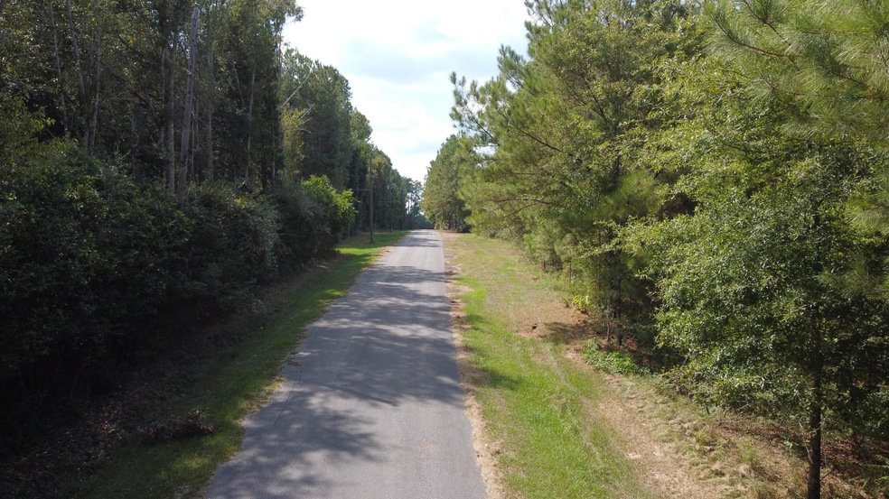
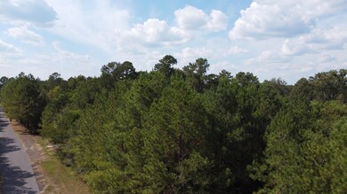
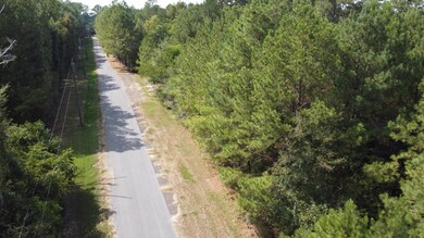
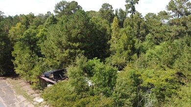
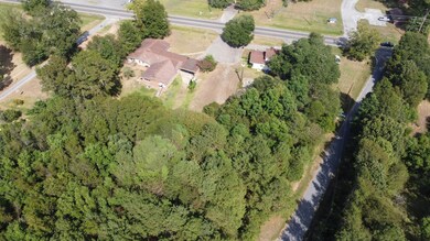
3.54 acres located just outside the city limits of Laurel with no restrictions. This property could have many uses as either residential or commercial development.

Last Agent to Sell the Property

Lee Boyette

Woodland Realty, Inc License #16901 Listed on: 09/22/2023

Last Buyer's Agent

NON-MEMBER AGENT

Non-member Office

Property Details

Property Type

  • Land

Est. Annual Taxes

  • $1,374

Lot Details

  • 3.54 Acre Lot
  • Level Lot

Utilities

  • Cable TV Available

Property Details

Property Type

Land

Est. Annual Taxes

$1,374

Lot Details

0

Listing Details

  • 16th Section Land: N
  • First Right of Refusal: Select One
  • Directions: Hwy 15 North; turn Left onto Lyon Drive
  • Electrical Service Provider: Mississippi Power Co
  • Garbage And Trash Svc Other: YES
  • Gas Svc Prvd Other: YES
  • Historical District: No
  • Lender Short Sale: No
  • Listing Member Name: G Lee Boyette, SRS
  • Listing Office Short Id: woodlandrlty
  • Open House Office I D: 20060830193111622661000000
  • Prop. Type: Land
  • List Price Range: 12
  • Realtor Ads: Yes
  • Selling Member Short Id: 88.1
  • Selling Office Short Id: 88
  • Sewage Companies Other: YES
  • Total Annual Property Tax: 1374.22
  • Utility Info Electric Supplier: MS Power
  • Utility Info Water Supplier: City
  • Water Service Provided Other: City
  • Road Frontage: Paved Road
  • Estimated Lot Size: 3 - 5 Acres
  • Buildings on Property: Other - See Remarks
  • Suitable Use: Other - See Remarks, Res Multi-Family, Res Single Family, Subdevelopment
  • Topo Natural Feats: Level
  • Type Of Property2: Commercial/Business, Other - See Remarks
  • Special Features: None
  • Property Sub Type: LotsLands

Interior Features

  • Foreclosure: No
  • Legal Description: 13-9-12 METES AND BOUNDS DESCRIPTION * Parcel Number: 147F-13-00-025.01

Exterior Features

  • Flood Zone: No
  • Price Per Acre: 24011.00

Utilities

  • Utilities: Cable TV, City Water, Electricity, Other - See Remarks

Schools

  • School District: West Jones
  • School District: West Jones

Lot Info

  • Lot Acres: 3.54
  • Lot Dimensions: 3.54

Tax Info

  • Tax Year: 2022

Range of Values:

Collateral Analytics

Collateral Analytics Collateral Analytics AVMs (Automated Valuation Model) employ a number of statistical approaches combined with neighborhood-specific comparable selection guarantees the most up-to-date and precise valuations.

Not Available

Collateral Analytics does not have data for the current month. Please view the chart for historical values.

ICE

ICE Mortgage Technology ICE Mortgage Technology’s AVM (Automated Valuation Model) is a state-of-the-art online residential property valuation tool that provides a quick and accurate estimate of the value of almost any home in the U.S.

Not Available

ICE Mortgage Technology does not have data for the current month. Please view the chart for historical values.

First American

First American First American Data & Analytics’ next-generation AVM combines unrivaled data assets with a blended ensemble of valuation models to produce highly accurate, reliable valuations you can trust.

Not Available

First American does not have data for the current month. Please view the chart for historical values.

Quantarium

Quantarium Quantarium’s valuation service, repeatedly proven the industry’s most accurate and comprehensive, is supercharged with a self-learning and auto-tuning AI engine that continually becomes smarter and more accurate as it processes daily inputs from the industry’s leading RE data lake.

Not Available

Quantarium does not have data for the current month. Please view the chart for historical values.

Average Value
Not Available
List Price
Sold Price
Create a Home Valuation Report for This Property
The Home Valuation Report is an in-depth analysis detailing your home's value as well as a comparison with similar homes in the area

Home Values in the Area

Source: Public Records

Average Home Value in this Area


Source: Public Records

Property History

Date Event Price Change Sq Ft Price
10/03/2023 10/03/23 Sold -- -- --
09/27/2023 09/27/23 Pending -- -- --
09/22/2023 09/22/23 For Sale $85,000 -- --
Source: Hattiesburg Area Association of REALTORS®

Tax History Compared to Growth

Source: Public Records

Tax History

Year Tax Paid Tax Assessment Tax Assessment Total Assessment is a certain percentage of the fair market value that is determined by local assessors to be the total taxable value of land and additions on the property. Land Improvement
2024 $1,344 $10,620 $0 $0
2023 $1,344 $10,620 $0 $0
2022 $1,374 $10,620 $0 $0
2021 $1,380 $10,620 $0 $0
2020 $1,404 $10,620 $0 $0
2019 $1,410 $10,620 $0 $0
2018 $1,410 $10,620 $0 $0
2017 $1,408 $10,620 $0 $0
2016 $1,376 $10,620 $0 $0
2015 -- $10,620 $0 $0
2014 -- $10,620 $0 $0
Source: Public Records

Agents Affiliated with this Home

  • Section Image
See All Agents

Map

Source: Hattiesburg Area Association of REALTORS®

MLS Number: 135179

Hattiesburg Area Association of REALTORS®

APN: 147F-13-00-025.01