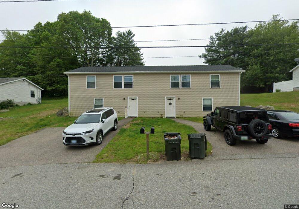
15 Maybrey Dr Westerly, RI 02891
Estimated Value: $418,000 - $519,000
4
Beds
2
Baths
1,440
Sq Ft
$326/Sq Ft
Est. Value
About This Home
This home is located at 15 Maybrey Dr, Westerly, RI 02891 and is currently estimated at $469,438, approximately $325 per square foot. 15 Maybrey Dr is a home located in Washington County with nearby schools including Westerly High School and St. Michael School.
Ownership History
Date
Name
Owned For
Owner Type
Purchase Details
Closed on
Jun 7, 2012
Sold by
Berenberg Melissa
Bought by
Chimento Melissa
Current Estimated Value
Purchase Details
Closed on
Aug 15, 2008
Sold by
Scavotto Philip L and Scavotto Anne M
Bought by
Berenberg Melissa
Home Financials for this Owner
Home Financials are based on the most recent Mortgage that was taken out on this home.
Original Mortgage
$225,000
Interest Rate
6.4%
Mortgage Type
Purchase Money Mortgage
Create a Home Valuation Report for This Property
The Home Valuation Report is an in-depth analysis detailing your home's value as well as a comparison with similar homes in the area
Home Values in the Area
Average Home Value in this Area
Purchase History
We collect this data history from publicly available records. To have your information removed, we recommend requesting removal directly through your county’s website.
| Date | Buyer | Sale Price | Title Company |
|---|---|---|---|
| Chimento Melissa | -- | -- | |
| Berenberg Melissa | $250,000 | -- |
Source: Public Records
Mortgage History
We collect this data history from publicly available records. To have your information removed, we recommend requesting removal directly through your county’s website.
| Date | Status | Borrower | Loan Amount |
|---|---|---|---|
| Previous Owner | Berenberg Melissa | $225,000 | |
| Previous Owner | Berenberg Melissa | $160,000 | |
| Previous Owner | Berenberg Melissa | $125,000 |
Source: Public Records
Tax History
| Year | Tax Paid | Tax Assessment Tax Assessment Total Assessment is a certain percentage of the fair market value that is determined by local assessors to be the total taxable value of land and additions on the property. | Land | Improvement |
|---|---|---|---|---|
| 2025 | $3,069 | $394,500 | $145,800 | $248,700 |
| 2024 | $3,161 | $302,500 | $104,600 | $197,900 |
| 2023 | $3,073 | $302,500 | $104,600 | $197,900 |
| 2022 | $3,055 | $302,500 | $104,600 | $197,900 |
| 2021 | $3,089 | $256,100 | $91,200 | $164,900 |
| 2020 | $2,420 | $204,200 | $91,200 | $113,000 |
| 2019 | $2,663 | $226,800 | $91,200 | $135,600 |
| 2018 | $2,617 | $211,900 | $91,200 | $120,700 |
| 2017 | $2,543 | $211,900 | $91,200 | $120,700 |
| 2016 | $2,543 | $211,900 | $91,200 | $120,700 |
| 2015 | $2,439 | $217,200 | $93,000 | $124,200 |
| 2014 | $2,400 | $217,200 | $93,000 | $124,200 |
Source: Public Records
Map
Nearby Homes
- 2 Marichris Dr
- 29 Coastwind Dr
- 38 Coastwind Dr
- 6 Marion St
- 19 Apache Dr Unit F
- 17 Apache Dr Unit G
- 9 Apache Dr Unit D
- 36 Ledward Ave
- 90 Ashaway Rd
- 177 High St
- 166 High St
- 23 Newton Ave
- 140 High St Unit 204
- 199 High St
- 17 West St Unit 3
- 35 Pearl St
- 38 School St
- 27 School St Unit 1
- 25 School St Unit 2
- 3 Columbus Ave
- 13 Maybrey Dr
- 17 Maybrey Dr
- 16 Sunrise Dr
- 14 Sunrise Dr
- 18 Maybrey Dr
- 16 Maybrey Dr
- 18 Sunrise Dr
- 12 Sunrise Dr
- 19 Maybrey Dr
- 21 Maybrey Dr
- 14 Maybrey Dr
- 11 Maybrey Dr
- 21A Maybrey Dr Unit 21A Maybrey
- 15 Sunrise Dr
- 9 Maybrey Dr
- 17 Sunrise Dr
- 13 Sunrise Dr
- 20 Sunrise Dr
- 20 Sunrise Dr
- 20 Sunrise Dr Unit 20B
Your Personal Tour Guide
Ask me questions while you tour the home.