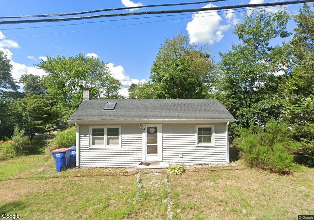
15 Rose Point Ave Wareham, MA 02576
Estimated Value: $334,193 - $355,000
2
Beds
1
Bath
644
Sq Ft
$537/Sq Ft
Est. Value
About This Home
This home is located at 15 Rose Point Ave, Wareham, MA 02576 and is currently estimated at $346,048, approximately $537 per square foot. 15 Rose Point Ave is a home located in Plymouth County.
Ownership History
Date
Name
Owned For
Owner Type
Purchase Details
Closed on
Jun 17, 2022
Sold by
Moran Paul W
Bought by
Milano Sandra
Current Estimated Value
Home Financials for this Owner
Home Financials are based on the most recent Mortgage that was taken out on this home.
Original Mortgage
$217,500
Outstanding Balance
$206,361
Interest Rate
5.27%
Mortgage Type
Purchase Money Mortgage
Estimated Equity
$139,687
Purchase Details
Closed on
Oct 29, 2009
Sold by
Levine Lenora D
Bought by
Moran Paul W
Home Financials for this Owner
Home Financials are based on the most recent Mortgage that was taken out on this home.
Original Mortgage
$121,754
Interest Rate
5.06%
Mortgage Type
Purchase Money Mortgage
Purchase Details
Closed on
Jun 30, 1997
Sold by
Keane Gerald J and Keane Dorothy E
Bought by
Levine Lenora D
Create a Home Valuation Report for This Property
The Home Valuation Report is an in-depth analysis detailing your home's value as well as a comparison with similar homes in the area
Purchase History
| Date | Buyer | Sale Price | Title Company |
|---|---|---|---|
| Milano Sandra | $290,000 | None Available | |
| Milano Sandra | $290,000 | None Available | |
| Moran Paul W | $124,000 | -- | |
| Moran Paul W | $124,000 | -- | |
| Levine Lenora D | $74,500 | -- | |
| Levine Lenora D | $74,500 | -- |
Source: Public Records
Mortgage History
| Date | Status | Borrower | Loan Amount |
|---|---|---|---|
| Open | Milano Sandra | $217,500 | |
| Closed | Milano Sandra | $217,500 | |
| Previous Owner | Levine Lenora D | $121,754 |
Source: Public Records
Tax History
| Year | Tax Paid | Tax Assessment Tax Assessment Total Assessment is a certain percentage of the fair market value that is determined by local assessors to be the total taxable value of land and additions on the property. | Land | Improvement |
|---|---|---|---|---|
| 2025 | $2,995 | $287,400 | $101,600 | $185,800 |
| 2024 | $3,061 | $272,600 | $78,600 | $194,000 |
| 2023 | $2,654 | $242,000 | $71,400 | $170,600 |
| 2022 | $2,654 | $201,400 | $71,400 | $130,000 |
| 2021 | $2,463 | $183,100 | $71,400 | $111,700 |
| 2020 | $2,334 | $176,000 | $71,400 | $104,600 |
| 2019 | $2,137 | $160,800 | $66,400 | $94,400 |
| 2018 | $2,083 | $152,800 | $66,400 | $86,400 |
| 2017 | $1,934 | $143,800 | $66,400 | $77,400 |
| 2016 | $1,760 | $130,100 | $63,500 | $66,600 |
| 2015 | $1,700 | $130,100 | $63,500 | $66,600 |
| 2014 | $1,577 | $122,700 | $59,500 | $63,200 |
Source: Public Records
Map
Nearby Homes
- 21 Bisbee St
- 34 Pine Hill Ln
- 14 Briarwood Dr
- 12 Taft St
- 37 Lincoln Hwy
- 15 14th Ave
- 929 Point Rd
- 0 Cromesett Rd (Off) Unit 73385395
- 233 Marion Rd
- 119 County Rd
- 127 County Rd
- 17 Lynne Rd
- 245 Wareham Rd
- 3 Cranberry Grove Way Unit C
- 4 Blackhall Ct
- 4 Mather Dr
- 3 Lynne Rd
- 21 Bayview St
- 10 Barnes St
- 6 Bourne Terrace
Your Personal Tour Guide
Ask me questions while you tour the home.