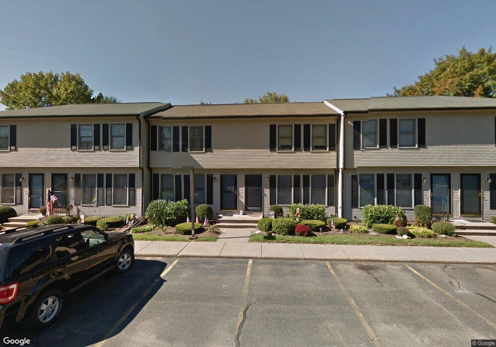
150 Hillside Rd Unit 18 Westfield, MA 01085
Estimated Value: $219,707 - $248,000
2
Beds
2
Baths
782
Sq Ft
$297/Sq Ft
Est. Value
About This Home
This home is located at 150 Hillside Rd Unit 18, Westfield, MA 01085 and is currently estimated at $231,927, approximately $296 per square foot. 150 Hillside Rd Unit 18 is a home located in Hampden County with nearby schools including Westfield High School and Saint Mary High School.
Ownership History
Date
Name
Owned For
Owner Type
Purchase Details
Closed on
May 1, 2025
Sold by
Curry Sharon E
Bought by
Curry Irt and Mcgurn
Current Estimated Value
Purchase Details
Closed on
Jul 8, 1994
Sold by
Woronoco Sb
Bought by
Curry Sharon E
Home Financials for this Owner
Home Financials are based on the most recent Mortgage that was taken out on this home.
Original Mortgage
$45,000
Interest Rate
8.51%
Mortgage Type
Purchase Money Mortgage
Purchase Details
Closed on
Oct 20, 1993
Sold by
Sanford Lois M
Bought by
Woronoco Sb
Purchase Details
Closed on
Aug 26, 1988
Sold by
Richfield Rlty Corp
Bought by
Sanford Lois M
Create a Home Valuation Report for This Property
The Home Valuation Report is an in-depth analysis detailing your home's value as well as a comparison with similar homes in the area
Home Values in the Area
Average Home Value in this Area
Purchase History
| Date | Buyer | Sale Price | Title Company |
|---|---|---|---|
| Curry Irt | -- | None Available | |
| Curry Irt | -- | None Available | |
| Curry Sharon E | $75,000 | -- | |
| Curry Sharon E | $75,000 | -- | |
| Woronoco Sb | $78,700 | -- | |
| Woronoco Sb | $78,700 | -- | |
| Sanford Lois M | $95,900 | -- |
Source: Public Records
Mortgage History
| Date | Status | Borrower | Loan Amount |
|---|---|---|---|
| Previous Owner | Sanford Lois M | $43,500 | |
| Previous Owner | Sanford Lois M | $45,000 |
Source: Public Records
Tax History
| Year | Tax Paid | Tax Assessment Tax Assessment Total Assessment is a certain percentage of the fair market value that is determined by local assessors to be the total taxable value of land and additions on the property. | Land | Improvement |
|---|---|---|---|---|
| 2025 | $2,851 | $187,800 | $0 | $187,800 |
| 2024 | $2,879 | $180,300 | $0 | $180,300 |
| 2023 | $2,701 | $164,300 | $0 | $164,300 |
| 2022 | $2,701 | $146,100 | $0 | $146,100 |
| 2021 | $2,709 | $143,500 | $0 | $143,500 |
| 2020 | $2,610 | $135,600 | $0 | $135,600 |
| 2019 | $2,561 | $130,200 | $0 | $130,200 |
| 2018 | $2,521 | $130,200 | $0 | $130,200 |
| 2017 | $2,528 | $130,200 | $0 | $130,200 |
| 2016 | $2,531 | $130,200 | $0 | $130,200 |
| 2015 | $2,547 | $137,400 | $0 | $137,400 |
| 2014 | $2,498 | $137,400 | $0 | $137,400 |
Source: Public Records
Map
Nearby Homes
- 25 Tannery Rd Unit 6A
- 44 Tannery Rd
- 74 S Maple St
- 70 S Maple St
- 16 Squawfield Rd
- 112 Sunnyside Rd
- 26 Hayre St
- 30 Wynnfield Cir
- 240 Hillside Rd
- 2 Sugar Maple Ln
- 0 Fox Hill Dr
- 65 Old Farm Rd
- 29 Tall Pines Trail
- 44 Kensington Ave
- 7 Washington St
- 32 Allen Ave
- 15 Silvergrass Ln
- 34 Silvergrass Ln
- 42 Putnam Dr
- 42R Jefferson St
- 150 Hillside Rd Unit 30
- 150 Hillside Rd Unit 29
- 150 Hillside Rd Unit 28
- 150 Hillside Rd Unit 27
- 150 Hillside Rd Unit 26
- 150 Hillside Rd Unit 25
- 150 Hillside Rd Unit 24
- 150 Hillside Rd Unit 22
- 150 Hillside Rd Unit 21
- 150 Hillside Rd Unit 20
- 150 Hillside Rd Unit 19
- 150 Hillside Rd Unit 17
- 150 Hillside Rd Unit 16
- 150 Hillside Rd Unit 15
- 150 Hillside Rd Unit 14
- 150 Hillside Rd Unit 13
- 150 Hillside Rd Unit 12
- 150 Hillside Rd Unit 10
- 150 Hillside Rd Unit 9
- 150 Hillside Rd Unit 8
Your Personal Tour Guide
Ask me questions while you tour the home.