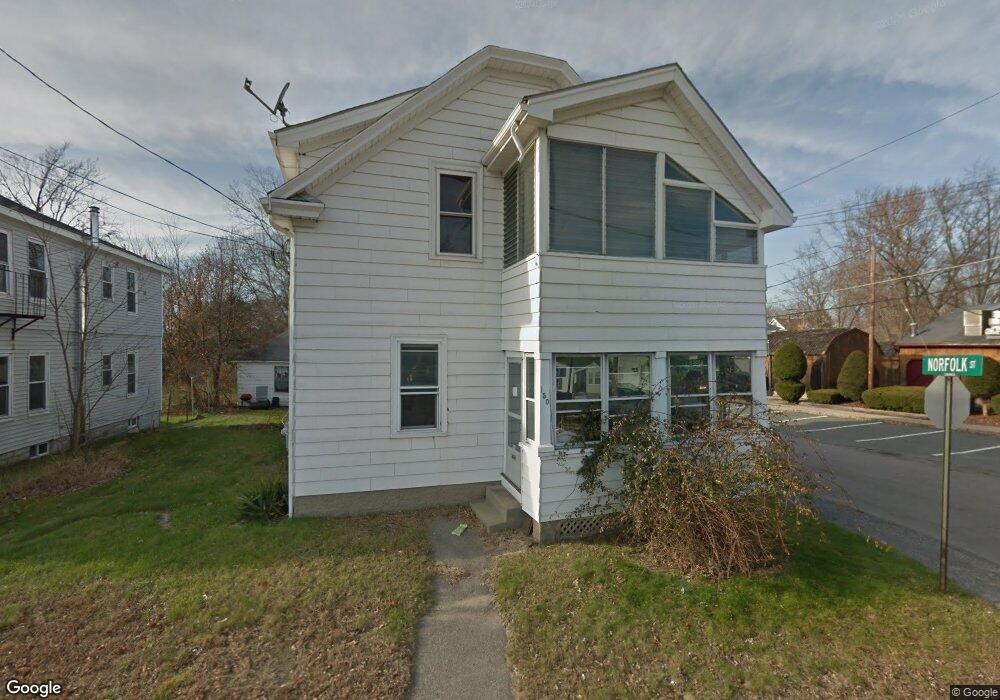
150 Pulaski Blvd Bellingham, MA 02019
Estimated Value: $407,388 - $500,000
4
Beds
2
Baths
2,028
Sq Ft
$227/Sq Ft
Est. Value
About This Home
This home is located at 150 Pulaski Blvd, Bellingham, MA 02019 and is currently estimated at $460,847, approximately $227 per square foot. 150 Pulaski Blvd is a home located in Norfolk County with nearby schools including Joseph F. DiPietro Elementary, Bellingham High School, and Rise Prep Mayoral Academy Middle School.
Ownership History
Date
Name
Owned For
Owner Type
Purchase Details
Closed on
Aug 26, 2005
Sold by
Jolicoeur Joshua G
Bought by
Hurteau Marc A
Current Estimated Value
Home Financials for this Owner
Home Financials are based on the most recent Mortgage that was taken out on this home.
Original Mortgage
$187,500
Outstanding Balance
$99,239
Interest Rate
5.68%
Mortgage Type
Purchase Money Mortgage
Estimated Equity
$361,608
Purchase Details
Closed on
Aug 25, 2005
Sold by
Chofay Catherine and Lane Debra A
Bought by
Jolicoeur Joshua G
Home Financials for this Owner
Home Financials are based on the most recent Mortgage that was taken out on this home.
Original Mortgage
$187,500
Outstanding Balance
$99,239
Interest Rate
5.68%
Mortgage Type
Purchase Money Mortgage
Estimated Equity
$361,608
Create a Home Valuation Report for This Property
The Home Valuation Report is an in-depth analysis detailing your home's value as well as a comparison with similar homes in the area
Home Values in the Area
Average Home Value in this Area
Purchase History
| Date | Buyer | Sale Price | Title Company |
|---|---|---|---|
| Hurteau Marc A | $250,000 | -- | |
| Jolicoeur Joshua G | $218,000 | -- |
Source: Public Records
Mortgage History
| Date | Status | Borrower | Loan Amount |
|---|---|---|---|
| Open | Hurteau Marc A | $187,500 | |
| Closed | Hurteau Marc A | $37,500 |
Source: Public Records
Tax History
| Year | Tax Paid | Tax Assessment Tax Assessment Total Assessment is a certain percentage of the fair market value that is determined by local assessors to be the total taxable value of land and additions on the property. | Land | Improvement |
|---|---|---|---|---|
| 2025 | $4,169 | $331,900 | $82,900 | $249,000 |
| 2024 | $3,979 | $309,400 | $75,700 | $233,700 |
| 2023 | $3,985 | $305,400 | $72,100 | $233,300 |
| 2022 | $3,935 | $279,500 | $60,100 | $219,400 |
| 2021 | $3,494 | $242,500 | $60,100 | $182,400 |
| 2020 | $3,190 | $224,300 | $60,900 | $163,400 |
| 2019 | $2,936 | $206,600 | $60,900 | $145,700 |
| 2018 | $2,869 | $199,100 | $59,200 | $139,900 |
| 2017 | $2,793 | $194,800 | $59,200 | $135,600 |
| 2016 | $2,862 | $200,300 | $66,500 | $133,800 |
| 2015 | $2,911 | $204,300 | $67,900 | $136,400 |
| 2014 | $3,102 | $211,600 | $71,400 | $140,200 |
Source: Public Records
Map
Nearby Homes
- Lot 2 Pulaski Blvd
- 33 Achille St
- 13 Ethel St
- 178 Saint Louis Ave
- 188 Saint Louis Ave
- 61 Lawrence St
- 79 Saint Agnes Ave
- 89 Saint Agnes Ave
- 212 Saint Louis Ave
- 213 St Louis Ave
- 108 Mill St Unit 104
- 1088 Diamond Hill Rd
- 194 Paine St
- 90 Mill St Unit 202
- 551 Wood Ave
- 31 S Main St
- 21 Irving St
- 538 Wood Ave
- 40 Valley St
- 7 Theresa Marie Ave
- 150 Pulaski Blvd Unit 2
- 150 Pulaski Blvd Unit 1
- 140 Pulaski Blvd
- 140 Pulaski Blvd Unit 1
- 160 Pulaski Blvd
- 131 Pulaski Blvd
- 130 Pulaski Blvd
- 151 Pulaski Blvd
- 170 Pulaski Blvd
- 31 Norfolk St
- 10 Suffolk St
- 111 Pulaski Blvd
- 36 Norfolk St
- 121-123 Pulaski Blvd
- 11 Carrier St
- 10 Central Blvd Unit 12
- 11 Central Blvd
- 30 Suffolk St
- 30 Suffolk St Unit 2
- 30 Suffolk St Unit 2
Your Personal Tour Guide
Ask me questions while you tour the home.