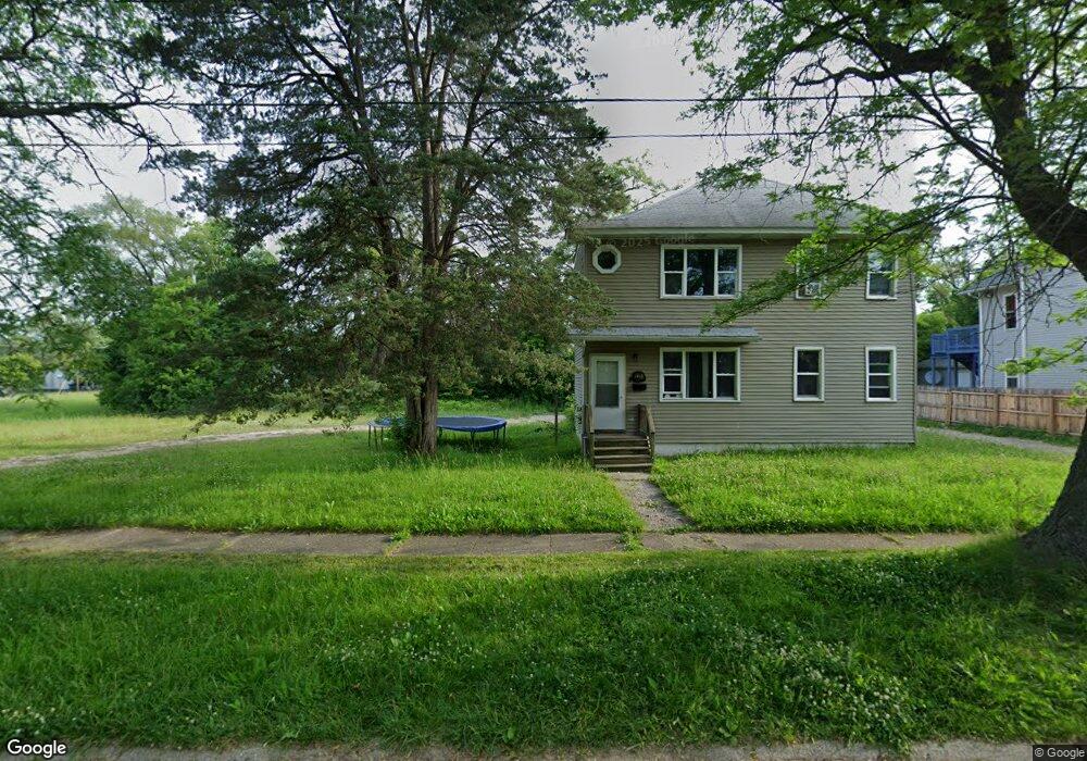
1502 W Moore St Flint, MI 48504
Sterling and Myrtle Neighborhood
4
Beds
2
Baths
1,688
Sq Ft
8,712
Sq Ft Lot
About This Home
This home is located at 1502 W Moore St, Flint, MI 48504. 1502 W Moore St is a home located in Genesee County with nearby schools including Brownell STEM Academy, The New Standard Academy, and Eagle's Nest Academy.
Create a Home Valuation Report for This Property
The Home Valuation Report is an in-depth analysis detailing your home's value as well as a comparison with similar homes in the area
Home Values in the Area
Average Home Value in this Area
Tax History
| Year | Tax Paid | Tax Assessment Tax Assessment Total Assessment is a certain percentage of the fair market value that is determined by local assessors to be the total taxable value of land and additions on the property. | Land | Improvement |
|---|---|---|---|---|
| 2024 | -- | $0 | $0 | $0 |
| 2023 | $300 | $3,500 | $0 | $0 |
| 2022 | $0 | $0 | $0 | $0 |
| 2021 | $0 | $0 | $0 | $0 |
| 2020 | $0 | $0 | $0 | $0 |
| 2019 | $757 | $0 | $0 | $0 |
| 2018 | $221 | $0 | $0 | $0 |
| 2017 | $221 | $0 | $0 | $0 |
| 2016 | $757 | $0 | $0 | $0 |
| 2015 | $0 | $0 | $0 | $0 |
| 2014 | -- | $0 | $0 | $0 |
| 2012 | -- | $16,500 | $0 | $0 |
Source: Public Records
Map
Nearby Homes
- 4306 Berger Dr
- 4110 Leerda St
- 4013 Sterling St
- 4310 Berger Dr
- 3918 Trumbull Ave
- 4539 Trumbull Dr
- 3722 Sterling St
- 3808 Comstock Ave
- 4008 Winona St
- 2013 Canniff St
- 2210 Canniff St
- 3517 Leerda St
- 1909 Cherrylawn Dr
- 3505 Leerda St
- 4816 Glenn Ave
- 3710 Kellar Ave
- 3413 Leerda St
- 3506 Brownell Blvd
- 3617 Kellar Ave
- 4808 Edwards Ave
- 1418 W Moore St
- 1501 W Stewart Ave
- 1414 W Moore St
- 1505 W Stewart Ave
- 1419 W Stewart Ave
- 4220 Fleming Rd
- 1415 W Stewart Ave
- 1410 W Moore St
- 1411 W Stewart Ave
- 1406 W Moore St
- 1407 W Stewart Ave
- 1402 W Moore St
- 1514 W Stewart Ave
- 4221 Fleming Rd
- 1418 W Stewart Ave
- 1401 W Stewart Ave
- 1502 W Stewart Ave
- 1506 W Stewart Ave Unit Bldg-Unit
- 1506 W Stewart Ave
- 1318 W Moore St
Your Personal Tour Guide
Ask me questions while you tour the home.