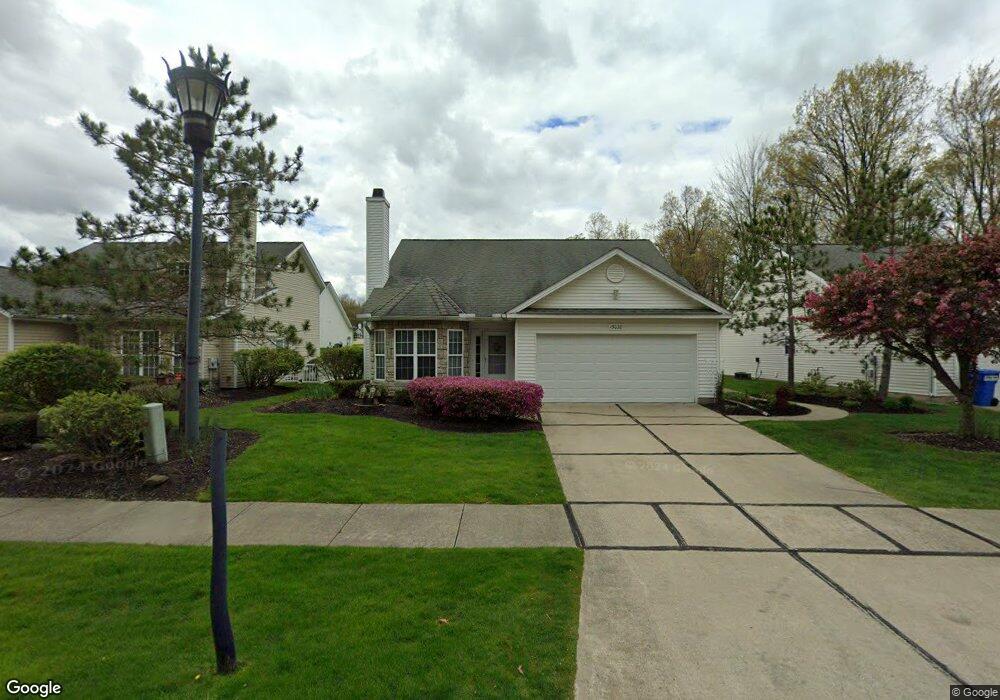
15040 Primrose Ln Middlefield, OH 44062
Estimated Value: $265,337 - $299,000
3
Beds
3
Baths
1,904
Sq Ft
$145/Sq Ft
Est. Value
About This Home
This home is located at 15040 Primrose Ln, Middlefield, OH 44062 and is currently estimated at $276,584, approximately $145 per square foot. 15040 Primrose Ln is a home located in Geauga County with nearby schools including Jordak Elementary School, Cardinal Middle School, and Cardinal High School.
Ownership History
Date
Name
Owned For
Owner Type
Purchase Details
Closed on
Apr 26, 2017
Bought by
Allan W Kolesar
Current Estimated Value
Home Financials for this Owner
Home Financials are based on the most recent Mortgage that was taken out on this home.
Interest Rate
3.97%
Purchase Details
Closed on
Sep 4, 2014
Sold by
Reum Russell E
Bought by
Reum Russell E and The Russell E Reum Family Trust
Purchase Details
Closed on
Aug 2, 2005
Sold by
Hamko Andrew S
Bought by
Reum Russell E and Reum Carol M
Home Financials for this Owner
Home Financials are based on the most recent Mortgage that was taken out on this home.
Original Mortgage
$50,000
Interest Rate
5.71%
Mortgage Type
Purchase Money Mortgage
Purchase Details
Closed on
Sep 6, 2002
Sold by
High Pointe Of Geauga Development Corp
Bought by
Hamko Andrew S
Create a Home Valuation Report for This Property
The Home Valuation Report is an in-depth analysis detailing your home's value as well as a comparison with similar homes in the area
Home Values in the Area
Average Home Value in this Area
Purchase History
| Date | Buyer | Sale Price | Title Company |
|---|---|---|---|
| Allan W Kolesar | $175,500 | -- | |
| Reum Russell E | -- | Attorney | |
| Reum Russell E | $172,500 | Real Living Title Agency Ltd | |
| Hamko Andrew S | $167,800 | Chicago Title Agency |
Source: Public Records
Mortgage History
| Date | Status | Borrower | Loan Amount |
|---|---|---|---|
| Closed | Allan W Kolesar | -- | |
| Previous Owner | Reum Russell E | $50,000 |
Source: Public Records
Tax History
| Year | Tax Paid | Tax Assessment Tax Assessment Total Assessment is a certain percentage of the fair market value that is determined by local assessors to be the total taxable value of land and additions on the property. | Land | Improvement |
|---|---|---|---|---|
| 2025 | $2,925 | $74,830 | $8,750 | $66,080 |
| 2024 | $2,925 | $74,830 | $8,750 | $66,080 |
| 2023 | $2,875 | $74,830 | $8,750 | $66,080 |
| 2022 | $2,621 | $56,350 | $8,750 | $47,600 |
| 2021 | $2,626 | $56,350 | $8,750 | $47,600 |
| 2020 | $2,712 | $56,350 | $8,750 | $47,600 |
| 2019 | $2,478 | $56,350 | $8,750 | $47,600 |
| 2018 | $2,933 | $56,350 | $8,750 | $47,600 |
| 2017 | $2,478 | $56,350 | $8,750 | $47,600 |
| 2016 | $2,191 | $56,920 | $14,880 | $42,040 |
| 2015 | $1,956 | $56,920 | $14,880 | $42,040 |
| 2014 | $1,956 | $56,920 | $14,880 | $42,040 |
| 2013 | $1,933 | $56,920 | $14,880 | $42,040 |
Source: Public Records
Map
Nearby Homes
- V/L High Pointe Cir
- 15100 Timber Ridge Dr
- 15114 Sawgrass Ln
- 15130 Sawgrass Ln
- 15229 Timber Ridge Dr
- 15224 Timber Ridge Dr
- 15243 Woodsong Dr
- 15539 Nantucket Cove Unit 2
- 15648 Elmwood St
- 16095 E High St
- 14706 Steeplechase Dr
- 16298 Weathervane Dr
- 16352 and 16350 Nauvoo Rd
- 15791 Madison Rd
- 15720 Jug Rd
- 13829 Carlton St
- 16310 Madison Rd
- 13888 Goodwin St
- 15904 Claridon Troy Rd
- VL Garden St
- 15420 High Pointe Cir
- 15043 Primrose Ln Unit 21
- 15418 High Pointe Cir Unit 40
- 15041 Primrose Ln
- 15045 Primrose Ln Unit 22
- 15416 High Pointe Cir
- 15052 Primrose Ln
- 15430 High Pointe Cir
- 15417 High Pointe Cir
- 15028 Woodsong Dr
- 15414 High Pointe Cir
- 15032 Woodsong Dr
- 15024 Woodsong Dr Unit 1
- 15036 Woodsong Dr
- 15415 High Pointe Cir Unit 72
- 15054 Primrose Ln
- 15412 High Pointe Cir
- 15038 Woodsong Dr Unit 5
- 15051 Primrose Ln
- 15056 Primrose Ln Unit 35
Your Personal Tour Guide
Ask me questions while you tour the home.