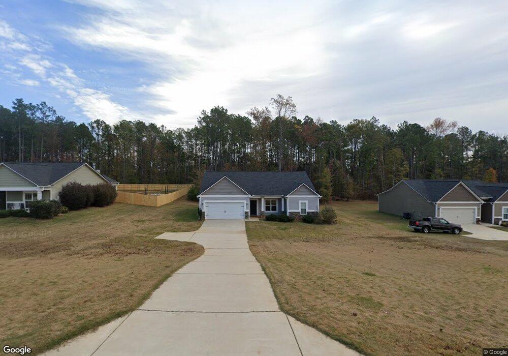
151 Amhurst Cir West Point, GA 31833
Estimated Value: $251,860 - $297,000
4
Beds
2
Baths
1,561
Sq Ft
$180/Sq Ft
Est. Value
About This Home
This home is located at 151 Amhurst Cir, West Point, GA 31833 and is currently estimated at $280,215, approximately $179 per square foot. 151 Amhurst Cir is a home with nearby schools including West Point Elementary School, Long Cane Elementary School, and Whitesville Road Elementary School.
Ownership History
Date
Name
Owned For
Owner Type
Purchase Details
Closed on
May 26, 2016
Sold by
Dri Amhurst Llc
Bought by
Francis Kevin A
Current Estimated Value
Home Financials for this Owner
Home Financials are based on the most recent Mortgage that was taken out on this home.
Original Mortgage
$148,920
Outstanding Balance
$117,278
Interest Rate
3.5%
Mortgage Type
FHA
Estimated Equity
$162,937
Create a Home Valuation Report for This Property
The Home Valuation Report is an in-depth analysis detailing your home's value as well as a comparison with similar homes in the area
Home Values in the Area
Average Home Value in this Area
Purchase History
| Date | Buyer | Sale Price | Title Company |
|---|---|---|---|
| Francis Kevin A | $151,700 | -- |
Source: Public Records
Mortgage History
| Date | Status | Borrower | Loan Amount |
|---|---|---|---|
| Open | Francis Kevin A | $148,920 |
Source: Public Records
Tax History
| Year | Tax Paid | Tax Assessment Tax Assessment Total Assessment is a certain percentage of the fair market value that is determined by local assessors to be the total taxable value of land and additions on the property. | Land | Improvement |
|---|---|---|---|---|
| 2025 | $2,357 | $93,320 | $14,000 | $79,320 |
| 2024 | $2,113 | $79,480 | $14,000 | $65,480 |
| 2023 | $2,172 | $81,640 | $14,000 | $67,640 |
| 2022 | $1,925 | $70,960 | $10,000 | $60,960 |
| 2021 | $1,880 | $64,320 | $10,000 | $54,320 |
| 2020 | $1,820 | $62,320 | $8,000 | $54,320 |
| 2019 | $1,705 | $58,520 | $6,000 | $52,520 |
| 2018 | $1,705 | $58,520 | $6,000 | $52,520 |
| 2017 | $1,705 | $58,520 | $6,000 | $52,520 |
| 2016 | $163 | $5,400 | $5,400 | $0 |
| 2015 | $163 | $5,400 | $5,400 | $0 |
| 2014 | $163 | $5,400 | $5,400 | $0 |
| 2013 | -- | $5,400 | $5,400 | $0 |
Source: Public Records
Map
Nearby Homes
- 107 Amhurst Dr
- 4172 Bartley Rd
- 145 Jarrell Hogg Rd
- 101 Garden Walk
- 101 Garden Walk Unit 85
- 648 Warner Rd
- 0 Warner Rd Unit 10686116
- 211 Harris Walk
- 223 Harris Walk
- 225 Harris Walk
- 209 Harris Walk
- 221 Harris Walk
- 215 Harris Walk
- 182 Lower Lovelace Rd
- 0 Sandtown Rd Unit 10255987
- Sandtown Rd
- 797 Gabbettville Rd
- 143 W Drummond Rd
- 151 W Drummond Rd
- 157 W Drummond Rd
- 149 Amhurst Cir Unit LOT 27
- 149 Amhurst Cir
- 153 Amhurst Cir Unit LOT 29
- 153 Amhurst Cir
- 147 Amhurst Dr
- 147 Amhurst Dr Unit 26
- 155 Amhurst Cir Unit LOT 30
- 155 Amhurst Cir
- 152 Amhurst Cir
- 145 Amhurst Dr
- 194 Amhurst Cir
- 157 Amhurst Cir Unit LOT 31
- 143 Amhurst Dr Unit 24
- 159 Amhurst Cir Unit LOT 32
- 161 Amhurst Cir Unit LOT 33
- 161 Amhurst Cir
- 144 Amhurst Dr Unit 49
- 141 Amhurst Dr Unit 23
- 166 Amhurst Cir
- 163 Amhurst Cir Unit LOT 34
Your Personal Tour Guide
Ask me questions while you tour the home.