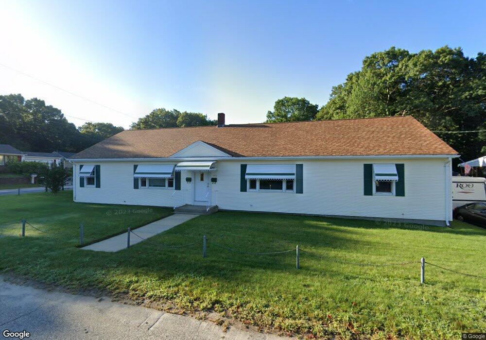
151 Monty Ave Woonsocket, RI 02895
Bernon District NeighborhoodEstimated Value: $486,147 - $562,000
About This Home
This home is located at 151 Monty Ave, Woonsocket, RI 02895 and is currently estimated at $522,537, approximately $233 per square foot. 151 Monty Ave is a home located in Providence County with nearby schools including Woonsocket High School, Founders Academy, and Beacon Charter School.
Ownership History
We collect this data history from publicly available records. To have your information removed, we recommend requesting removal directly through your county’s website.
Purchase Details
Purchase Details
Home Values in the Area
Average Home Value in this Area
Purchase History
We collect this data history from publicly available records. To have your information removed, we recommend requesting removal directly through your county’s website.
| Date | Buyer | Sale Price | Title Company |
|---|---|---|---|
| -- | -- | ||
| -- | -- | ||
| $124,500 | -- | ||
| $124,500 | -- |
Mortgage History
We collect this data history from publicly available records. To have your information removed, we recommend requesting removal directly through your county’s website.
| Date | Status | Borrower | Loan Amount |
|---|---|---|---|
| Previous Owner | $108,000 | ||
| Previous Owner | $104,106 |
Tax History
We collect this data history from publicly available records. To have your information removed, we recommend requesting removal directly through your county’s website.
| Year | Tax Paid | Tax Assessment Tax Assessment Total Assessment is a certain percentage of the fair market value that is determined by local assessors to be the total taxable value of land and additions on the property. | Land | Improvement |
|---|---|---|---|---|
| 2025 | $5,971 | $531,700 | $107,500 | $424,200 |
| 2024 | $5,240 | $360,400 | $95,300 | $265,100 |
| 2023 | $5,038 | $360,400 | $95,300 | $265,100 |
| 2022 | $5,038 | $360,400 | $95,300 | $265,100 |
| 2021 | $3,935 | $165,700 | $59,900 | $105,800 |
| 2020 | $3,977 | $165,700 | $59,900 | $105,800 |
| 2018 | $3,990 | $165,700 | $59,900 | $105,800 |
| 2017 | $5,147 | $171,000 | $46,800 | $124,200 |
| 2016 | $5,445 | $171,000 | $46,800 | $124,200 |
| 2015 | $6,255 | $171,000 | $46,800 | $124,200 |
| 2014 | $6,167 | $171,600 | $51,500 | $120,100 |
Map
- 0 Cranston St
- 0 Laflamme Ave
- 103 Elmore Ave
- 87 Kermit St
- 36 Old Louisquisset Pike Unit 210
- 36 Old Louisquisset Pike Unit 308
- 36 Old Louisquisset Pike Unit 307
- 36 Old Louisquisset Pike Unit 208
- 36 Old Louisquisset Pike Unit 204
- 0 Chester St
- 36 Louisquisset Pike Unit 105
- 0 Irving Ave Unit 1414507
- 277 Ward St
- 63 Blakeley St Unit 107
- 0 Irving Lot 192 Ave Unit 1383138
- 41 Summit Ave
- 688 Providence St
- 63 Capwell Ave
- 40 Old Louisquisset Pike Unit 801H
- 40 Old Louisquisset Pike Unit 1804
- 196 Cranston St
- 172 Cranston St
- 219 Cranston St
- 160 Monty Ave
- 137 Monty Ave
- 195 Hemond Ave
- 144 Monty Ave
- 211 Hemond Ave
- 173 Hemond Ave
- 130 Monty Ave
- 127 Monty Ave
- 157 Hemond Ave
- 0 Caron Ave Unit 73342710
- 0 Caron Ave Unit 1379503
- 0 Caron Ave Unit 73210537
- 0 Caron Ave Unit 1354373
- 126 Monty Ave
- 147 Hemond Ave
- 196 Hemond Ave
- 210 Hemond Ave
Ask me questions while you tour the home.