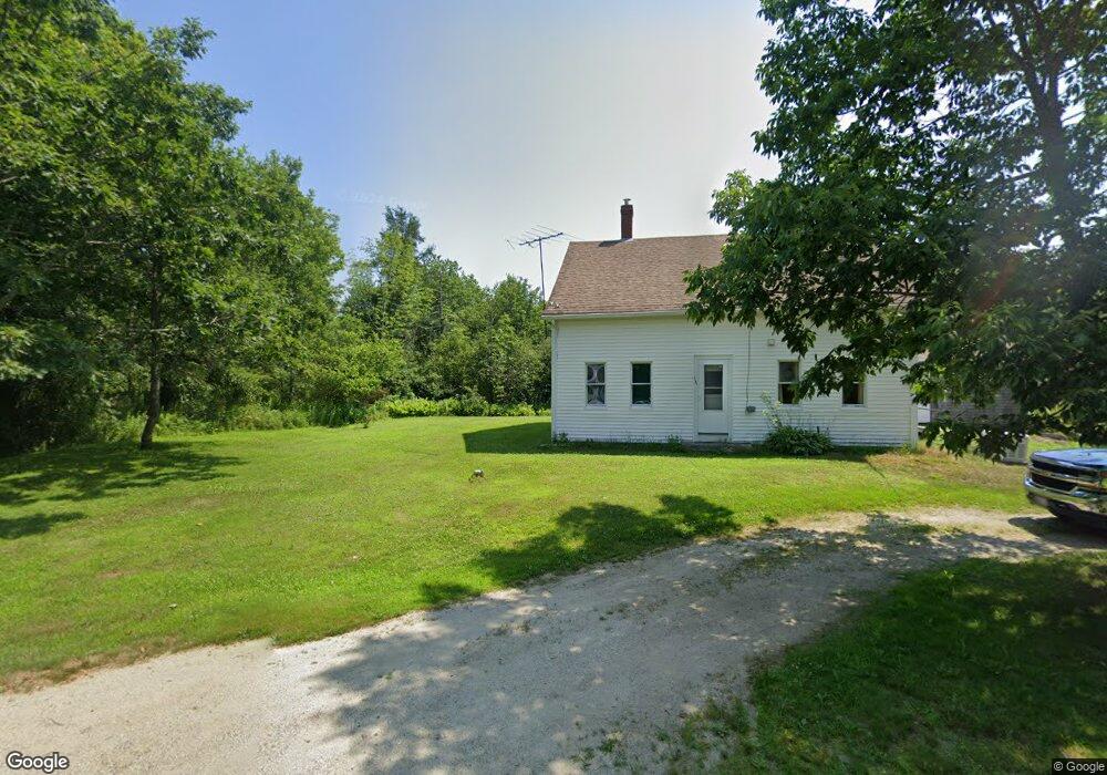
151 Range Rd Blue Hill, ME 04614
Blue Hill AreaEstimated Value: $308,284 - $363,000
3
Beds
2
Baths
1,404
Sq Ft
$240/Sq Ft
Est. Value
About This Home
This home is located at 151 Range Rd, Blue Hill, ME 04614 and is currently estimated at $337,571, approximately $240 per square foot. 151 Range Rd is a home with nearby schools including Blue Hill Consolidated School, The Bay School, and George Stevens Academy.
Create a Home Valuation Report for This Property
The Home Valuation Report is an in-depth analysis detailing your home's value as well as a comparison with similar homes in the area
Home Values in the Area
Average Home Value in this Area
Tax History
We collect this data history from publicly available records. To have your information removed, we recommend requesting removal directly through your county’s website.
| Year | Tax Paid | Tax Assessment Tax Assessment Total Assessment is a certain percentage of the fair market value that is determined by local assessors to be the total taxable value of land and additions on the property. | Land | Improvement |
|---|---|---|---|---|
| 2025 | $2,881 | $308,100 | $100,000 | $208,100 |
| 2024 | $2,696 | $308,100 | $100,000 | $208,100 |
| 2023 | $2,447 | $181,800 | $74,000 | $107,800 |
| 2022 | $2,291 | $181,800 | $74,000 | $107,800 |
| 2021 | $2,191 | $181,800 | $74,000 | $107,800 |
| 2020 | $2,541 | $181,800 | $74,000 | $107,800 |
| 2019 | $1,965 | $181,800 | $74,000 | $107,800 |
| 2018 | $1,818 | $181,800 | $74,000 | $107,800 |
| 2017 | $23 | $181,800 | $74,000 | $107,800 |
| 2016 | $1,692 | $181,800 | $74,000 | $107,800 |
| 2015 | $1,818 | $181,800 | $74,000 | $107,800 |
| 2014 | $1,600 | $181,800 | $74,000 | $107,800 |
| 2013 | $1,527 | $181,800 | $74,000 | $107,800 |
Source: Public Records
Map
Nearby Homes
- 205 Range Rd
- 0 Range Rd Unit 1658141
- 18-B Back Pasture Ln
- M34, L40 Hinckley Ridge Rd
- 47 Turkey Farm Rd
- 655 Hinckley Ridge Rd
- 176 Ellsworth Rd
- 1058 Pleasant St
- 35 Larnus Hill Ln
- 57 Ellsworth Rd
- 40 Main St
- 33 Water St
- 020-078 Blue Hill
- 681 Ellsworth Rd
- 14 & 18 Mackay Ln
- 0 Ellsworth Rd Unit 1669986
- 48 Douglass Loop
- lot 31 Parker Point Rd
- 737 E Blue Hill Rd
- Lot #15 Toddy Pond Rd
Your Personal Tour Guide
Ask me questions while you tour the home.