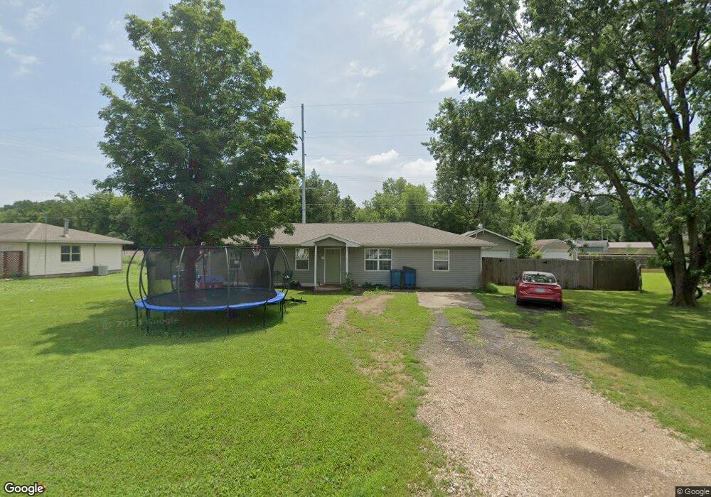
1514 Maple Ln Unit ln Seneca, MO 64865
Estimated Value: $150,011 - $190,000
4
Beds
2
Baths
1,320
Sq Ft
$128/Sq Ft
Est. Value
About This Home
This home is located at 1514 Maple Ln Unit ln, Seneca, MO 64865 and is currently estimated at $169,503, approximately $128 per square foot. 1514 Maple Ln Unit ln is a home located in Newton County with nearby schools including Seneca Elementary School, Seneca Intermediate School, and Seneca Junior High School.
Ownership History
Date
Name
Owned For
Owner Type
Purchase Details
Closed on
Oct 11, 2021
Sold by
Lawson and Lawson Tammie
Bought by
Moore Jacob and Moore Rachel H
Current Estimated Value
Home Financials for this Owner
Home Financials are based on the most recent Mortgage that was taken out on this home.
Original Mortgage
$125,000
Outstanding Balance
$112,494
Interest Rate
2.8%
Mortgage Type
New Conventional
Estimated Equity
$57,009
Purchase Details
Closed on
Oct 20, 2020
Sold by
Twelfth Stone Properties Llc
Bought by
Lawson Steven and Lawson Tammie
Home Financials for this Owner
Home Financials are based on the most recent Mortgage that was taken out on this home.
Original Mortgage
$100,152
Interest Rate
2.8%
Mortgage Type
FHA
Purchase Details
Closed on
Mar 6, 2014
Sold by
Lpp Mtg Ltd
Bought by
Friend Avis Colleen
Create a Home Valuation Report for This Property
The Home Valuation Report is an in-depth analysis detailing your home's value as well as a comparison with similar homes in the area
Purchase History
| Date | Buyer | Sale Price | Title Company |
|---|---|---|---|
| Moore Jacob | -- | None Listed On Document | |
| Moore Jacob A | -- | None Listed On Document | |
| Moore Jacob | -- | None Listed On Document | |
| Moore Jacob A | -- | None Listed On Document | |
| Lawson Steven | -- | None Listed On Document | |
| Lawson Steven | -- | None Listed On Document | |
| Friend Avis Colleen | -- | Lenderlive Settlement | |
| Friend Avis Colleen | -- | Lenderlive Settlement |
Source: Public Records
Mortgage History
| Date | Status | Borrower | Loan Amount |
|---|---|---|---|
| Open | Moore Jacob A | $125,000 | |
| Closed | Moore Jacob A | $125,000 | |
| Previous Owner | Lawson Steven | $100,152 |
Source: Public Records
Tax History
| Year | Tax Paid | Tax Assessment Tax Assessment Total Assessment is a certain percentage of the fair market value that is determined by local assessors to be the total taxable value of land and additions on the property. | Land | Improvement |
|---|---|---|---|---|
| 2024 | $810 | $14,100 | -- | -- |
| 2023 | $810 | $14,100 | $1,919 | $12,181 |
| 2022 | $810 | $13,610 | -- | -- |
| 2021 | $732 | $12,750 | $0 | $0 |
| 2020 | $690 | $12,260 | $0 | $0 |
| 2019 | $687 | $12,260 | $0 | $0 |
| 2018 | $677 | $12,010 | $0 | $0 |
| 2017 | $663 | $12,010 | $0 | $0 |
| 2016 | $663 | $11,760 | $0 | $0 |
| 2015 | -- | $11,760 | $0 | $0 |
| 2014 | -- | $11,510 | $0 | $0 |
Source: Public Records
Map
Nearby Homes
- 106 Greenfield Cir
- 1904 Cherry St
- 1020 Seneca Ave
- 1014 Cherokee Ave
- Tbd Woodland
- 1418 Cherokee Ave
- 1507 Washington Ave
- 514 Ottawa St
- TBD Washington St
- 436 Oneida St
- 608 Chippewa St
- 503 Peoria St
- 608 Osage St
- 419 Washington Ave
- 606 Cemetery Rd
- 1306 Curtin Ave
- 121 Fawn Trail
- XXX Highway 60
- 000 Condor Dr Unit Tract 3
- 000 Condor Dr Unit Tract 3s
Your Personal Tour Guide
Ask me questions while you tour the home.