Estimated Value: $149,161 - $316,000
1
Bed
1
Bath
988
Sq Ft
$238/Sq Ft
Est. Value
About This Home
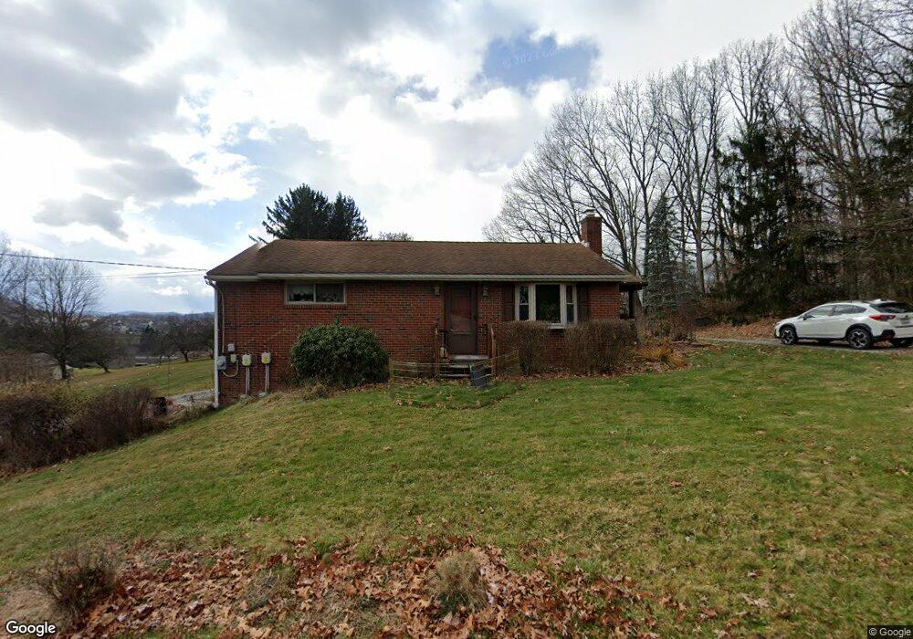
This home is located at 152 Dobson Rd, Mars, PA 16046 and is currently estimated at $235,540, approximately $238 per square foot. 152 Dobson Rd is a home located in Butler County with nearby schools including Mars Area Primary Center, Mars Area Elementary School, and Mars Area Centennial School.
Ownership History
Date
Name
Owned For
Owner Type
Purchase Details
Closed on
Sep 15, 2009
Sold by
Beidl Jill A
Bought by
Smith Chad E
Current Estimated Value
Home Financials for this Owner
Home Financials are based on the most recent Mortgage that was taken out on this home.
Original Mortgage
$100,000
Outstanding Balance
$65,233
Interest Rate
5.14%
Mortgage Type
New Conventional
Estimated Equity
$170,307
Create a Home Valuation Report for This Property
The Home Valuation Report is an in-depth analysis detailing your home's value as well as a comparison with similar homes in the area
Home Values in the Area
Average Home Value in this Area
Purchase History
| Date | Buyer | Sale Price | Title Company |
|---|---|---|---|
| Smith Chad E | $125,000 | -- |
Source: Public Records
Mortgage History
| Date | Status | Borrower | Loan Amount |
|---|---|---|---|
| Open | Smith Chad E | $100,000 |
Source: Public Records
Tax History
| Year | Tax Paid | Tax Assessment Tax Assessment Total Assessment is a certain percentage of the fair market value that is determined by local assessors to be the total taxable value of land and additions on the property. | Land | Improvement |
|---|---|---|---|---|
| 2025 | $1,645 | $11,720 | $1,470 | $10,250 |
| 2024 | $1,604 | $11,720 | $1,470 | $10,250 |
| 2023 | $1,556 | $11,720 | $1,470 | $10,250 |
| 2022 | $1,556 | $11,720 | $1,470 | $10,250 |
| 2021 | $1,556 | $11,720 | $0 | $0 |
| 2020 | $1,556 | $11,720 | $1,470 | $10,250 |
| 2019 | $1,556 | $11,720 | $1,470 | $10,250 |
| 2018 | $1,528 | $11,720 | $1,470 | $10,250 |
| 2017 | $1,528 | $11,720 | $1,470 | $10,250 |
| 2016 | $405 | $11,720 | $1,470 | $10,250 |
| 2015 | $238 | $11,720 | $1,470 | $10,250 |
| 2014 | $238 | $11,720 | $1,470 | $10,250 |
Source: Public Records
Map
Nearby Homes
- 111 Gray Ln
- 6056 Ruby Way
- 8013 Chief Way
- 8008 Chief Way
- 6031 Ruby Way
- 8020 Chief Way
- 532 Blackrock Blvd
- 139 Olivia Ave
- 110 Ridgetop Dr
- 200 Clark St
- 230 Crowe Ave
- 401 Blackstone Ln
- 3001 Greeneview Ln
- 309 Dirkshire Ct
- 218 Myoma Rd
- 710 Braddock Ct
- 257 Stoup Rd
- 819 Strasburg Dr
- 143 Gracie Ln
- 1653 Chapel Ridge
Your Personal Tour Guide
Ask me questions while you tour the home.