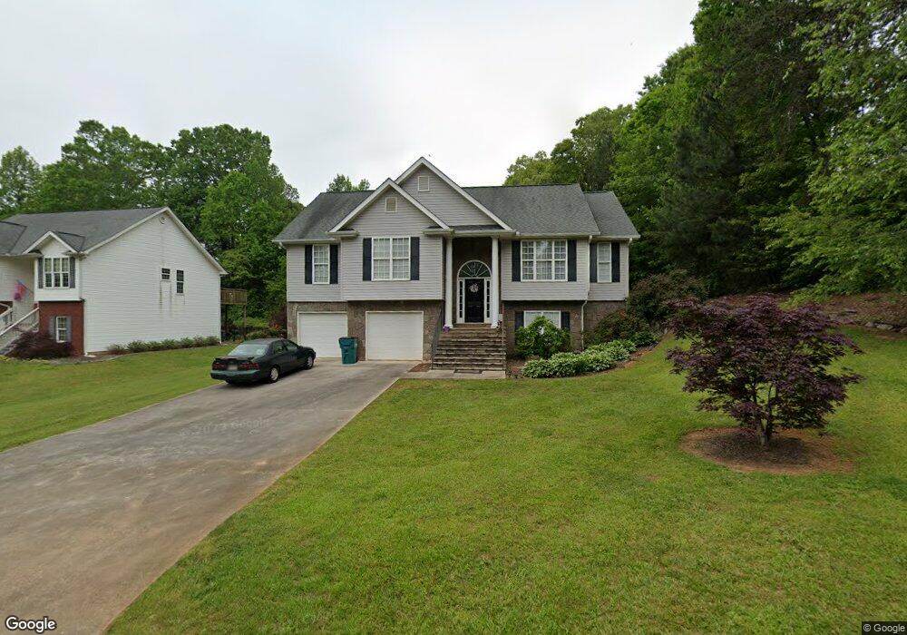
152 Rockwind Way Unit 12 Demorest, GA 30535
Estimated Value: $331,000 - $395,455
4
Beds
3
Baths
1,749
Sq Ft
$208/Sq Ft
Est. Value
About This Home
This home is located at 152 Rockwind Way Unit 12, Demorest, GA 30535 and is currently estimated at $364,614, approximately $208 per square foot. 152 Rockwind Way Unit 12 is a home located in Habersham County with nearby schools including Demorest Elementary School, Wilbanks Middle School, and Habersham Success Academy.
Ownership History
Date
Name
Owned For
Owner Type
Purchase Details
Closed on
Oct 23, 2020
Sold by
Mcallister Caleb T
Bought by
Rodriguez Jose
Current Estimated Value
Home Financials for this Owner
Home Financials are based on the most recent Mortgage that was taken out on this home.
Original Mortgage
$220,173
Outstanding Balance
$195,832
Interest Rate
2.9%
Mortgage Type
VA
Estimated Equity
$168,782
Purchase Details
Closed on
May 20, 2016
Sold by
Swing Lawrence D
Bought by
Mcallister Caleb T and Mcallister Elisabeth L
Home Financials for this Owner
Home Financials are based on the most recent Mortgage that was taken out on this home.
Original Mortgage
$169,665
Interest Rate
3.59%
Mortgage Type
New Conventional
Create a Home Valuation Report for This Property
The Home Valuation Report is an in-depth analysis detailing your home's value as well as a comparison with similar homes in the area
Home Values in the Area
Average Home Value in this Area
Purchase History
| Date | Buyer | Sale Price | Title Company |
|---|---|---|---|
| Rodriguez Jose | $228,000 | -- | |
| Mcallister Caleb T | $165,000 | -- |
Source: Public Records
Mortgage History
| Date | Status | Borrower | Loan Amount |
|---|---|---|---|
| Open | Rodriguez Jose | $220,173 | |
| Previous Owner | Mcallister Caleb T | $169,665 |
Source: Public Records
Tax History
| Year | Tax Paid | Tax Assessment Tax Assessment Total Assessment is a certain percentage of the fair market value that is determined by local assessors to be the total taxable value of land and additions on the property. | Land | Improvement |
|---|---|---|---|---|
| 2025 | $3,456 | $166,620 | $10,000 | $156,620 |
| 2024 | -- | $151,404 | $10,000 | $141,404 |
| 2023 | $3,164 | $126,564 | $10,000 | $116,564 |
| 2022 | $2,860 | $109,692 | $10,000 | $99,692 |
| 2021 | $2,323 | $89,508 | $10,000 | $79,508 |
| 2020 | $2,050 | $76,212 | $8,000 | $68,212 |
| 2019 | $2,052 | $76,212 | $8,000 | $68,212 |
| 2018 | $2,036 | $76,212 | $8,000 | $68,212 |
| 2017 | $1,768 | $65,844 | $4,000 | $61,844 |
| 2016 | $1,688 | $161,870 | $4,000 | $60,748 |
| 2015 | -- | $161,870 | $4,000 | $60,748 |
| 2014 | -- | $157,150 | $4,000 | $58,860 |
| 2013 | -- | $62,860 | $4,000 | $58,860 |
Source: Public Records
Map
Nearby Homes
- 194 Chestnut Ave
- 180 Springbrook Dr
- 1910 Hancock Rd
- 152 Eastside Dr
- 114 Springbrook Dr
- 139 Saluda Dr
- 121 Saluda Dr
- 451 Spiral Hills Dr
- 545 Wauka Dr
- 642 Bald Ridge Cir
- 620 Bald Ridge Cir
- 660 Bald Ridge Cir
- 834 Hancock Rd
- 140 Kim Loop
- 3750 Old Cleveland Rd
- 314 Holley St
- 4444 State Highway 365
- 8 Habersham Landing Dr
- 2778 J Warren Rd
- 241 Huntington Manor Ct
- 152 Rockwind Way
- 158 Rockwind Way
- 276 Stonebrook Dr
- 164 Rockwind Way
- 268 Stonebrook Dr
- 230 Stonebrook Dr
- 145 Rockwind Way
- 155 Rockwind Way
- 139 Rockwind Way
- 216 Stonebrook Dr
- 178 Rockwind Way
- 118 Rockwind Way
- 267 Stonebrook Dr
- 241 Stonebrook Dr
- 223 Stonebrook Dr
- 261 Stonebrook Dr
- 119 Rockwind Way
- 110 Rockwind Way
- 257 Stonebrook Dr
- 210 Stonebrook Dr
Your Personal Tour Guide
Ask me questions while you tour the home.