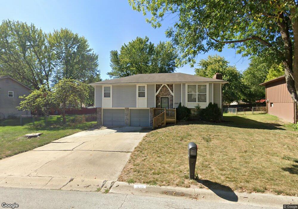
1520 N Hanover Ave Independence, MO 64056
Ripley NeighborhoodEstimated Value: $205,063 - $227,000
About This Home
This home is located at 1520 N Hanover Ave, Independence, MO 64056 and is currently estimated at $218,516, approximately $192 per square foot. 1520 N Hanover Ave is a home located in Jackson County with nearby schools including Fort Osage High School.
Ownership History
We collect this data history from publicly available records. To have your information removed, we recommend requesting removal directly through your county’s website.
Purchase Details
Purchase Details
Home Values in the Area
Average Home Value in this Area
Purchase History
We collect this data history from publicly available records. To have your information removed, we recommend requesting removal directly through your county’s website.
| Date | Buyer | Sale Price | Title Company |
|---|---|---|---|
| -- | -- | ||
| -- | None Listed On Document | ||
| -- | -- |
Tax History
We collect this data history from publicly available records. To have your information removed, we recommend requesting removal directly through your county’s website.
| Year | Tax Paid | Tax Assessment Tax Assessment Total Assessment is a certain percentage of the fair market value that is determined by local assessors to be the total taxable value of land and additions on the property. | Land | Improvement |
|---|---|---|---|---|
| 2025 | $2,263 | $23,368 | $4,735 | $18,633 |
| 2024 | $2,263 | $28,500 | $4,233 | $24,267 |
| 2023 | $2,253 | $35,720 | $4,072 | $31,648 |
| 2022 | $1,470 | $17,670 | $2,524 | $15,146 |
| 2021 | $1,469 | $17,670 | $2,524 | $15,146 |
| 2020 | $1,424 | $16,884 | $2,524 | $14,360 |
| 2019 | $1,410 | $16,884 | $2,524 | $14,360 |
| 2018 | $1,235 | $14,694 | $2,196 | $12,498 |
| 2017 | $1,235 | $14,694 | $2,196 | $12,498 |
| 2016 | $994 | $12,920 | $2,793 | $10,127 |
| 2014 | $1,363 | $17,613 | $2,780 | $14,833 |
Map
- 1325 N Holland Ct
- 1407 N Hanover Ave
- 19808 E 17th Street Ct N
- 1336 N Holland Dr
- 19704 E 14th Terrace N
- 19706 E 14th St N
- 1219 N Heartland Ave
- 1313 N Holland Dr
- 1819 N Keenan St
- 1812 N Ethan Ln
- 19309 E Lynchburg Place N
- 19415 E 13th St N
- 1207 N Glenview Ave
- 1500 N Aztec Ave
- 20612 Highway 24
- 22721 Highway 24
- 19212 E 15th St N
- 1211 N Davis Rd
- 1819 N York St
- 19613 E 11th Terrace N
- 20300 E 15th Terrace N
- 1519 N Hanover Ave
- 20304 E 15th Terrace N
- 1519 N Hanover Ave
- 20308 E 15th Terrace N
- 1516 N Hanover Ave
- 1515 N Hanover Ave
- 20309 E 16th St N
- 20313 E 16th St N
- 20305 E 16th St N
- 20305 E 15th Terrace N
- 20400 E 15th Terrace N
- 20301 E 16th St N
- 20317 E 16th St N
- 20309 E 15th Terrace N
- 1512 N Hanover Ave
- 1511 N Blue Mills Rd
- 20401 E 15th Terrace N
- 20404 E 15th Terrace N
- 20401 E 16th St N
Ask me questions while you tour the home.