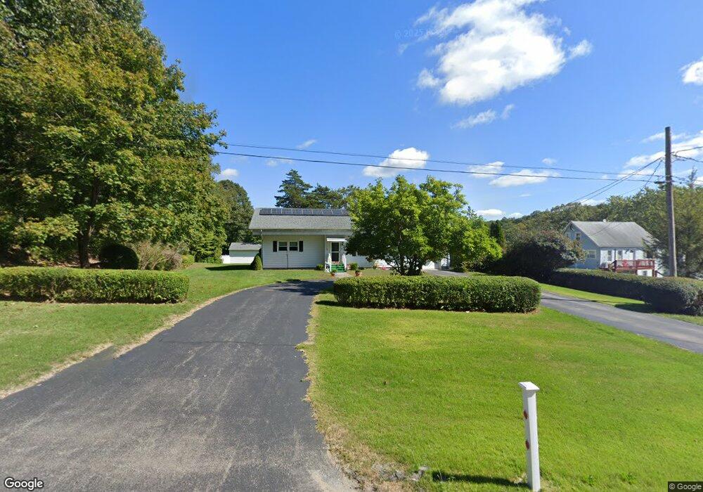
153 Route 12 Preston, CT 06365
Estimated Value: $302,000 - $356,000
3
Beds
2
Baths
1,370
Sq Ft
$245/Sq Ft
Est. Value
About This Home
This home is located at 153 Route 12, Preston, CT 06365 and is currently estimated at $335,344, approximately $244 per square foot. 153 Route 12 is a home located in New London County with nearby schools including Bradley School-New London Regional, St. Bernard School, and Saint Bernard School.
Create a Home Valuation Report for This Property
The Home Valuation Report is an in-depth analysis detailing your home's value as well as a comparison with similar homes in the area
Home Values in the Area
Average Home Value in this Area
Tax History
| Year | Tax Paid | Tax Assessment Tax Assessment Total Assessment is a certain percentage of the fair market value that is determined by local assessors to be the total taxable value of land and additions on the property. | Land | Improvement |
|---|---|---|---|---|
| 2025 | $4,152 | $165,340 | $45,780 | $119,560 |
| 2024 | $3,864 | $165,340 | $45,780 | $119,560 |
| 2023 | $3,795 | $165,340 | $45,780 | $119,560 |
| 2022 | $3,150 | $113,000 | $37,500 | $75,500 |
| 2021 | $3,044 | $113,000 | $37,500 | $75,500 |
| 2020 | $3,040 | $113,000 | $37,500 | $75,500 |
| 2019 | $2,987 | $113,000 | $37,500 | $75,500 |
| 2018 | $2,941 | $113,000 | $37,500 | $75,500 |
| 2017 | $2,640 | $110,000 | $38,600 | $71,400 |
| 2016 | $2,613 | $110,000 | $38,600 | $71,400 |
| 2015 | $2,530 | $110,000 | $38,600 | $71,400 |
| 2014 | $2,545 | $110,000 | $38,600 | $71,400 |
Source: Public Records
Map
Nearby Homes
- 3 Holdsworth Rd
- 43 Drawbridge Rd
- 4 N Glenwoods Rd
- 36 Bittersweet Dr
- 16 Marlene Dr
- 51 Dydo Dr
- 118 Route 2a
- 27 Linda Ave
- 104 Route 2a
- 23 Avery Hill Rd
- 0 Clarks Falls Unit 24089817
- 87 Fort Shantok Rd
- 61 Fort Shantok Rd
- 9 Oakridge Dr
- 5 Tom Allyn Ct
- 183 Whalehead Rd
- 36 Route 2a
- 31 Woodland Dr
- 7 Halls Mill Rd
- 1637 Connecticut 12
Your Personal Tour Guide
Ask me questions while you tour the home.