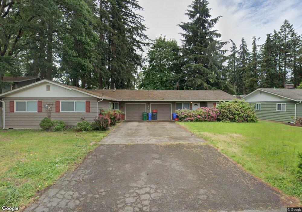
1530 Bond Ln Eugene, OR 97401
Cal Young NeighborhoodEstimated Value: $542,000 - $643,000
5
Beds
2
Baths
1,949
Sq Ft
$301/Sq Ft
Est. Value
About This Home
This home is located at 1530 Bond Ln, Eugene, OR 97401 and is currently estimated at $586,535, approximately $300 per square foot. 1530 Bond Ln is a home located in Lane County with nearby schools including Willagillespie Elementary School, Cal Young Middle School, and Sheldon High School.
Ownership History
Date
Name
Owned For
Owner Type
Purchase Details
Closed on
Nov 23, 2005
Sold by
Gorthy Joel H and Gorthy Adele A
Bought by
Brown Theodore N
Current Estimated Value
Purchase Details
Closed on
Apr 24, 2002
Sold by
Wood Helga W and Helga W Wood Revocable Trust
Bought by
Gorthy Joel H and Gorthy Adele A
Home Financials for this Owner
Home Financials are based on the most recent Mortgage that was taken out on this home.
Original Mortgage
$175,750
Interest Rate
7.13%
Create a Home Valuation Report for This Property
The Home Valuation Report is an in-depth analysis detailing your home's value as well as a comparison with similar homes in the area
Home Values in the Area
Average Home Value in this Area
Purchase History
| Date | Buyer | Sale Price | Title Company |
|---|---|---|---|
| Brown Theodore N | $293,500 | Cascade Title Co | |
| Gorthy Joel H | $185,000 | Fidelity National Title Co |
Source: Public Records
Mortgage History
| Date | Status | Borrower | Loan Amount |
|---|---|---|---|
| Previous Owner | Gorthy Joel H | $175,750 |
Source: Public Records
Tax History
| Year | Tax Paid | Tax Assessment Tax Assessment Total Assessment is a certain percentage of the fair market value that is determined by local assessors to be the total taxable value of land and additions on the property. | Land | Improvement |
|---|---|---|---|---|
| 2025 | $5,129 | $263,257 | -- | -- |
| 2024 | $5,065 | $255,590 | -- | -- |
| 2023 | $5,065 | $248,146 | $0 | $0 |
| 2022 | $4,745 | $240,919 | $0 | $0 |
| 2021 | $4,457 | $233,902 | $0 | $0 |
| 2020 | $4,473 | $227,090 | $0 | $0 |
| 2019 | $4,320 | $220,476 | $0 | $0 |
| 2018 | $4,066 | $207,820 | $0 | $0 |
| 2017 | $3,884 | $207,820 | $0 | $0 |
| 2016 | $3,788 | $201,767 | $0 | $0 |
| 2015 | $3,679 | $195,890 | $0 | $0 |
| 2014 | $3,605 | $190,184 | $0 | $0 |
Source: Public Records
Map
Nearby Homes
- 1500 Norkenzie Rd Unit 12
- 1625 Monterey Ln
- 0 Piper Ln Unit Lot 1
- 0 Piper Ln Unit Lot 3
- 0 Piper Ln Unit Lot 2
- 0 Piper Ln Unit Lot 5
- 1332 Jeppesen Ave
- 1328 Spyglass Dr
- 1810 Minda Dr
- 1376 Brickley Rd
- 1943 Monterey Ln
- 0 Cal Young Rd Unit Lot 4
- 1901 Minda Dr
- 2281 Ridgeway Dr
- 410 Spyglass Dr
- 1521 Gilham Rd
- 982 Shaughnessy Ln
- 2291 Norkenzie Rd
- 1230 Debrick Rd
- 2280 Tabor St
- 1520 Bond Ln
- 1480 Bond Ln
- 1500 Norkenzie Rd Unit 22
- 1500 Norkenzie Rd Unit 73
- 1500 Norkenzie Rd Unit 69
- 1500 Norkenzie Rd Unit 68
- 1500 Norkenzie Rd Unit 65
- 1500 Norkenzie Rd Unit 64
- 1500 Norkenzie Rd Unit 60
- 1500 Norkenzie Rd Unit 59
- 1500 Norkenzie Rd Unit 57
- 1500 Norkenzie Rd Unit 55
- 1500 Norkenzie Rd Unit 56
- 1500 Norkenzie Rd Unit 54
- 1500 Norkenzie Rd Unit 53
- 1500 Norkenzie Rd Unit 51
- 1500 Norkenzie Rd Unit 50
- 1500 Norkenzie Rd Unit 17
- 1500 Norkenzie Rd Unit 18
- 1500 Norkenzie Rd Unit 40
Your Personal Tour Guide
Ask me questions while you tour the home.