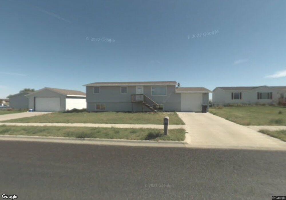
1532 Northstar Ave Pierre, SD 57501
Estimated Value: $149,077 - $323,000
2
Beds
1
Bath
1,008
Sq Ft
$237/Sq Ft
Est. Value
About This Home
This home is located at 1532 Northstar Ave, Pierre, SD 57501 and is currently estimated at $238,769, approximately $236 per square foot. 1532 Northstar Ave is a home with nearby schools including T.F. Riggs High School and Pierre SDA School.
Ownership History
Date
Name
Owned For
Owner Type
Purchase Details
Closed on
Jan 9, 2009
Sold by
Westergren Sven J and Westergren Brandi L
Bought by
Malsam Conrad J and Malsam Kristy M
Current Estimated Value
Home Financials for this Owner
Home Financials are based on the most recent Mortgage that was taken out on this home.
Original Mortgage
$88,000
Outstanding Balance
$56,391
Interest Rate
5.44%
Estimated Equity
$182,378
Create a Home Valuation Report for This Property
The Home Valuation Report is an in-depth analysis detailing your home's value as well as a comparison with similar homes in the area
Home Values in the Area
Average Home Value in this Area
Purchase History
| Date | Buyer | Sale Price | Title Company |
|---|---|---|---|
| Malsam Conrad J | $84,500 | -- |
Source: Public Records
Mortgage History
| Date | Status | Borrower | Loan Amount |
|---|---|---|---|
| Open | Malsam Conrad J | $88,000 |
Source: Public Records
Tax History
| Year | Tax Paid | Tax Assessment Tax Assessment Total Assessment is a certain percentage of the fair market value that is determined by local assessors to be the total taxable value of land and additions on the property. | Land | Improvement |
|---|---|---|---|---|
| 2025 | $1,807 | $145,476 | $34,550 | $110,926 |
| 2024 | $1,801 | $140,194 | $34,550 | $105,644 |
| 2023 | $1,633 | $136,129 | $33,062 | $103,067 |
| 2022 | $1,539 | $117,377 | $31,488 | $85,889 |
| 2021 | $1,508 | $104,801 | $28,114 | $76,687 |
| 2020 | $1,543 | $101,748 | $27,295 | $74,453 |
| 2019 | $1,540 | $101,748 | $27,295 | $74,453 |
| 2018 | $1,477 | $98,784 | $26,500 | $72,284 |
| 2017 | -- | $94,080 | $25,238 | $68,842 |
| 2016 | $1,544 | $94,080 | $25,238 | $68,842 |
| 2015 | -- | $91,340 | $24,503 | $66,837 |
| 2014 | -- | $88,679 | $23,789 | $64,890 |
| 2013 | -- | $88,679 | $23,789 | $64,890 |
| 2011 | -- | $88,679 | $23,789 | $64,890 |
Source: Public Records
Map
Nearby Homes
- 104 Mercury St
- 149 Polaris Ave
- 219 Mars St
- Lot 13R N Garfield Ave
- 131 Hampton Dr
- 0 Woodview Dr
- 109 Baja Dr
- 1814 Camden Ct
- 2013 Ridgeway Place
- 2400 E Capitol Ave
- 0 Brookstone Lp
- 1217 Hilgers Dr
- 404 Yucca Dr
- 2004 Buffalo St
- 2817 E Humboldt St
- 2416 E Franklin St
- TBD Lilac Dr
- 313 N Taylor Ave
- 2415 E Franklin St
- 2827 E Irwin St
- 1540 Northstar Ave
- 1516 Northstar Ave
- 209 Polaris Ave
- 205 Polaris Ave
- 201 Polaris Ave
- 1525 Northstar Ave
- 217 Polaris Ave
- 1508 Northstar Ave
- 1509 Northstar Ave
- 1609 Northstar Ave
- 1500 Northstar Ave
- 100 Mars St
- 165 Polaris Ave
- 1541 Crested Ave
- 161 Polaris Ave
- 1440 Northstar Ave
- 1625 Northstar Ave
- 0 Crested Ridge
- 1432 Northstar Ave
- 101 Mercury St
Your Personal Tour Guide
Ask me questions while you tour the home.