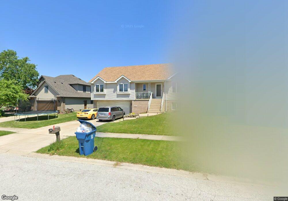
1534 Krame Dr Crown Point, IN 46307
Estimated Value: $417,000 - $443,000
About This Home
This home is located at 1534 Krame Dr, Crown Point, IN 46307 and is currently estimated at $432,153, approximately $169 per square foot. 1534 Krame Dr is a home located in Lake County with nearby schools including Peifer Elementary School, Hal E Clark Middle School, and Lake Central High School.
Ownership History
We collect this data history from publicly available records. To have your information removed, we recommend requesting removal directly through your county’s website.
Purchase Details
Home Financials for this Owner
Home Financials are based on the most recent Mortgage that was taken out on this home.Purchase Details
Home Values in the Area
Average Home Value in this Area
Purchase History
We collect this data history from publicly available records. To have your information removed, we recommend requesting removal directly through your county’s website.
| Date | Buyer | Sale Price | Title Company |
|---|---|---|---|
| -- | Meridian Title Corp | ||
| $170,460 | None Available |
Mortgage History
We collect this data history from publicly available records. To have your information removed, we recommend requesting removal directly through your county’s website.
| Date | Status | Borrower | Loan Amount |
|---|---|---|---|
| Previous Owner | $196,377 |
Tax History
We collect this data history from publicly available records. To have your information removed, we recommend requesting removal directly through your county’s website.
| Year | Tax Paid | Tax Assessment Tax Assessment Total Assessment is a certain percentage of the fair market value that is determined by local assessors to be the total taxable value of land and additions on the property. | Land | Improvement |
|---|---|---|---|---|
| 2025 | $3,349 | $422,000 | $52,100 | $369,900 |
| 2024 | $7,337 | $407,800 | $52,100 | $355,700 |
| 2023 | $2,554 | $360,300 | $52,100 | $308,200 |
| 2022 | $2,554 | $261,400 | $52,100 | $209,300 |
| 2021 | $2,403 | $251,500 | $52,100 | $199,400 |
| 2020 | $2,288 | $236,700 | $41,000 | $195,700 |
| 2019 | $2,483 | $233,700 | $38,200 | $195,500 |
| 2018 | $2,321 | $220,800 | $38,200 | $182,600 |
| 2017 | $2,071 | $210,800 | $38,200 | $172,600 |
| 2016 | $1,974 | $201,400 | $38,200 | $163,200 |
| 2014 | $2,000 | $211,100 | $38,200 | $172,900 |
| 2013 | $2,043 | $210,000 | $38,200 | $171,800 |
Map
- 2962 Liberty Dr
- 2914 Morningside Dr
- 8327 Fairbanks St Unit 4C
- 6880 W 84th Place
- 6076 Wexford Way
- 6910 W 85th Ave
- 5980 Wexford Way
- 1895 Orchard Ct
- 6440 W 89th Ave
- 5833 Lancaster St
- 5710 Burr Ridge Cir
- 7331 W 83rd Ln
- 8676 Fulton Place
- 2539 Harvest Dr
- 1444 Woodview Dr Unit 7
- 5494 Victoria Place
- 8112 Victoria Place
- 8113 Victoria Place
- 8674 Durbin Ln
- 7605 W 86th Ave
Ask me questions while you tour the home.