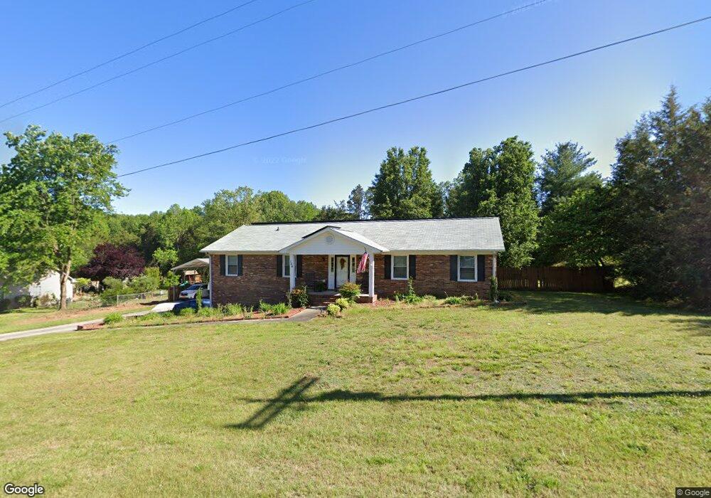
154 Applegate Rd Kernersville, NC 27284
Northwest Kernersville NeighborhoodEstimated Value: $332,000 - $357,000
4
Beds
2
Baths
1,800
Sq Ft
$191/Sq Ft
Est. Value
About This Home
This home is located at 154 Applegate Rd, Kernersville, NC 27284 and is currently estimated at $343,011, approximately $190 per square foot. 154 Applegate Rd is a home located in Forsyth County with nearby schools including Piney Grove Elementary, Kernersville Middle, and East Forsyth High School.
Ownership History
Date
Name
Owned For
Owner Type
Purchase Details
Closed on
Oct 22, 2001
Sold by
Martin Samuel F and Martin Caroline H
Bought by
Martin Frank Edward and Martin Vicky B
Current Estimated Value
Home Financials for this Owner
Home Financials are based on the most recent Mortgage that was taken out on this home.
Original Mortgage
$122,000
Interest Rate
6.39%
Purchase Details
Closed on
Dec 29, 1999
Sold by
Knesel Danny F and Mary Knesel
Bought by
Martin Frank Edward and Martin Vicky Barnhardt
Home Financials for this Owner
Home Financials are based on the most recent Mortgage that was taken out on this home.
Original Mortgage
$119,700
Interest Rate
7.68%
Create a Home Valuation Report for This Property
The Home Valuation Report is an in-depth analysis detailing your home's value as well as a comparison with similar homes in the area
Home Values in the Area
Average Home Value in this Area
Purchase History
| Date | Buyer | Sale Price | Title Company |
|---|---|---|---|
| Martin Frank Edward | -- | -- | |
| Martin Frank Edward | $133,000 | -- |
Source: Public Records
Mortgage History
| Date | Status | Borrower | Loan Amount |
|---|---|---|---|
| Closed | Martin Frank Edward | $122,000 | |
| Closed | Martin Frank Edward | $119,700 |
Source: Public Records
Tax History
| Year | Tax Paid | Tax Assessment Tax Assessment Total Assessment is a certain percentage of the fair market value that is determined by local assessors to be the total taxable value of land and additions on the property. | Land | Improvement |
|---|---|---|---|---|
| 2025 | $1,661 | $364,800 | $60,000 | $304,800 |
| 2024 | $1,661 | $202,200 | $30,000 | $172,200 |
| 2023 | $1,661 | $202,200 | $30,000 | $172,200 |
| 2022 | $1,661 | $202,200 | $30,000 | $172,200 |
| 2021 | $1,661 | $202,200 | $30,000 | $172,200 |
| 2020 | $1,688 | $189,500 | $27,300 | $162,200 |
| 2019 | $1,707 | $189,500 | $27,300 | $162,200 |
| 2018 | $1,643 | $189,500 | $27,300 | $162,200 |
| 2016 | $1,498 | $173,969 | $33,600 | $140,369 |
Source: Public Records
Map
Nearby Homes
- 1309 Linview Dr
- 140 Hidden Hills Dr
- 311 Vancouver Ct
- 812 Wood Dale Dr
- 836 Donnell St
- 275 Cliffwood Dr
- 9184 County Line Rd
- 170 Cliffwood Dr
- 128 Humberside Dr
- 1289 Piney Grove Rd
- 562 Porter Trace Dr
- 1355 Ouray Dr
- 150 Roswell Dr
- 2004 Abbotts Vista Dr
- 1758 Black Horse Rd Unit 49
- 1762 Black Horse Rd Unit 50
- 305 Bowen Lake Dr
- 3474 River Farm Dr
- 3439 River Farm Dr
- 802 Lisa Run Ct
- 148 Applegate Rd
- 160 Applegate Rd
- 940 Starkhill Dr
- 945 Starkhill Dr
- 155 Applegate Rd
- 142 Applegate Rd
- 159 Applegate Rd
- 145 Applegate Rd
- 165 Applegate Rd
- 136 Applegate Rd
- 139 Applegate Rd
- 950 Starkhill Dr
- 1004 Applegate Ct
- 1000 Starkhill Dr
- 1009 Starkhill Dr
- 1003 Applegate Ct
- 133 Applegate Rd
- 130 Applegate Rd
- 1008 Applegate Ct
- 1013 Starkhill Dr
Your Personal Tour Guide
Ask me questions while you tour the home.