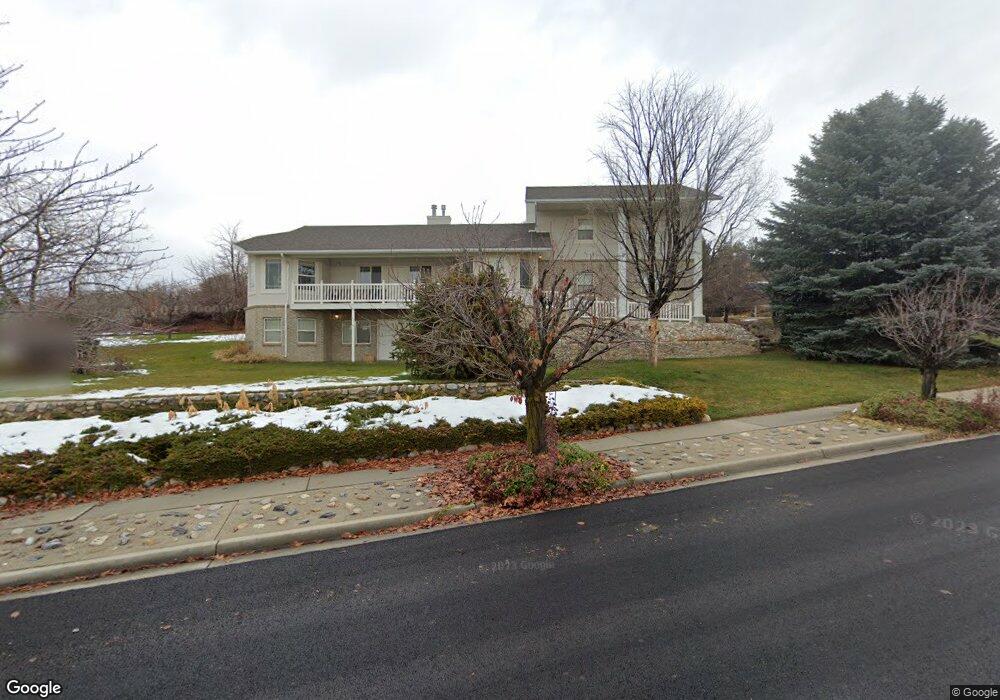
154 May Cir Alpine, UT 84004
Estimated Value: $1,015,000 - $1,128,000
4
Beds
4
Baths
4,312
Sq Ft
$249/Sq Ft
Est. Value
About This Home
This home is located at 154 May Cir, Alpine, UT 84004 and is currently estimated at $1,072,438, approximately $248 per square foot. 154 May Cir is a home located in Utah County with nearby schools including Westfield School, Timberline Middle School, and Lone Peak High School.
Ownership History
Date
Name
Owned For
Owner Type
Purchase Details
Closed on
May 15, 1998
Sold by
Western Tony B and Western Ellen M
Bought by
Western Tony B and Western Ellen M
Current Estimated Value
Home Financials for this Owner
Home Financials are based on the most recent Mortgage that was taken out on this home.
Original Mortgage
$75,600
Interest Rate
7.13%
Create a Home Valuation Report for This Property
The Home Valuation Report is an in-depth analysis detailing your home's value as well as a comparison with similar homes in the area
Home Values in the Area
Average Home Value in this Area
Purchase History
| Date | Buyer | Sale Price | Title Company |
|---|---|---|---|
| Western Tony B | -- | First American Title |
Source: Public Records
Mortgage History
| Date | Status | Borrower | Loan Amount |
|---|---|---|---|
| Closed | Western Tony B | $75,600 |
Source: Public Records
Tax History
| Year | Tax Paid | Tax Assessment Tax Assessment Total Assessment is a certain percentage of the fair market value that is determined by local assessors to be the total taxable value of land and additions on the property. | Land | Improvement |
|---|---|---|---|---|
| 2025 | $3,874 | $478,665 | -- | -- |
| 2024 | $3,874 | $451,550 | $0 | $0 |
| 2023 | $3,620 | $452,980 | $0 | $0 |
| 2022 | $3,660 | $444,730 | $0 | $0 |
| 2021 | $3,196 | $603,300 | $302,100 | $301,200 |
| 2020 | $3,085 | $569,900 | $274,600 | $295,300 |
| 2019 | $2,894 | $558,100 | $274,600 | $283,500 |
| 2018 | $2,575 | $490,600 | $244,100 | $246,500 |
| 2017 | $2,661 | $269,830 | $0 | $0 |
| 2016 | $2,753 | $260,260 | $0 | $0 |
| 2015 | $2,669 | $238,700 | $0 | $0 |
| 2014 | $2,563 | $226,710 | $0 | $0 |
Source: Public Records
Map
Nearby Homes
- 243 W Conrad Ct
- 868 S Braddock Ln
- 596 S Cascade Ct
- 366 River Rd
- 875 S Blue Ridge Ln
- 259 Twin River Loop
- 250 S Main St Unit 25
- 250 S Main St Unit 9
- 250 S Main St Unit 7
- 5046 W Jonathon Rd Unit 10
- 5246 W 11200 N Unit 1
- 5984 W 11200 N Unit 1
- 5238 W 11100 St N Unit 2
- 30 S Main St
- 5983 W 11270 N Unit 4
- 5976 W 11270 N Unit 5
- 48 N 100 E
- 5159 W 11000 N
- 5175 W 11000 N
- 5077 W 11000 N
- 123 May Cir
- 701 Bateman Ln
- 651 Bateman Ln
- 109 May Cir
- 682 Bateman Ln
- 656 Bateman Ln
- 731 Bateman Ln
- 142 Sunset Dr
- 126 Sunset Dr
- 177 Cascade Ave
- 177 Cascade Ave Unit 502
- 145 Cascade Ave
- 186 Sunset Dr
- 702 Rocky Mountain Dr
- 694 S Rocky Mountain Dr
- 104 W Sunset Dr
- 104 Sunset Dr
- 127 W Cascade Ave
- 206 Sunset Dr
- 103 W Cascade Ave Unit 2
Your Personal Tour Guide
Ask me questions while you tour the home.