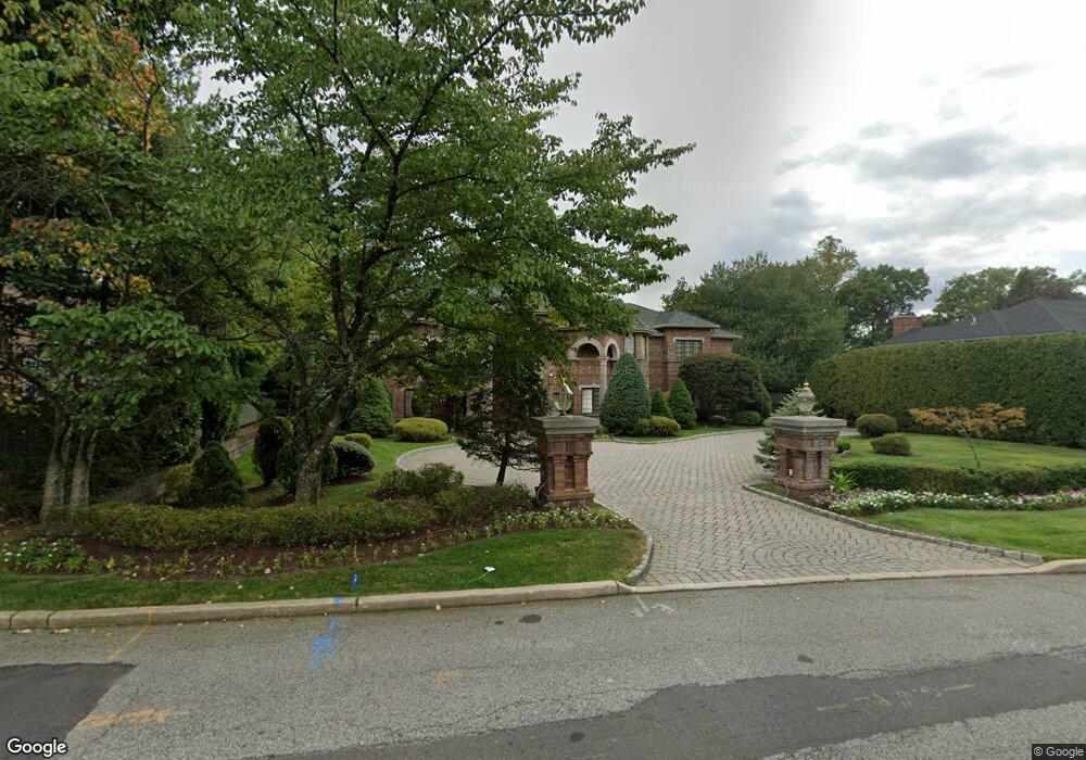
154 Pershing Rd Englewood Cliffs, NJ 07632
Estimated Value: $3,104,115 - $4,316,000
5
Beds
6
Baths
6,627
Sq Ft
$528/Sq Ft
Est. Value
About This Home
This home is located at 154 Pershing Rd, Englewood Cliffs, NJ 07632 and is currently estimated at $3,497,779, approximately $527 per square foot. 154 Pershing Rd is a home located in Bergen County with nearby schools including North Cliff Elementary School, Upper School Elementary School, and The Moriah School.
Ownership History
Date
Name
Owned For
Owner Type
Purchase Details
Closed on
Jul 21, 2025
Sold by
102 Realty Group Llc
Bought by
Chug Cheng Jeffrey Ming and Missony Cheng Missony
Current Estimated Value
Home Financials for this Owner
Home Financials are based on the most recent Mortgage that was taken out on this home.
Original Mortgage
$1,576,500
Outstanding Balance
$1,565,446
Interest Rate
5.8%
Mortgage Type
New Conventional
Estimated Equity
$1,932,333
Purchase Details
Closed on
Oct 7, 2017
Sold by
Est Lerner Birton and Lerner Ex Scott
Bought by
102 Realty Group Llc
Home Financials for this Owner
Home Financials are based on the most recent Mortgage that was taken out on this home.
Original Mortgage
$1,900,000
Interest Rate
3.85%
Mortgage Type
Purchase Money Mortgage
Purchase Details
Closed on
Nov 6, 1998
Sold by
Zeccardi Carmine and Zeccardi Lucille
Bought by
Lerner Burton
Create a Home Valuation Report for This Property
The Home Valuation Report is an in-depth analysis detailing your home's value as well as a comparison with similar homes in the area
Home Values in the Area
Average Home Value in this Area
Purchase History
We collect this data history from publicly available records. To have your information removed, we recommend requesting removal directly through your county’s website.
| Date | Buyer | Sale Price | Title Company |
|---|---|---|---|
| Chug Cheng Jeffrey Ming | -- | United Land Title | |
| 102 Realty Group Llc | $2,750,000 | -- | |
| Lerner Burton | $625,000 | -- |
Source: Public Records
Mortgage History
We collect this data history from publicly available records. To have your information removed, we recommend requesting removal directly through your county’s website.
| Date | Status | Borrower | Loan Amount |
|---|---|---|---|
| Open | Chug Cheng Jeffrey Ming | $1,576,500 | |
| Previous Owner | 102 Realty Group Llc | $1,900,000 |
Source: Public Records
Tax History
| Year | Tax Paid | Tax Assessment Tax Assessment Total Assessment is a certain percentage of the fair market value that is determined by local assessors to be the total taxable value of land and additions on the property. | Land | Improvement |
|---|---|---|---|---|
| 2025 | $32,918 | $2,850,000 | $1,241,100 | $1,608,900 |
| 2024 | $32,519 | $2,850,000 | $1,241,100 | $1,608,900 |
| 2023 | $32,006 | $2,850,000 | $1,241,100 | $1,608,900 |
| 2022 | $32,006 | $2,850,000 | $1,241,100 | $1,608,900 |
| 2021 | $32,034 | $2,850,000 | $1,241,100 | $1,608,900 |
| 2020 | $35,741 | $3,105,200 | $1,241,100 | $1,864,100 |
| 2019 | $33,567 | $3,105,200 | $1,241,100 | $1,864,100 |
| 2018 | $32,387 | $3,105,200 | $1,241,100 | $1,864,100 |
| 2017 | $30,990 | $3,105,200 | $1,241,100 | $1,864,100 |
| 2016 | $30,400 | $3,105,200 | $1,241,100 | $1,864,100 |
| 2015 | $28,628 | $3,105,200 | $1,241,100 | $1,864,100 |
| 2014 | $26,765 | $3,105,200 | $1,241,100 | $1,864,100 |
Source: Public Records
Map
Nearby Homes
- 140 Demarest Ave
- 144 Demarest Ave
- 11 Raymond St
- 2 Maple St
- 111 Demarest Ave
- 577 Floyd St
- 12 Beverly Rd
- 485 E Palisade Ave
- 48 Cambridge Place
- 22 Berkshire Place
- 655 Floyd St
- 675 Summit St
- 231 N Woodland St
- 394 E Palisade Ave
- 30 Skyline Dr
- 3 Daniel Dr
- 200 Lincoln St
- 11 Roberts Rd
- 294 Oakwood Rd
- 285 Maple St
- 560 Summit St
- 158 Pershing Rd
- 556 Summit St
- 147 Pershing Rd
- 162 Pershing Rd
- 149 Pershing Rd
- 151 Demarest Ave
- 164 Pershing Rd
- 575 Summit St
- 567 Summit St
- 552 Summit St
- 146 Chestnut St
- 594 Summit St
- 150 Chestnut St
- 129 Demarest Ave
- 155 Demarest Ave
- 171 Pershing Rd
- 152 Demarest Ave
- 127 Pershing Rd
- 152 Chestnut St
Your Personal Tour Guide
Ask me questions while you tour the home.