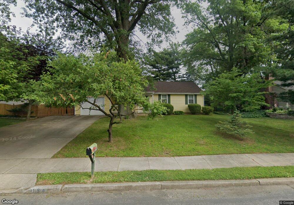
154 Red Stone Ridge Delran, NJ 08075
Tenby Chase NeighborhoodEstimated Value: $323,961 - $433,000
Studio
--
Bath
1,258
Sq Ft
$307/Sq Ft
Est. Value
About This Home
This home is located at 154 Red Stone Ridge, Delran, NJ 08075 and is currently estimated at $386,740, approximately $307 per square foot. 154 Red Stone Ridge is a home located in Burlington County with nearby schools including Millbridge Elementary School, Delran Intermediate School, and Delran Middle School.
Ownership History
Date
Name
Owned For
Owner Type
Purchase Details
Closed on
Dec 3, 2015
Sold by
Gebhardt Michael P
Bought by
Schlindwein Susan M
Current Estimated Value
Home Financials for this Owner
Home Financials are based on the most recent Mortgage that was taken out on this home.
Original Mortgage
$161,500
Outstanding Balance
$126,590
Interest Rate
3.77%
Mortgage Type
New Conventional
Estimated Equity
$260,150
Purchase Details
Closed on
Sep 23, 2010
Sold by
Gebhardt Ronald L
Bought by
Gebhardt Michael P
Home Financials for this Owner
Home Financials are based on the most recent Mortgage that was taken out on this home.
Original Mortgage
$100,000
Interest Rate
4.36%
Mortgage Type
New Conventional
Create a Home Valuation Report for This Property
The Home Valuation Report is an in-depth analysis detailing your home's value as well as a comparison with similar homes in the area
Home Values in the Area
Average Home Value in this Area
Purchase History
| Date | Buyer | Sale Price | Title Company |
|---|---|---|---|
| Schlindwein Susan M | $185,000 | Turnkey Title | |
| Gebhardt Michael P | $150,000 | Integrity Title |
Source: Public Records
Mortgage History
| Date | Status | Borrower | Loan Amount |
|---|---|---|---|
| Open | Schlindwein Susan M | $161,500 | |
| Previous Owner | Gebhardt Michael P | $100,000 |
Source: Public Records
Tax History
| Year | Tax Paid | Tax Assessment Tax Assessment Total Assessment is a certain percentage of the fair market value that is determined by local assessors to be the total taxable value of land and additions on the property. | Land | Improvement |
|---|---|---|---|---|
| 2025 | $6,914 | $173,900 | $65,000 | $108,900 |
| 2024 | $6,852 | $173,900 | $65,000 | $108,900 |
| 2023 | $6,852 | $173,900 | $65,000 | $108,900 |
| 2022 | $6,763 | $173,900 | $65,000 | $108,900 |
| 2021 | $6,766 | $173,900 | $65,000 | $108,900 |
| 2020 | $6,753 | $173,900 | $65,000 | $108,900 |
| 2019 | $6,690 | $173,900 | $65,000 | $108,900 |
| 2018 | $6,579 | $173,900 | $65,000 | $108,900 |
| 2017 | $6,474 | $173,900 | $65,000 | $108,900 |
| 2016 | $6,379 | $173,900 | $65,000 | $108,900 |
| 2015 | $6,273 | $173,900 | $65,000 | $108,900 |
| 2014 | $6,000 | $173,900 | $65,000 | $108,900 |
Source: Public Records
Map
Nearby Homes
- 139 Coopers Kill Rd
- 102 Red Stone Ridge
- 51 Suburban Blvd
- 49 Haines Mill Rd
- 70 Suburban Blvd
- 190 Westover Dr
- 707 Parry Blvd
- 2105 Chestnut Hill Dr
- 117 Randle Ct
- 42 Cornell Dr
- 108 Patricia Ave
- 114 Windmoor Rd
- 30 Purdue Dr
- 119 Linda Ave
- 2803 Waterford Dr
- 347 Tom Brown Rd
- 343 Tom Brown Rd
- 134 Jacqueline Ave
- 4327 Bridgeboro Rd
- 8 Saratoga Springs Dr
- 152 Red Stone Ridge
- 156 Red Stone Ridge
- 256 Tenby Chase Dr
- 161 Coopers Kill Rd
- 260 Tenby Chase Dr
- 254 Tenby Chase Dr
- 148 Red Stone Ridge
- 159 Coopers Kill Rd
- 262 Tenby Chase Dr
- 210 Aqua Ln
- 156 Coopers Kill Rd
- 211 Sharrow Vale Rd
- 211 Aqua Ln
- 154 Coopers Kill Rd
- 157 Coopers Kill Rd
- 146 Red Stone Ridge
- 264 Tenby Chase Dr
- 212 Aqua Ln
- 213 Sharrow Vale Rd
- 213 Aqua Ln
Your Personal Tour Guide
Ask me questions while you tour the home.