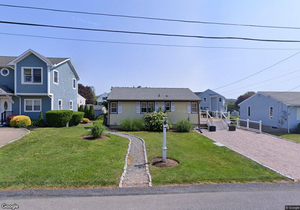
155 E Shore Rd Narragansett, RI 02882
Estimated Value: $649,524 - $816,000
3
Beds
2
Baths
918
Sq Ft
$792/Sq Ft
Est. Value
About This Home
This home is located at 155 E Shore Rd, Narragansett, RI 02882 and is currently estimated at $727,381, approximately $792 per square foot. 155 E Shore Rd is a home located in Washington County with nearby schools including Narragansett Elementary School, Narragansett Pier Middle School, and Narragansett High School.
Ownership History
Date
Name
Owned For
Owner Type
Purchase Details
Closed on
Aug 5, 2016
Sold by
Nangle Thomas
Bought by
Combs Margaret K
Current Estimated Value
Purchase Details
Closed on
Apr 29, 2003
Sold by
Welch Patrick J
Bought by
Nangle Thomas E and Nangle Kathleen E
Home Financials for this Owner
Home Financials are based on the most recent Mortgage that was taken out on this home.
Original Mortgage
$206,000
Interest Rate
5.64%
Purchase Details
Closed on
Apr 11, 2000
Sold by
Culatta Barbara
Bought by
Welch Patrick J and Welch Keleigh
Home Financials for this Owner
Home Financials are based on the most recent Mortgage that was taken out on this home.
Original Mortgage
$117,000
Interest Rate
8.3%
Create a Home Valuation Report for This Property
The Home Valuation Report is an in-depth analysis detailing your home's value as well as a comparison with similar homes in the area
Home Values in the Area
Average Home Value in this Area
Purchase History
| Date | Buyer | Sale Price | Title Company |
|---|---|---|---|
| Combs Margaret K | -- | -- | |
| Nangle Thomas E | $271,000 | -- | |
| Welch Patrick J | $130,000 | -- |
Source: Public Records
Mortgage History
| Date | Status | Borrower | Loan Amount |
|---|---|---|---|
| Previous Owner | Welch Patrick J | $182,550 | |
| Previous Owner | Welch Patrick J | $206,000 | |
| Previous Owner | Welch Patrick J | $117,000 |
Source: Public Records
Tax History
| Year | Tax Paid | Tax Assessment Tax Assessment Total Assessment is a certain percentage of the fair market value that is determined by local assessors to be the total taxable value of land and additions on the property. | Land | Improvement |
|---|---|---|---|---|
| 2025 | $3,555 | $523,600 | $297,500 | $226,100 |
| 2024 | $3,430 | $523,600 | $297,500 | $226,100 |
| 2023 | $3,189 | $342,500 | $191,900 | $150,600 |
| 2022 | $3,083 | $342,500 | $191,900 | $150,600 |
| 2021 | $3,035 | $342,500 | $191,900 | $150,600 |
| 2020 | $3,156 | $301,100 | $154,000 | $147,100 |
| 2019 | $3,080 | $301,100 | $154,000 | $147,100 |
| 2018 | $2,996 | $301,100 | $154,000 | $147,100 |
| 2017 | $2,803 | $265,400 | $173,400 | $92,000 |
| 2016 | $2,675 | $265,400 | $173,400 | $92,000 |
| 2015 | $2,638 | $265,400 | $173,400 | $92,000 |
| 2014 | $2,511 | $250,100 | $158,100 | $92,000 |
Source: Public Records
Map
Nearby Homes
- 17 Goose Island Rd
- 7 Conch Rd
- 0 Barnacle Rd
- 0 Point Judith Rd
- 0 Hemlock Ave
- 1185 Succotash Rd
- 268 Foddering Farm Rd
- 31 Hemlock Ave
- 62 Daytona Ave
- 60 Daytona Ave
- 609 Point Judith Rd
- 200 Clarke Rd Unit A208
- 1140 Succotash Rd
- 1138 Succotash Rd
- 6 MacAlder St
- 28 Palm Beach Ave
- 1125 Point Judith Rd Unit D5
- 0 Daytona Ave
- 576 Point Judith Rd
- 2 Bristol Rd
- 157 E Shore Rd
- 50 Goose Island Rd
- 5 Marine Dr
- 46 Goose Island Rd
- 150 E Shore Rd
- 160 E Shore Rd
- 147 E Shore Rd
- 28 Goose Island Rd
- 43 Goose Island Rd
- 145 E Shore Rd
- 24 Goose Island Rd
- 164 E Shore Rd
- 10 Marine Dr
- 142 E Shore Rd
- 34 Goose Island Rd
- 22 Goose Island Rd
- 138 E Shore Rd
- 135 Conch Rd
- 139 E Shore Rd
- 2 Marine Dr
Your Personal Tour Guide
Ask me questions while you tour the home.