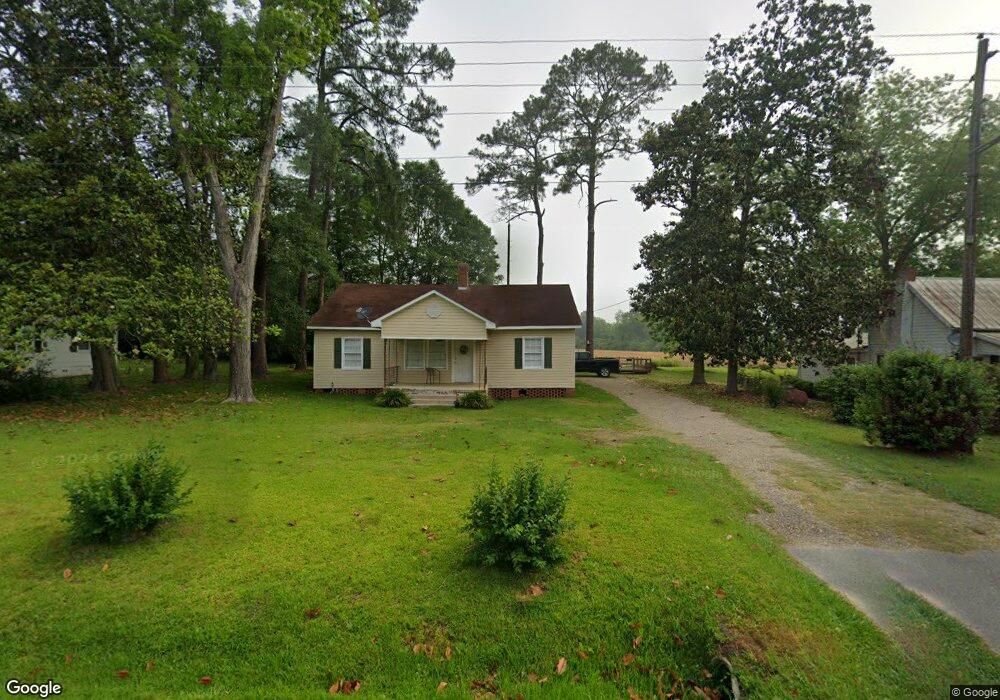
156 E Mulberry St Moultrie, GA 31768
Estimated Value: $76,971 - $157,000
Studio
1
Bath
1,200
Sq Ft
$109/Sq Ft
Est. Value
About This Home
This home is located at 156 E Mulberry St, Moultrie, GA 31768 and is currently estimated at $130,993, approximately $109 per square foot. 156 E Mulberry St is a home located in Colquitt County with nearby schools including Funston Elementary School, C.A. Gray Junior High School, and Willie J. Williams Middle School.
Ownership History
Date
Name
Owned For
Owner Type
Purchase Details
Closed on
Feb 9, 2026
Sold by
Ruis Marvin Eugene
Bought by
William Avery Investments Llc
Current Estimated Value
Home Financials for this Owner
Home Financials are based on the most recent Mortgage that was taken out on this home.
Original Mortgage
$174,250
Outstanding Balance
$174,250
Interest Rate
6.16%
Mortgage Type
Purchase Money Mortgage
Estimated Equity
-$43,257
Purchase Details
Closed on
Jan 18, 2018
Sold by
Johnson Vickie
Bought by
Ruis Marvin Eugene and Ruis Cheryl Taylor
Home Financials for this Owner
Home Financials are based on the most recent Mortgage that was taken out on this home.
Original Mortgage
$17,600
Interest Rate
3.94%
Mortgage Type
Purchase Money Mortgage
Purchase Details
Closed on
Jan 29, 2004
Sold by
Carden Vickie
Bought by
Johnson Vickie
Purchase Details
Closed on
Dec 23, 1995
Bought by
Carden Vickie
Purchase Details
Closed on
Jan 16, 1972
Bought by
Goodman Roy
Create a Home Valuation Report for This Property
The Home Valuation Report is an in-depth analysis detailing your home's value as well as a comparison with similar homes in the area
Purchase History
| Date | Buyer | Sale Price | Title Company |
|---|---|---|---|
| William Avery Investments Llc | $205,000 | -- | |
| Ruis Marvin Eugene | $22,000 | -- | |
| Johnson Vickie | -- | -- | |
| Carden Vickie | $13,900 | -- | |
| Goodman Roy | -- | -- |
Source: Public Records
Mortgage History
| Date | Status | Borrower | Loan Amount |
|---|---|---|---|
| Open | William Avery Investments Llc | $174,250 | |
| Previous Owner | Ruis Marvin Eugene | $17,600 |
Source: Public Records
Tax History
| Year | Tax Paid | Tax Assessment Tax Assessment Total Assessment is a certain percentage of the fair market value that is determined by local assessors to be the total taxable value of land and additions on the property. | Land | Improvement |
|---|---|---|---|---|
| 2025 | $842 | $37,478 | $876 | $36,602 |
| 2024 | $842 | $26,449 | $876 | $25,573 |
| 2023 | $621 | $21,783 | $876 | $20,907 |
| 2022 | $478 | $17,964 | $876 | $17,088 |
| 2021 | $425 | $15,722 | $876 | $14,846 |
| 2020 | $400 | $14,491 | $876 | $13,615 |
| 2019 | $414 | $13,618 | $876 | $12,742 |
| 2018 | $427 | $14,173 | $876 | $13,297 |
| 2017 | $423 | $14,173 | $876 | $13,297 |
| 2016 | $426 | $14,173 | $876 | $13,297 |
| 2015 | $427 | $14,173 | $876 | $13,297 |
| 2014 | $379 | $14,173 | $876 | $13,297 |
| 2013 | -- | $14,172 | $876 | $13,296 |
Source: Public Records
Map
Nearby Homes
- Lot 45 Fox Trot Dr
- LOT 52 Fox Trot Dr
- LOT 58 Fox Trot Dr
- LOT 56 Fox Trot Dr
- LOT 54 Fox Trot Dr
- LOT 53 Fox Trot Dr
- LOT 55 Fox Trot Dr
- 176 Fox Trot Dr
- LOT 29 Merganser Ln
- LOT 32 Merganser Ln
- LOT 28 Merganser Ln
- LOT 26 Merganser Ln
- LOT 30 Merganser Ln
- LOT 39 Westwoods Dr
- LOT 1 Westwoods Dr
- LOT 23 Westwoods Dr
- LOT 35 Westwoods Dr
- LOT 36 Westwoods Dr
- LOT 37 Westwoods Dr
- LOT 41 Westwoods Dr
- 159 E Mulberry St
- 162 E Mulberry St
- 148 E Mulberry St
- 156,162, St
- 149 E Mulberry St
- 132 E Mulberry St
- 170 E Mulberry St
- 123 E Mulberry St
- 118 E Mulberry St
- 173 E Mulberry St
- 113 E Mulberry St
- 132 S Manning St
- 124 Peachtree Cir SE
- 209 E Mulberry St
- 127 S Manning St
- 127 Peachtree Cir SE
- 136 N Manning St
- 130 Peachtree Cir SE
- 123 N Manning St
- 114 S Academy St SW
Your Personal Tour Guide
Ask me questions while you tour the home.