Estimated Value: $760,178 - $885,000
3
Beds
2
Baths
2,046
Sq Ft
$404/Sq Ft
Est. Value
About This Home
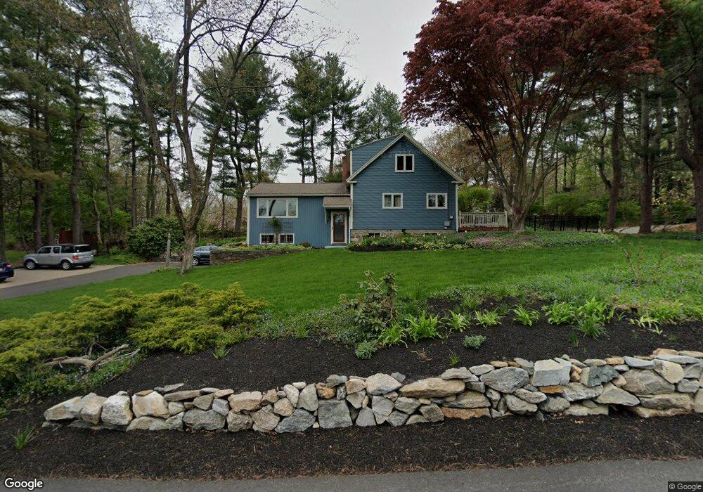
This home is located at 156 High St, Acton, MA 01720 and is currently estimated at $827,045, approximately $404 per square foot. 156 High St is a home located in Middlesex County with nearby schools including Acton-Boxborough Regional High School, Maynard Knowledge Beginnings, and The Imago School.
Create a Home Valuation Report for This Property
The Home Valuation Report is an in-depth analysis detailing your home's value as well as a comparison with similar homes in the area
Home Values in the Area
Average Home Value in this Area
Tax History
| Year | Tax Paid | Tax Assessment Tax Assessment Total Assessment is a certain percentage of the fair market value that is determined by local assessors to be the total taxable value of land and additions on the property. | Land | Improvement |
|---|---|---|---|---|
| 2025 | $11,864 | $691,800 | $316,600 | $375,200 |
| 2024 | $11,217 | $672,900 | $316,600 | $356,300 |
| 2023 | $11,310 | $644,100 | $287,800 | $356,300 |
| 2022 | $10,248 | $526,900 | $250,500 | $276,400 |
| 2021 | $10,046 | $496,600 | $231,600 | $265,000 |
| 2020 | $9,291 | $482,900 | $231,600 | $251,300 |
| 2019 | $8,922 | $460,600 | $231,600 | $229,000 |
| 2018 | $8,775 | $452,800 | $231,600 | $221,200 |
| 2017 | $8,630 | $452,800 | $231,600 | $221,200 |
| 2016 | $8,219 | $427,400 | $231,600 | $195,800 |
| 2015 | $8,211 | $431,000 | $231,600 | $199,400 |
| 2014 | $8,037 | $413,200 | $231,600 | $181,600 |
Source: Public Records
Map
Nearby Homes
- 128 Parker St Unit 3C
- 39 Adams St
- 91 Drummer Rd Unit 91
- 68 Main St
- 70 River St
- 148 School St
- 8 Tremont St
- 70 Powder Mill Rd
- 22 Hillcrest Dr
- 2 Everett St
- 96 Forest Ridge Rd Unit 96
- 26 Powder Mill Rd
- 10 Concord St
- 22 Douglas Ave Unit 2
- 62 Waltham St
- 13 Arthur St Unit 15
- 11 Sunset Rd
- 2 Dartmouth Ct Unit 2
- 1844 Main St
- 1844 Main St Unit 1
Your Personal Tour Guide
Ask me questions while you tour the home.