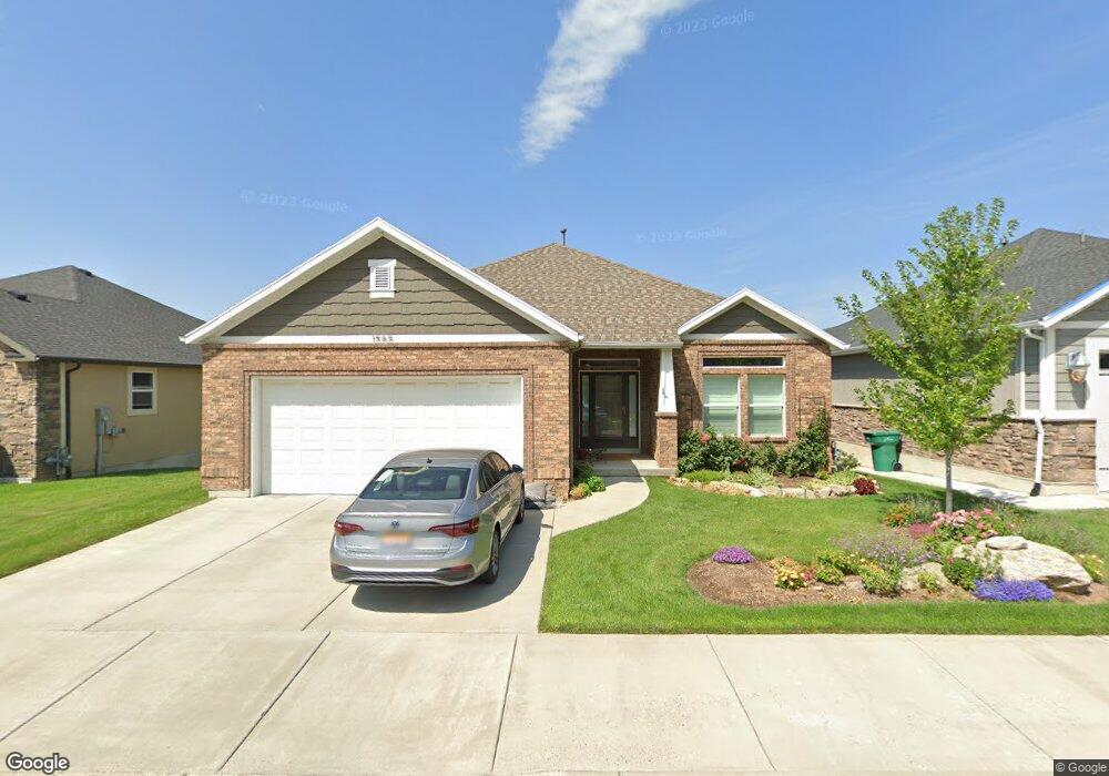
1565 N 2850 E Unit 6 Layton, UT 84040
Estimated Value: $611,000 - $653,000
4
Beds
3
Baths
1,719
Sq Ft
$370/Sq Ft
Est. Value
About This Home
This home is located at 1565 N 2850 E Unit 6, Layton, UT 84040 and is currently estimated at $635,355, approximately $369 per square foot. 1565 N 2850 E Unit 6 is a home located in Davis County with nearby schools including East Layton Elementary School, Central Davis Junior High School, and Northridge High School.
Ownership History
Date
Name
Owned For
Owner Type
Purchase Details
Closed on
Nov 15, 2019
Sold by
Every Robert H and Every Fiona F M G
Bought by
Linsley Fiona L and Every Amber N
Current Estimated Value
Purchase Details
Closed on
Aug 25, 2017
Sold by
Every Robert H and Every Fiona Frances Masson Griffin
Bought by
Every Robert H and Every Fiona F M G
Home Financials for this Owner
Home Financials are based on the most recent Mortgage that was taken out on this home.
Original Mortgage
$157,000
Outstanding Balance
$131,004
Interest Rate
3.96%
Mortgage Type
New Conventional
Estimated Equity
$504,351
Purchase Details
Closed on
Sep 26, 2014
Sold by
Every Robert H
Bought by
Every Robert H and Griffin Every Fiona Frances Masson
Home Financials for this Owner
Home Financials are based on the most recent Mortgage that was taken out on this home.
Original Mortgage
$275,129
Outstanding Balance
$210,239
Interest Rate
4.09%
Mortgage Type
New Conventional
Estimated Equity
$425,116
Purchase Details
Closed on
Jun 18, 2013
Sold by
Boam Construction Lc
Bought by
Wasatch West Llc
Purchase Details
Closed on
Dec 28, 2012
Sold by
Boam David
Bought by
Wasatch West Llc
Purchase Details
Closed on
Mar 30, 2011
Sold by
Boam Construction L C
Bought by
Benchmark Holding Llc
Create a Home Valuation Report for This Property
The Home Valuation Report is an in-depth analysis detailing your home's value as well as a comparison with similar homes in the area
Home Values in the Area
Average Home Value in this Area
Purchase History
We collect this data history from publicly available records. To have your information removed, we recommend requesting removal directly through your county’s website.
| Date | Buyer | Sale Price | Title Company |
|---|---|---|---|
| Linsley Fiona L | -- | None Available | |
| Every Robert H | -- | Founders Title | |
| Every Robert H | -- | Founders Title Co L | |
| Every Robert H | -- | Founders Title Co | |
| Wasatch West Llc | -- | Founders Title Co L | |
| Wasatch West Llc | -- | Founders Totle Co Llc | |
| Benchmark Holding Llc | -- | Lincoln Title Insuranc |
Source: Public Records
Mortgage History
We collect this data history from publicly available records. To have your information removed, we recommend requesting removal directly through your county’s website.
| Date | Status | Borrower | Loan Amount |
|---|---|---|---|
| Open | Every Robert H | $157,000 | |
| Open | Every Robert H | $275,129 |
Source: Public Records
Tax History
| Year | Tax Paid | Tax Assessment Tax Assessment Total Assessment is a certain percentage of the fair market value that is determined by local assessors to be the total taxable value of land and additions on the property. | Land | Improvement |
|---|---|---|---|---|
| 2025 | $3,112 | $326,700 | $89,650 | $237,050 |
| 2024 | $3,100 | $327,800 | $55,000 | $272,800 |
| 2023 | $3,176 | $592,000 | $87,000 | $505,000 |
| 2022 | $3,347 | $338,800 | $52,250 | $286,550 |
| 2021 | $3,147 | $475,000 | $94,000 | $381,000 |
| 2020 | $2,859 | $414,000 | $80,100 | $333,900 |
| 2019 | $2,757 | $391,000 | $77,000 | $314,000 |
| 2018 | $2,746 | $391,000 | $77,000 | $314,000 |
| 2016 | $2,535 | $186,230 | $18,333 | $167,897 |
| 2015 | $2,398 | $167,255 | $18,333 | $148,922 |
| 2014 | $468 | $33,333 | $33,333 | $0 |
| 2013 | -- | $14,570 | $14,570 | $0 |
Source: Public Records
Map
Nearby Homes
- 2698 E 1650 N
- 2652 E 1600 N
- 1763 N 2675 E
- 2573 Kays Creek Dr
- 1347 N 3100 E Unit 3
- 2547 E 1900 N
- 2589 E 1930 N
- 1948 N 2700 E
- 2509 E 1900 N
- 2493 E 1900 N
- 2391 Kays Creek Dr
- 1332 N 2350 E
- 2727 E Gentile St
- 2855 E Gentile St Unit 1
- 2972 E Orson F Dr N
- 2452 Oak Ln
- 2141 E Oak Ln Unit 5
- 2136 N 2800 E
- 1522 N 2200 E
- 2612 E Antelope Dr
- 1577 N 2850 E Unit 7
- 1553 N 2850 E Unit 5
- 1562 N 2800 E
- 1589 N 2850 E
- 1568 N 2850 E Unit 4
- 1580 N 2800 E
- 1544 N 2800 E
- 1582 N 2850 E Unit 3
- 1582 N 2850 E
- 1541 N Cherry Cir
- 1601 N 2850 E
- 1596 N 2850 E Unit 2
- 1541 N Cherry Ln
- 1598 N 2800 E
- 1613 N 2850 E
- 1528 N 2800 E
- 1569 N 2800 E
- 1549 N 2800 E
- 1625 N 2850 E Unit 11
- 1625 N 2850 E
Your Personal Tour Guide
Ask me questions while you tour the home.