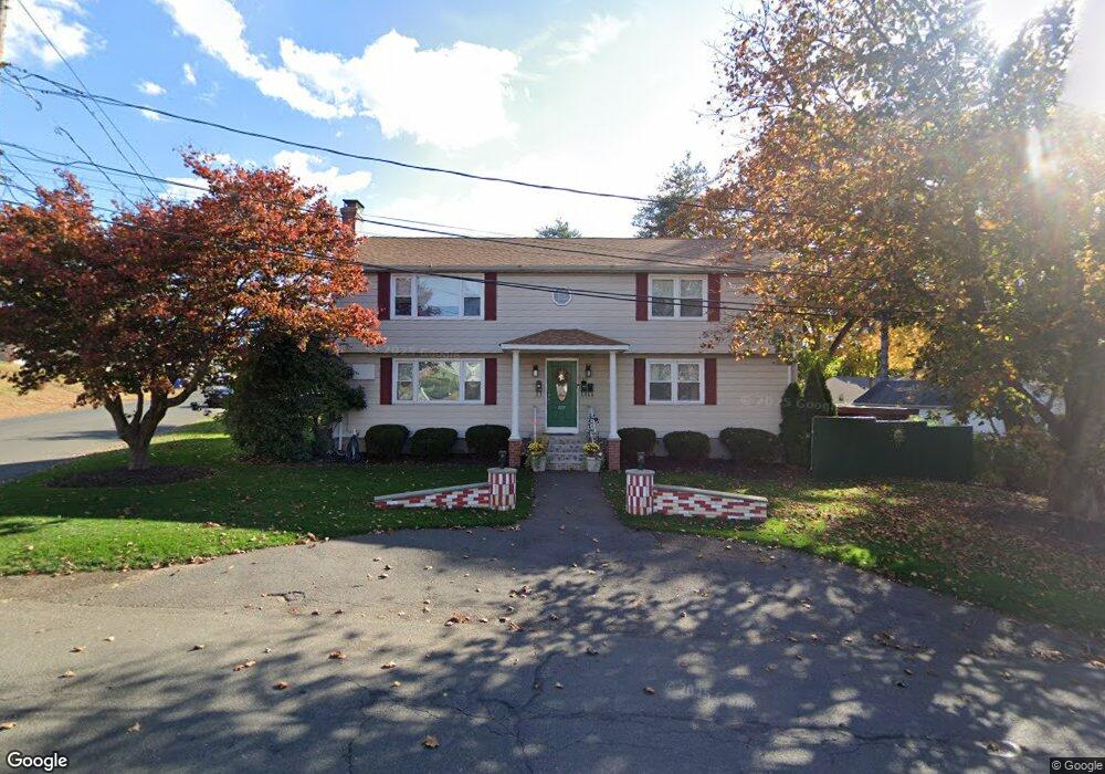
157 Pershing Ave New Britain, CT 06053
Estimated Value: $373,194 - $497,000
5
Beds
3
Baths
2,438
Sq Ft
$182/Sq Ft
Est. Value
About This Home
This home is located at 157 Pershing Ave, New Britain, CT 06053 and is currently estimated at $444,799, approximately $182 per square foot. 157 Pershing Ave is a home located in Hartford County with nearby schools including Gaffney School and Slade Middle School.
Ownership History
Date
Name
Owned For
Owner Type
Purchase Details
Closed on
Jul 2, 2004
Sold by
Davirro Joann M
Bought by
Dabrowski Irena and Dabrowski Krzysztof
Current Estimated Value
Purchase Details
Closed on
Jun 11, 2002
Sold by
Morabito Joseph
Bought by
Davirro Joann M
Create a Home Valuation Report for This Property
The Home Valuation Report is an in-depth analysis detailing your home's value as well as a comparison with similar homes in the area
Home Values in the Area
Average Home Value in this Area
Purchase History
| Date | Buyer | Sale Price | Title Company |
|---|---|---|---|
| Dabrowski Irena | $210,000 | -- | |
| Davirro Joann M | $145,000 | -- |
Source: Public Records
Mortgage History
| Date | Status | Borrower | Loan Amount |
|---|---|---|---|
| Open | Davirro Joann M | $213,600 | |
| Closed | Davirro Joann M | $53,400 | |
| Closed | Davirro Joann M | $100,000 |
Source: Public Records
Tax History
| Year | Tax Paid | Tax Assessment Tax Assessment Total Assessment is a certain percentage of the fair market value that is determined by local assessors to be the total taxable value of land and additions on the property. | Land | Improvement |
|---|---|---|---|---|
| 2025 | $7,740 | $197,540 | $58,170 | $139,370 |
| 2024 | $7,821 | $197,540 | $58,170 | $139,370 |
| 2023 | $7,562 | $197,540 | $58,170 | $139,370 |
| 2022 | $6,473 | $130,760 | $26,810 | $103,950 |
| 2021 | $6,473 | $130,760 | $26,810 | $103,950 |
| 2020 | $6,603 | $130,760 | $26,810 | $103,950 |
| 2019 | $6,603 | $130,760 | $26,810 | $103,950 |
| 2018 | $6,603 | $130,760 | $26,810 | $103,950 |
| 2017 | $6,239 | $123,550 | $22,330 | $101,220 |
| 2016 | $6,239 | $123,550 | $22,330 | $101,220 |
| 2015 | $6,054 | $123,550 | $22,330 | $101,220 |
| 2014 | $6,054 | $123,550 | $22,330 | $101,220 |
Source: Public Records
Map
Nearby Homes
- 61 Sterling St
- 33 Hillhurst Ave
- 19 Maplehurst Ave
- 157 Skinner Dr
- 131 Torkom Dr
- 37 Richard St
- 7 Ledyard Rd
- 25 Clinton St
- 272 Burritt St
- 199 Burritt St
- 527 Burritt St
- 545 Burritt St
- 822 Slater Rd
- 19 Wakefield Ct
- 164 Curtis St
- 54 N Mountain Rd Unit 204
- 234 Pierremount Ave
- 181 Gold St
- 900 Slater Rd
- 179 Broad St
- 145 Pershing Ave
- 94 Pinehurst Ave
- 92 Pinehurst Ave
- 158 Pershing Ave
- 103 Sterling St
- 97 Sterling St
- 88 Pinehurst Ave
- 146 Pershing Ave
- 111 Sterling St
- 115 Pinehurst Ave
- 91 Sterling St
- 93 Pinehurst Ave
- 85 Sterling St
- 121 Pinehurst Ave
- 121 Pinehurst Ave Unit Second Floor
- 121 Pinehurst Ave Unit 2nd flr
- 84 Pinehurst Ave
- 132 Pinehurst Ave
- 121 Sterling St
- 127 Pinehurst Ave
Your Personal Tour Guide
Ask me questions while you tour the home.