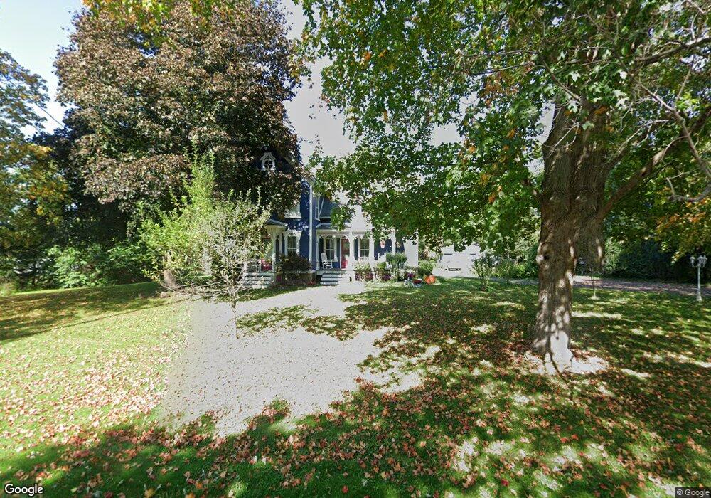
15701 Armada Center Rd Armada, MI 48005
Estimated Value: $390,286 - $535,000
Studio
1
Bath
2,580
Sq Ft
$184/Sq Ft
Est. Value
About This Home
This home is located at 15701 Armada Center Rd, Armada, MI 48005 and is currently estimated at $475,072, approximately $184 per square foot. 15701 Armada Center Rd is a home located in Macomb County with nearby schools including Orville C. Krause Elementary School, Armada Middle School, and Armada High School.
Ownership History
Date
Name
Owned For
Owner Type
Purchase Details
Closed on
Mar 25, 2003
Sold by
Fearnley Robert and Fearnley Linda E
Bought by
Duhr Dane C and Duhr Margaret A
Current Estimated Value
Purchase Details
Closed on
Oct 13, 1994
Sold by
James Fisher
Bought by
Fearnley Robert W and Fearnley Linda H
Home Financials for this Owner
Home Financials are based on the most recent Mortgage that was taken out on this home.
Original Mortgage
$131,200
Interest Rate
8.68%
Mortgage Type
New Conventional
Create a Home Valuation Report for This Property
The Home Valuation Report is an in-depth analysis detailing your home's value as well as a comparison with similar homes in the area
Home Values in the Area
Average Home Value in this Area
Purchase History
| Date | Buyer | Sale Price | Title Company |
|---|---|---|---|
| Duhr Dane C | $236,500 | Philip R Seaver Title Co Inc | |
| Fearnley Robert W | $164,000 | -- |
Source: Public Records
Mortgage History
| Date | Status | Borrower | Loan Amount |
|---|---|---|---|
| Previous Owner | Fearnley Robert W | $131,200 |
Source: Public Records
Tax History
| Year | Tax Paid | Tax Assessment Tax Assessment Total Assessment is a certain percentage of the fair market value that is determined by local assessors to be the total taxable value of land and additions on the property. | Land | Improvement |
|---|---|---|---|---|
| 2025 | $2,134 | $168,200 | $0 | $0 |
| 2024 | $21 | $164,200 | $0 | $0 |
| 2023 | $1,967 | $145,100 | $0 | $0 |
| 2022 | $2,978 | $131,500 | $0 | $0 |
| 2021 | $2,896 | $125,800 | $0 | $0 |
| 2020 | $1,808 | $121,100 | $0 | $0 |
| 2019 | $2,659 | $114,300 | $0 | $0 |
| 2018 | $2,604 | $111,200 | $0 | $0 |
| 2017 | $2,404 | $103,600 | $22,100 | $81,500 |
| 2016 | $2,387 | $103,600 | $0 | $0 |
| 2015 | -- | $97,700 | $0 | $0 |
| 2011 | -- | $85,829 | $21,563 | $64,266 |
Source: Public Records
Map
Nearby Homes
- 0 Romeo Plank Rd Unit 50180632
- 14750 Reid Rd
- 73636 Mc Kay Rd
- 0 Capac Rd Unit G50063654
- 78730 Brown Rd
- 72859 Sorrel Dr
- 71712 Hidden River Dr
- 72755 Sorrel Dr
- 71714 Hidden River Dr
- 71608 Hidden River Dr
- 71649 Hidden River Dr
- 71649 Dolores Dr
- 74380 Nordman Ct
- 74800 Judges Ct
- 00 33 Mile Rd
- 73213 Coon Creek Rd
- 73763 Coon Creek Rd
- 2.0 Acres Vacant Lan Coon Creek Rd
- 12370 Saint James Ct
- 11572 Erins Way
- 15751 Armada Center Rd
- 15751 Armanda Center
- 75255 Mcfadden Rd
- 15744 Armada Center Rd
- Parcel #1 Armada Center Rd
- 15805 Armada Center Rd
- 75200 Mcfadden Rd
- 15696 Armada Center Rd
- 15681 Armada Center Rd
- 74944 Mcfadden Rd
- 15915 Armada Center Rd
- 74711 Mcfadden Rd
- Parcel #3 Mcfadden Rd
- 15600 Armada Center Rd
- 15300 Armada Center Rd
- 16049 Armada Center Rd
- 74677 Mcfadden Rd
- 74623 Mcfadden Rd
- Parcel #4 Mcfadden Rd
- 16163 Armada Center Rd
Your Personal Tour Guide
Ask me questions while you tour the home.