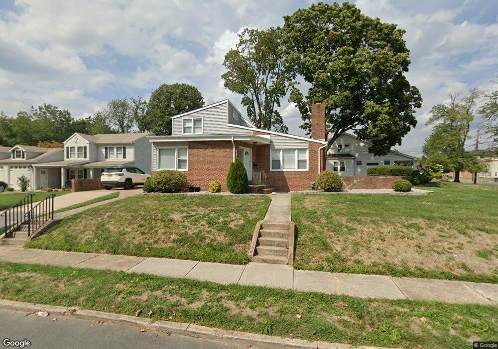
1571 Pennington Rd Ewing, NJ 08618
Parkway Village NeighborhoodEstimated Value: $324,381 - $381,000
Studio
--
Bath
1,629
Sq Ft
$222/Sq Ft
Est. Value
About This Home
This home is located at 1571 Pennington Rd, Ewing, NJ 08618 and is currently estimated at $361,095, approximately $221 per square foot. 1571 Pennington Rd is a home located in Mercer County with nearby schools including Ewing High School, Paul Robeson Charter School For The Humanities, and Trenton Stem-To-Civics Charter School.
Ownership History
Date
Name
Owned For
Owner Type
Purchase Details
Closed on
Dec 30, 2014
Sold by
Nelson Holdings Llc
Bought by
Roseo Holdings Llc
Current Estimated Value
Purchase Details
Closed on
Nov 15, 2011
Sold by
Nelson John T
Bought by
Nelson Holdings Llc
Purchase Details
Closed on
Jul 23, 2007
Sold by
Andrews Edward W and Andrews Frank Andrews
Bought by
Nelson John T
Home Financials for this Owner
Home Financials are based on the most recent Mortgage that was taken out on this home.
Interest Rate
6.73%
Create a Home Valuation Report for This Property
The Home Valuation Report is an in-depth analysis detailing your home's value as well as a comparison with similar homes in the area
Home Values in the Area
Average Home Value in this Area
Purchase History
We collect this data history from publicly available records. To have your information removed, we recommend requesting removal directly through your county’s website.
| Date | Buyer | Sale Price | Title Company |
|---|---|---|---|
| Roseo Holdings Llc | $100,000 | S & H Abstract Co | |
| Nelson Holdings Llc | -- | None Available | |
| Nelson John T | -- | -- |
Source: Public Records
Mortgage History
We collect this data history from publicly available records. To have your information removed, we recommend requesting removal directly through your county’s website.
| Date | Status | Borrower | Loan Amount |
|---|---|---|---|
| Previous Owner | Nelson John T | -- |
Source: Public Records
Tax History
| Year | Tax Paid | Tax Assessment Tax Assessment Total Assessment is a certain percentage of the fair market value that is determined by local assessors to be the total taxable value of land and additions on the property. | Land | Improvement |
|---|---|---|---|---|
| 2025 | $6,757 | $171,800 | $48,700 | $123,100 |
| 2024 | $6,351 | $171,800 | $48,700 | $123,100 |
| 2023 | $6,351 | $171,800 | $48,700 | $123,100 |
| 2022 | $6,180 | $171,800 | $48,700 | $123,100 |
| 2021 | $6,028 | $171,800 | $48,700 | $123,100 |
| 2020 | $5,943 | $171,800 | $48,700 | $123,100 |
| 2019 | $5,788 | $171,800 | $48,700 | $123,100 |
| 2018 | $5,821 | $110,200 | $32,100 | $78,100 |
| 2017 | $5,956 | $110,200 | $32,100 | $78,100 |
| 2016 | $5,876 | $110,200 | $32,100 | $78,100 |
| 2015 | $5,798 | $106,900 | $32,100 | $74,800 |
| 2014 | $5,609 | $106,900 | $32,100 | $74,800 |
Source: Public Records
Map
Nearby Homes
- 50 Groveland Ave
- 10 Hawthorne Ave
- 37 Central Ave
- 45 Central Ave
- 87 Pennwood Dr
- 24 Keswick Ave
- 423 Sutherland Rd
- 158 Woodland Ave
- 1 Sussex St
- 36 Browning Ave
- 530 Greenway Ave
- 5 Pershing Ave
- 56 Ridgewood Ave
- 644 Parkway Ave
- 1410 Pennington Rd
- 1600 13th St
- 584 Parkway Ave
- 268 Weber Ave
- 365 Concord Ave
- 27 Walton Ave
- 1575 Pennington Rd
- 44 Harrop Place
- 0 Braeburn Dr
- 1579 Pennington Rd
- 1565 Pennington Rd
- 1574 Pennington Rd
- 1572 1/2 Pennington Rd
- 1572 -1574 Pennington Rd
- 48 Harrop Place
- 1572 Pennington Rd
- 1570 Pennington Rd
- 1563 Pennington Rd
- 1585 Pennington Rd
- 1 Thurston Ave
- 3 Thurston Ave
- 1576 Pennington Rd
- 5 Thurston Ave
- 50 Harrop Place
- 1578 Pennington Rd
- 7 Braeburn Dr
Your Personal Tour Guide
Ask me questions while you tour the home.