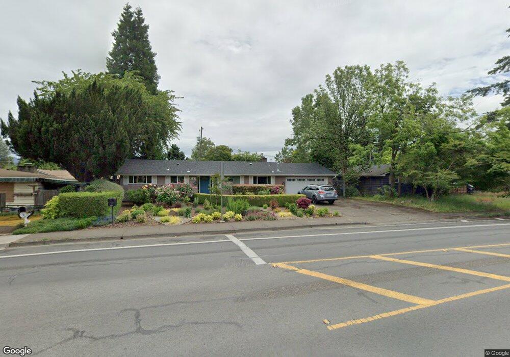
1585 Norkenzie Rd Eugene, OR 97401
Cal Young NeighborhoodEstimated Value: $412,544 - $447,000
3
Beds
1
Bath
1,094
Sq Ft
$389/Sq Ft
Est. Value
About This Home
This home is located at 1585 Norkenzie Rd, Eugene, OR 97401 and is currently estimated at $425,386, approximately $388 per square foot. 1585 Norkenzie Rd is a home located in Lane County with nearby schools including Willagillespie Elementary School, Cal Young Middle School, and Sheldon High School.
Ownership History
Date
Name
Owned For
Owner Type
Purchase Details
Closed on
May 25, 2012
Sold by
Schmidt Joseph H and Schmidt Susan
Bought by
Witt Rachel Brenna
Current Estimated Value
Home Financials for this Owner
Home Financials are based on the most recent Mortgage that was taken out on this home.
Original Mortgage
$160,550
Outstanding Balance
$110,632
Interest Rate
3.86%
Mortgage Type
New Conventional
Estimated Equity
$314,754
Purchase Details
Closed on
Nov 30, 2010
Sold by
Schmidt Joseph H
Bought by
Schmidt Joseph H and Schmidt Susan
Purchase Details
Closed on
Sep 19, 2000
Sold by
Schmidt Howard B and Schmidt Matilda G
Bought by
Schmidt Joseph H
Create a Home Valuation Report for This Property
The Home Valuation Report is an in-depth analysis detailing your home's value as well as a comparison with similar homes in the area
Home Values in the Area
Average Home Value in this Area
Purchase History
| Date | Buyer | Sale Price | Title Company |
|---|---|---|---|
| Witt Rachel Brenna | $169,000 | Western Title & Escrow Compa | |
| Schmidt Joseph H | -- | None Available | |
| Schmidt Joseph H | -- | -- |
Source: Public Records
Mortgage History
| Date | Status | Borrower | Loan Amount |
|---|---|---|---|
| Open | Witt Rachel Brenna | $160,550 |
Source: Public Records
Tax History
| Year | Tax Paid | Tax Assessment Tax Assessment Total Assessment is a certain percentage of the fair market value that is determined by local assessors to be the total taxable value of land and additions on the property. | Land | Improvement |
|---|---|---|---|---|
| 2025 | $3,479 | $178,563 | -- | -- |
| 2024 | $3,436 | $173,363 | -- | -- |
| 2023 | $3,436 | $168,314 | $0 | $0 |
| 2022 | $3,219 | $163,412 | $0 | $0 |
| 2021 | $3,023 | $158,653 | $0 | $0 |
| 2020 | $3,034 | $154,033 | $0 | $0 |
| 2019 | $2,930 | $149,547 | $0 | $0 |
| 2018 | $2,758 | $140,963 | $0 | $0 |
| 2017 | $2,635 | $140,963 | $0 | $0 |
| 2016 | $2,569 | $136,857 | $0 | $0 |
| 2015 | $2,495 | $132,871 | $0 | $0 |
| 2014 | $2,445 | $129,001 | $0 | $0 |
Source: Public Records
Map
Nearby Homes
- 1625 Monterey Ln
- 1500 Norkenzie Rd Unit 12
- 1943 Monterey Ln
- 1810 Minda Dr
- 0 Cal Young Rd Unit Lot 4
- 1901 Minda Dr
- 1328 Spyglass Dr
- 0 Piper Ln Unit Lot 1
- 0 Piper Ln Unit Lot 3
- 0 Piper Ln Unit Lot 2
- 0 Piper Ln Unit Lot 5
- 1332 Jeppesen Ave
- 1521 Gilham Rd
- 1376 Brickley Rd
- 410 Spyglass Dr
- 982 Shaughnessy Ln
- 2291 Norkenzie Rd
- 2281 Ridgeway Dr
- 2280 Tabor St
- 516 Spyglass Dr
- 1565 Norkenzie Rd
- 1610 Monterey Ln
- 1658 Monterey Ln
- 1590 Larkspur Loop
- 1545 Norkenzie Rd
- 1690 Monterey Ln
- 1588 Larkspur Loop
- 1590 Norkenzie Rd
- 1585 Bond Ln
- 1615 Norkenzie Rd
- 1576 Larkspur Loop
- 1510 Larkspur Loop
- 1655 Monterey Ln
- 1695 Monterey Ln
- 1590 Monterey Ave
- 1575 Bond Ln
- 1520 Larkspur Loop
- 1593 Larkspur Loop
- 1595 Larkspur Loop
- 1624 Larkspur Loop
Your Personal Tour Guide
Ask me questions while you tour the home.