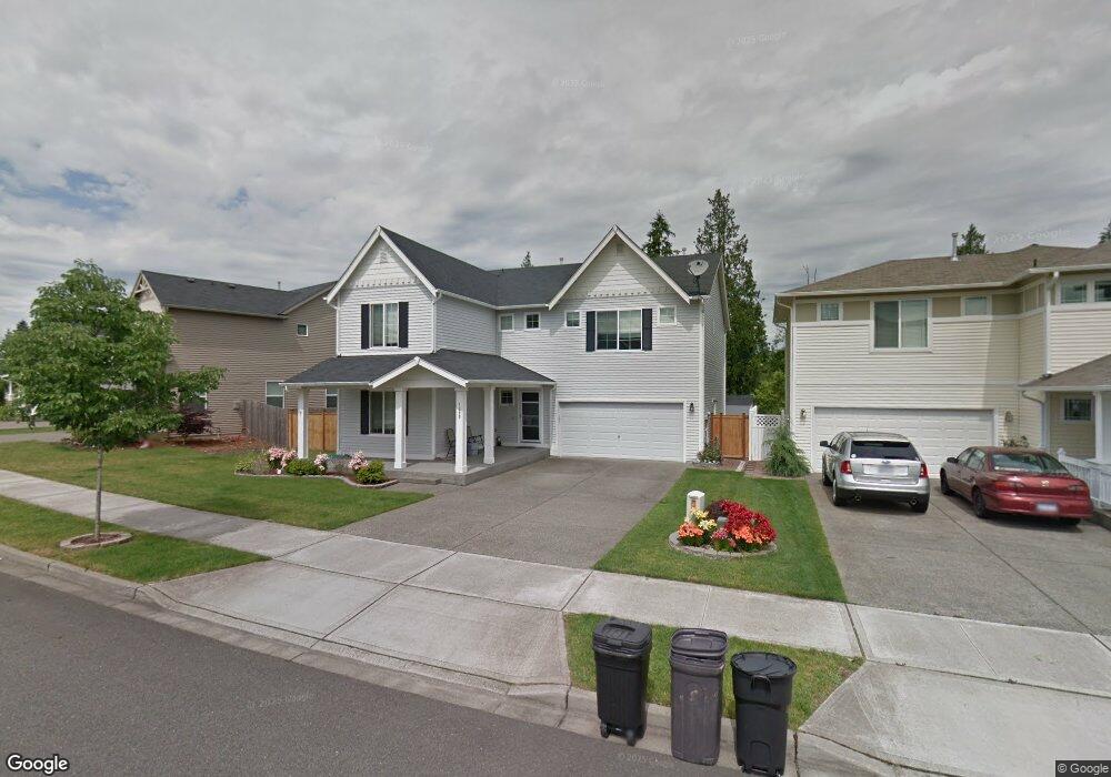
1589 Sinclair Dr Dupont, WA 98327
Estimated Value: $639,570 - $752,000
5
Beds
3
Baths
2,729
Sq Ft
$251/Sq Ft
Est. Value
About This Home
This home is located at 1589 Sinclair Dr, Dupont, WA 98327 and is currently estimated at $683,893, approximately $250 per square foot. 1589 Sinclair Dr is a home located in Pierce County with nearby schools including Chloe Clark Elementary School, Saltars Point Elementary School, and Pioneer Middle School.
Ownership History
Date
Name
Owned For
Owner Type
Purchase Details
Closed on
Mar 31, 2010
Sold by
Daniel Joseph P and Daniel Chantal
Bought by
Granum Randy Allen and Granum Rhoda Lea
Current Estimated Value
Home Financials for this Owner
Home Financials are based on the most recent Mortgage that was taken out on this home.
Original Mortgage
$331,500
Outstanding Balance
$219,474
Interest Rate
4.88%
Mortgage Type
VA
Estimated Equity
$464,419
Purchase Details
Closed on
Mar 1, 2007
Sold by
The Quadrant Corp
Bought by
Daniel Joseph P and Daniel Chantal
Home Financials for this Owner
Home Financials are based on the most recent Mortgage that was taken out on this home.
Original Mortgage
$273,824
Interest Rate
6.12%
Mortgage Type
Purchase Money Mortgage
Create a Home Valuation Report for This Property
The Home Valuation Report is an in-depth analysis detailing your home's value as well as a comparison with similar homes in the area
Home Values in the Area
Average Home Value in this Area
Purchase History
| Date | Buyer | Sale Price | Title Company |
|---|---|---|---|
| Granum Randy Allen | $331,500 | Attorneys Title Of Washingto | |
| Daniel Joseph P | $342,281 | Chicago Title |
Source: Public Records
Mortgage History
| Date | Status | Borrower | Loan Amount |
|---|---|---|---|
| Open | Granum Randy Allen | $331,500 | |
| Previous Owner | Daniel Joseph P | $273,824 |
Source: Public Records
Tax History
| Year | Tax Paid | Tax Assessment Tax Assessment Total Assessment is a certain percentage of the fair market value that is determined by local assessors to be the total taxable value of land and additions on the property. | Land | Improvement |
|---|---|---|---|---|
| 2025 | $4,519 | $613,800 | $232,200 | $381,600 |
| 2024 | $4,519 | $584,700 | $223,600 | $361,100 |
| 2023 | $4,519 | $561,700 | $216,400 | $345,300 |
| 2022 | $4,513 | $572,700 | $216,400 | $356,300 |
| 2021 | $4,282 | $425,400 | $137,500 | $287,900 |
| 2019 | $3,837 | $391,400 | $114,600 | $276,800 |
| 2018 | $4,133 | $375,400 | $114,600 | $260,800 |
| 2017 | $3,641 | $354,200 | $99,900 | $254,300 |
| 2016 | $3,384 | $306,200 | $84,300 | $221,900 |
| 2014 | $3,281 | $300,700 | $84,300 | $216,400 |
| 2013 | $3,281 | $277,300 | $85,900 | $191,400 |
Source: Public Records
Map
Nearby Homes
- 1563 Sinclair Dr
- 3172 Sheaser Way
- 3171 Walker Rd
- 3070 Hoffman Hill Blvd
- 28 Madrona Place
- 1179 Swan Loop
- 1673 Burnside Place Unit C
- 1061 Hiton Cir
- 3070 O'Brien St
- 1320 Burnside Place
- 3047 Ridge View Place
- 2839 Hyland St
- 2886 Hannen St
- 2766 Mcneil St
- 2261 Wallace Loop
- 2055 Garry Oaks Ave Unit B
- 1827 Mcneil Cir Unit 3F
- 1846 Fisher St
- 2245 McDonald Ave
- 2279 Palisade Blvd
- 1593 Sinclair Dr
- 1577 Sinclair Dr
- 1573 Sinclair Dr
- 1578 Sinclair Dr
- 1589 Grant Ave
- 1566 Sinclair Dr
- 1564 Sinclair Dr
- 1560 Sinclair Dr
- 1571 Sinclair Dr
- 1627 Sinclair Dr
- 1577 Grant Ave
- 1556 Sinclair Dr
- 1573 Grant Ave
- 1639 Sinclair Dr
- 1551 Grant Ave
- 1565 Sinclair Dr
- 1537 Grant Ave
- 1645 Sinclair Dr
- 1548 Brackenridge Ave
Your Personal Tour Guide
Ask me questions while you tour the home.